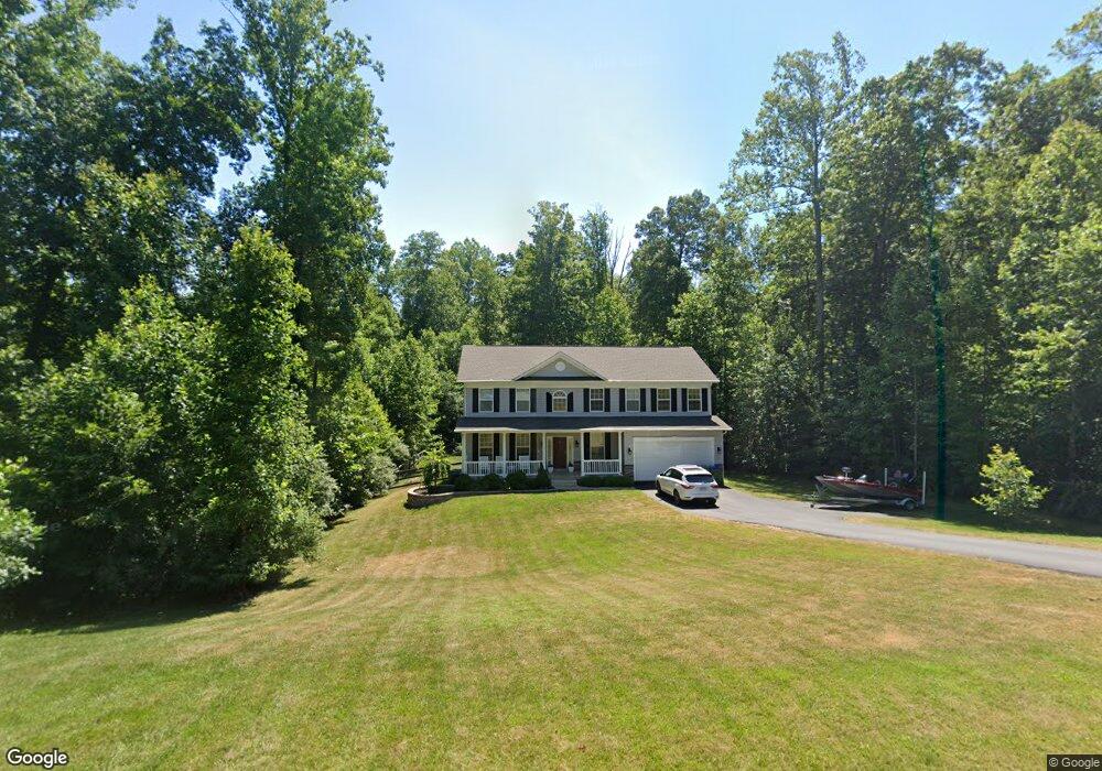
141 Donovan Ln Stafford, VA 22556
Mountain View NeighborhoodEstimated Value: $821,656 - $914,000
4
Beds
4
Baths
2,898
Sq Ft
$298/Sq Ft
Est. Value
About This Home
This home is located at 141 Donovan Ln, Stafford, VA 22556 and is currently estimated at $864,885, approximately $298 per square foot. 141 Donovan Ln is a home located in Stafford County with nearby schools including Margaret Brent Elementary School, Rodney E. Thompson Middle School, and Mountain View High School.
Ownership History
Date
Name
Owned For
Owner Type
Purchase Details
Closed on
Sep 28, 2016
Sold by
Brookstone Homes Inc A Virignia Corporat
Bought by
Klaubo Michael C and Klaubo Shelley W
Current Estimated Value
Home Financials for this Owner
Home Financials are based on the most recent Mortgage that was taken out on this home.
Original Mortgage
$481,500
Outstanding Balance
$385,645
Interest Rate
3.43%
Mortgage Type
VA
Estimated Equity
$479,240
Create a Home Valuation Report for This Property
The Home Valuation Report is an in-depth analysis detailing your home's value as well as a comparison with similar homes in the area
Home Values in the Area
Average Home Value in this Area
Purchase History
| Date | Buyer | Sale Price | Title Company |
|---|---|---|---|
| Klaubo Michael C | $486,894 | First Guardian Title&Escr Lc |
Source: Public Records
Mortgage History
| Date | Status | Borrower | Loan Amount |
|---|---|---|---|
| Open | Klaubo Michael C | $481,500 |
Source: Public Records
Tax History Compared to Growth
Tax History
| Year | Tax Paid | Tax Assessment Tax Assessment Total Assessment is a certain percentage of the fair market value that is determined by local assessors to be the total taxable value of land and additions on the property. | Land | Improvement |
|---|---|---|---|---|
| 2025 | $181 | $683,300 | $210,000 | $473,300 |
| 2024 | $181 | $683,300 | $210,000 | $473,300 |
| 2023 | $189 | $623,300 | $175,000 | $448,300 |
| 2022 | $5,298 | $623,300 | $175,000 | $448,300 |
| 2021 | $4,743 | $489,000 | $130,000 | $359,000 |
| 2020 | $4,709 | $485,500 | $130,000 | $355,500 |
| 2019 | $4,768 | $472,100 | $130,000 | $342,100 |
| 2018 | $4,559 | $460,500 | $130,000 | $330,500 |
| 2017 | $4,397 | $444,100 | $130,000 | $314,100 |
| 2016 | $1,287 | $130,000 | $130,000 | $0 |
| 2015 | -- | $130,000 | $130,000 | $0 |
| 2014 | -- | $50,000 | $50,000 | $0 |
Source: Public Records
Map
Nearby Homes
- 132 Donovan Ln
- 64 Autumn Dr
- 13 Carter Ln
- 641 Rock Hill Church Rd
- Bridgewater Plan at Hampstead
- Torrey Plan at Hampstead
- Lewis Plan at Hampstead
- Finley Plan at Hampstead
- Carson Plan at Hampstead
- Amberly Plan at Hampstead
- 24 Ruffian Dr
- 0 Mountain View Rd Unit VAST2035978
- 0 Poplar Rd Unit VAST2042368
- 304 Montpelier Dr
- 0 Hampstead Farm Ln
- 123 Autumn Dr
- 112 Leisure St
- 11 Citation Ct
- 6 Whistler Way
- 126 Waverly Way
- 138 Donovan Ln
- 143 Donovan Ln
- 136 Donovan Ln
- 12 Whistler Way
- 145 Donovan Ln
- 40 Evanston Ct
- 137 Donovan Ln
- 173 Sequester Dr
- 44 Evanston Ct
- 183 Sequester Dr
- 134 Donovan Ln
- 15 Whistler Way
- 195 Sequester Dr
- 150 Donovan Ln
- 155 Donovan Ln
- 52 Evanston Ct
- 52 Evanston Ct
- 20 Orion Way