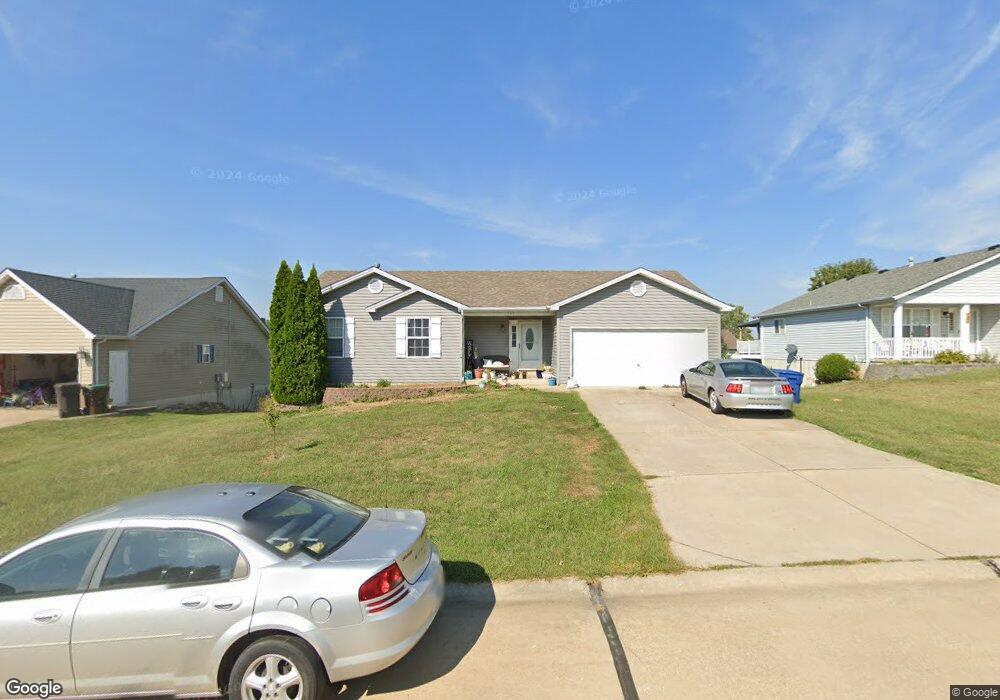
141 Falcon Way Winfield, MO 63389
Estimated Value: $247,713 - $258,000
3
Beds
2
Baths
1,306
Sq Ft
$193/Sq Ft
Est. Value
About This Home
This home is located at 141 Falcon Way, Winfield, MO 63389 and is currently estimated at $252,428, approximately $193 per square foot. 141 Falcon Way is a home located in Lincoln County with nearby schools including Winfield Primary School, Winfield Intermediate School, and Winfield Middle School.
Ownership History
Date
Name
Owned For
Owner Type
Purchase Details
Closed on
Aug 29, 2019
Sold by
Dodd George P and Dodd Carrie L
Bought by
Dodd Miles P and Dodd Kaitlin A
Current Estimated Value
Home Financials for this Owner
Home Financials are based on the most recent Mortgage that was taken out on this home.
Original Mortgage
$126,000
Outstanding Balance
$110,592
Interest Rate
3.7%
Mortgage Type
New Conventional
Estimated Equity
$141,836
Purchase Details
Closed on
Mar 19, 2018
Sold by
Wells Fargo Bank N A
Bought by
Dodd George P
Purchase Details
Closed on
Sep 11, 2017
Sold by
Colbert Holli M and Colbert Patrick D
Bought by
Wells Fargo Bank National Association
Create a Home Valuation Report for This Property
The Home Valuation Report is an in-depth analysis detailing your home's value as well as a comparison with similar homes in the area
Home Values in the Area
Average Home Value in this Area
Purchase History
| Date | Buyer | Sale Price | Title Company |
|---|---|---|---|
| Dodd Miles P | -- | None Available | |
| Dodd George P | -- | Title Partners Agency Llc | |
| Wells Fargo Bank National Association | $122,586 | None Available |
Source: Public Records
Mortgage History
| Date | Status | Borrower | Loan Amount |
|---|---|---|---|
| Open | Dodd Miles P | $126,000 |
Source: Public Records
Tax History Compared to Growth
Tax History
| Year | Tax Paid | Tax Assessment Tax Assessment Total Assessment is a certain percentage of the fair market value that is determined by local assessors to be the total taxable value of land and additions on the property. | Land | Improvement |
|---|---|---|---|---|
| 2025 | $1,662 | $28,979 | $2,905 | $26,074 |
| 2024 | $1,662 | $27,445 | $2,905 | $24,540 |
| 2023 | $1,667 | $27,446 | $2,905 | $24,540 |
| 2022 | $1,567 | $25,973 | $2,905 | $23,068 |
| 2021 | $1,574 | $136,700 | $0 | $0 |
| 2020 | $1,355 | $120,420 | $0 | $0 |
| 2019 | $1,356 | $120,420 | $0 | $0 |
| 2018 | $1,382 | $23,038 | $0 | $0 |
| 2017 | $1,344 | $22,336 | $0 | $0 |
| 2016 | $1,198 | $19,384 | $0 | $0 |
| 2015 | $1,205 | $19,384 | $0 | $0 |
| 2014 | $1,205 | $19,559 | $0 | $0 |
| 2013 | -- | $19,559 | $0 | $0 |
Source: Public Records
Map
Nearby Homes
- 220 Kitson Rd
- 228 Church St
- 320 Fourbush Ct
- 94 Darla Dr
- 65 Eagles Bluff Dr
- 490 Sandra Way
- 281 West Ave
- 4 Hahn Estates Rd
- 20 Merganser Ct
- 671 Birkhead Rd
- 25 Rolfes Ln
- 480 N Lindsey Rd
- 0 Pillsbury Rd
- 168 Lakeview Rd
- 3 Winfield Plaza
- 30 Sandy Creek Dr
- 69 Walnut Grove Dr
- 0000 Pillsbury Rd
- 00 Pillsbury Rd
- 32 Cedar Cove
- 131 Falcon Way
- 151 Falcon Way
- 340 Condor Dr
- 350 Condor Dr
- 330 Condor Dr
- 161 Falcon Way
- 121 Falcon Way
- 200 Hawks Rest Ct
- 150 Falcon Way
- 320 Condor Dr
- 360 Condor Dr
- 111 Falcon Way
- 171 Falcon Way
- 160 Falcon Way
- 370 Condor Dr
- 310 Condor Dr
- 210 Hawks Rest Ct
- 211 Hawks Rest Ct
- 400 Peregrine Ct
- 401 Peregrine Ct