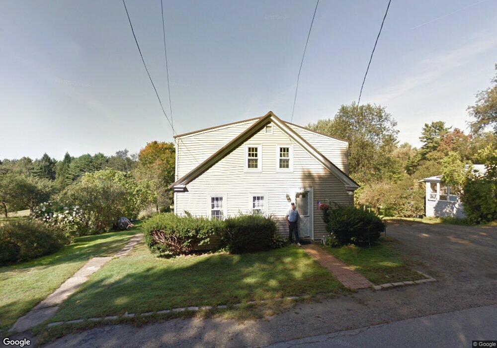
141 Fore Rd Eliot, ME 03903
South Eliot NeighborhoodEstimated Value: $454,469 - $708,000
3
Beds
2
Baths
2,088
Sq Ft
$282/Sq Ft
Est. Value
About This Home
This home is located at 141 Fore Rd, Eliot, ME 03903 and is currently estimated at $588,617, approximately $281 per square foot. 141 Fore Rd is a home located in York County with nearby schools including Marshwood High School and Seacoast Waldorf School.
Create a Home Valuation Report for This Property
The Home Valuation Report is an in-depth analysis detailing your home's value as well as a comparison with similar homes in the area
Home Values in the Area
Average Home Value in this Area
Tax History Compared to Growth
Tax History
| Year | Tax Paid | Tax Assessment Tax Assessment Total Assessment is a certain percentage of the fair market value that is determined by local assessors to be the total taxable value of land and additions on the property. | Land | Improvement |
|---|---|---|---|---|
| 2024 | $3,384 | $285,600 | $128,500 | $157,100 |
| 2023 | $3,334 | $272,200 | $122,100 | $150,100 |
| 2022 | $3,294 | $272,200 | $122,100 | $150,100 |
| 2021 | $3,169 | $264,200 | $116,800 | $147,400 |
| 2020 | $3,128 | $243,500 | $111,400 | $132,100 |
| 2019 | $3,579 | $243,500 | $111,400 | $132,100 |
| 2018 | $3,579 | $243,500 | $111,400 | $132,100 |
| 2017 | $133 | $255,000 | $111,400 | $143,600 |
| 2016 | $128 | $255,000 | $111,400 | $143,600 |
| 2015 | $3,555 | $253,900 | $111,400 | $142,500 |
| 2014 | $3,504 | $253,900 | $111,400 | $142,500 |
| 2013 | $3,344 | $253,900 | $111,400 | $142,500 |
Source: Public Records
Map
Nearby Homes
- 18 Governor Hill Rd
- 0 Franks Fort Island Unit 1631886
- 1708 State Rd
- 27 Wentworth Terrace
- 33 Little Bay Dr
- 0 Cote Dr
- 18 Little Bay Dr
- 956 Main St
- SLIP 15 Little Bay Marina
- 71 Shipwright Way
- 10 Shipwright Way
- 850 Main St
- 708 River Rd Unit 2
- 708 River Rd Unit 3
- Slip B18 Little Bay
- 41 Clearwater Dr
- 18 Shipping Ln
- TBD Cedar Rd
- 10 Pasture Hill Dr
- 10 Broadfields Rd