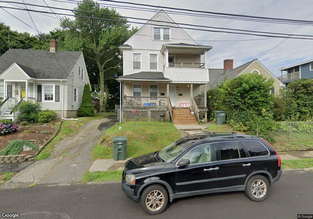
141 Fox St Bridgeport, CT 06605
Black Rock NeighborhoodEstimated Value: $332,000 - $585,000
4
Beds
2
Baths
2,376
Sq Ft
$198/Sq Ft
Est. Value
About This Home
This home is located at 141 Fox St, Bridgeport, CT 06605 and is currently estimated at $470,145, approximately $197 per square foot. 141 Fox St is a home located in Fairfield County with nearby schools including Holland Hill Elementary, Fairfield Ludlowe High School, and Park City Prep Charter School.
Ownership History
Date
Name
Owned For
Owner Type
Purchase Details
Closed on
May 10, 1999
Sold by
Mceldowney Ralph E and Eilbertie Tyler
Bought by
Carr-Jr Charles N
Current Estimated Value
Home Financials for this Owner
Home Financials are based on the most recent Mortgage that was taken out on this home.
Original Mortgage
$130,000
Interest Rate
6.92%
Purchase Details
Closed on
May 22, 1996
Sold by
Medvey Daniel L
Bought by
Mceldowney Ralph E and Gilbertie Tyler
Home Financials for this Owner
Home Financials are based on the most recent Mortgage that was taken out on this home.
Original Mortgage
$56,700
Interest Rate
8.5%
Mortgage Type
Unknown
Create a Home Valuation Report for This Property
The Home Valuation Report is an in-depth analysis detailing your home's value as well as a comparison with similar homes in the area
Home Values in the Area
Average Home Value in this Area
Purchase History
| Date | Buyer | Sale Price | Title Company |
|---|---|---|---|
| Carr-Jr Charles N | $115,000 | -- | |
| Carr-Jr Charles N | $115,000 | -- | |
| Mceldowney Ralph E | $31,500 | -- | |
| Mceldowney Ralph E | $31,500 | -- | |
| Mceldowney Ralph E | $31,500 | -- |
Source: Public Records
Mortgage History
| Date | Status | Borrower | Loan Amount |
|---|---|---|---|
| Open | Mceldowney Ralph E | $167,000 | |
| Closed | Mceldowney Ralph E | $130,000 | |
| Previous Owner | Mceldowney Ralph E | $56,700 |
Source: Public Records
Tax History
| Year | Tax Paid | Tax Assessment Tax Assessment Total Assessment is a certain percentage of the fair market value that is determined by local assessors to be the total taxable value of land and additions on the property. | Land | Improvement |
|---|---|---|---|---|
| 2025 | $8,995 | $207,030 | $101,780 | $105,250 |
| 2024 | $8,995 | $207,030 | $101,780 | $105,250 |
| 2023 | $8,995 | $207,030 | $101,780 | $105,250 |
| 2022 | $8,995 | $207,030 | $101,780 | $105,250 |
| 2021 | $8,995 | $207,030 | $101,780 | $105,250 |
| 2020 | $7,582 | $140,430 | $66,080 | $74,350 |
| 2019 | $8,129 | $140,430 | $66,080 | $74,350 |
| 2018 | $7,635 | $140,430 | $66,080 | $74,350 |
| 2017 | $7,635 | $140,430 | $66,080 | $74,350 |
| 2016 | $7,635 | $140,430 | $66,080 | $74,350 |
| 2015 | $6,511 | $154,300 | $55,520 | $98,780 |
| 2014 | $6,511 | $154,300 | $55,520 | $98,780 |
Source: Public Records
Map
Nearby Homes
- 165 Bennett St
- 3250 Fairfield Ave Unit 302
- 855 Brewster St Unit 857
- 90 Clarkson St
- 132 Gilman St
- 148 Alfred St
- 554 Brewster St Unit 4
- 37 Rowsley St Unit 6
- 27 Nash Ln Unit 5
- 20 Haddon St Unit 5
- 377 Midland St
- 78 Rowsley St Unit 4
- 315 Seaside Ave
- 117 Nash Ln
- 97 Fayerweather Terrace
- 22 Monroe St Unit 24
- 287 Hansen Ave
- 318 Grovers Ave
- 65 Ellsworth St Unit 302
- 188 Monroe St Unit 190
- 131 Fox St
- 147 Fox St
- 115 Fox St
- 115 Fox St Unit 2nd Floor
- 153 Fox St
- 112 Morehouse St
- 104 Morehouse St
- 122 Morehouse St
- 2838 Fairfield Ave Unit 204
- 2838 Fairfield Ave Unit 103
- 2838 Fairfield Ave Unit 202
- 2838 Fairfield Ave Unit 207
- 2838 Fairfield Ave Unit 107
- 2838 Fairfield Ave Unit 108
- 2838 Fairfield Ave Unit 203
- 2838 Fairfield Ave Unit 106
- 2838 Fairfield Ave Unit 105
- 2838 Fairfield Ave Unit 104
- 167 Fox St Unit 171
- 96 Morehouse St Unit 98
Your Personal Tour Guide
Ask me questions while you tour the home.