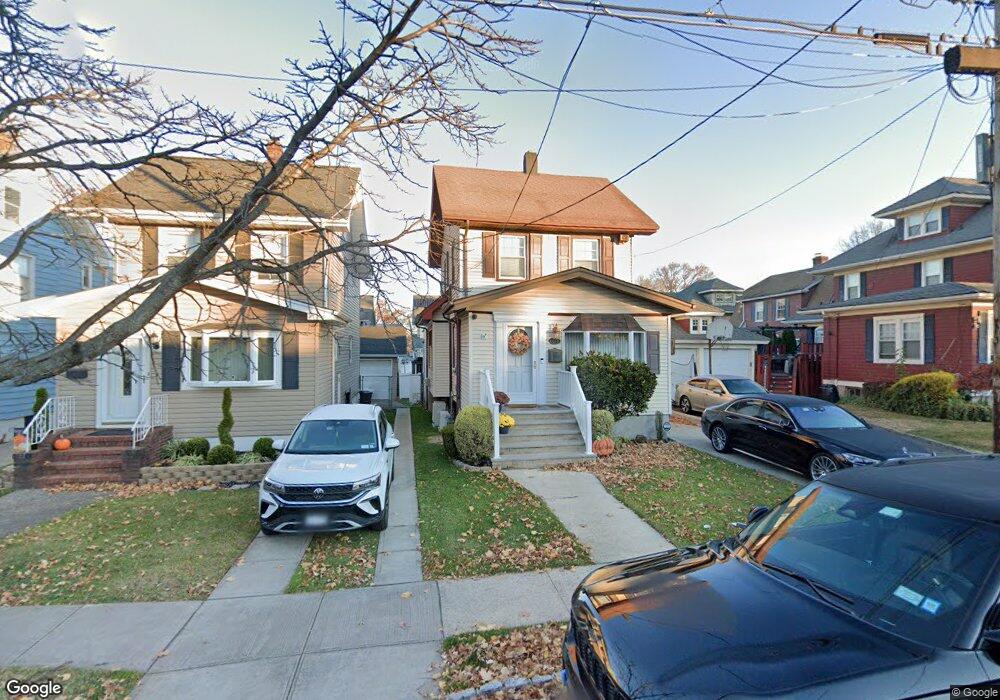
141 Harvest Ave Staten Island, NY 10310
West Brighton NeighborhoodEstimated Value: $609,397 - $795,000
--
Bed
4
Baths
1,302
Sq Ft
$544/Sq Ft
Est. Value
About This Home
This home is located at 141 Harvest Ave, Staten Island, NY 10310 and is currently estimated at $707,849, approximately $543 per square foot. 141 Harvest Ave is a home located in Richmond County with nearby schools including P.S. 45 John Tyler, Is 61 William A Morris, and Curtis High School.
Ownership History
Date
Name
Owned For
Owner Type
Purchase Details
Closed on
Feb 13, 2006
Sold by
Martucci Joseph A and Wilk Diane M
Bought by
Martucci Joseph A and Martucci Diane M
Current Estimated Value
Home Financials for this Owner
Home Financials are based on the most recent Mortgage that was taken out on this home.
Original Mortgage
$262,000
Interest Rate
7%
Mortgage Type
New Conventional
Create a Home Valuation Report for This Property
The Home Valuation Report is an in-depth analysis detailing your home's value as well as a comparison with similar homes in the area
Home Values in the Area
Average Home Value in this Area
Purchase History
| Date | Buyer | Sale Price | Title Company |
|---|---|---|---|
| Martucci Joseph A | -- | None Available |
Source: Public Records
Mortgage History
| Date | Status | Borrower | Loan Amount |
|---|---|---|---|
| Closed | Martucci Joseph A | $262,000 |
Source: Public Records
Tax History Compared to Growth
Tax History
| Year | Tax Paid | Tax Assessment Tax Assessment Total Assessment is a certain percentage of the fair market value that is determined by local assessors to be the total taxable value of land and additions on the property. | Land | Improvement |
|---|---|---|---|---|
| 2025 | $5,657 | $38,520 | $8,743 | $29,777 |
| 2024 | $5,657 | $41,100 | $7,730 | $33,370 |
| 2023 | $5,720 | $28,166 | $7,951 | $20,215 |
| 2022 | $5,580 | $38,940 | $11,280 | $27,660 |
| 2021 | $5,550 | $36,240 | $11,280 | $24,960 |
| 2020 | $5,266 | $31,260 | $11,280 | $19,980 |
| 2019 | $4,910 | $30,720 | $11,280 | $19,440 |
| 2018 | $4,785 | $23,472 | $10,006 | $13,466 |
| 2017 | $4,748 | $23,294 | $9,930 | $13,364 |
| 2016 | $4,393 | $21,976 | $10,787 | $11,189 |
| 2015 | $3,754 | $20,733 | $11,373 | $9,360 |
| 2014 | $3,754 | $19,560 | $12,540 | $7,020 |
Source: Public Records
Map
Nearby Homes
- 152 Harvest Ave
- 100 Lawrence Ave
- 677 Bement Ave
- 34 Harvest Ave
- 20 Baker Place
- 605 Bard Ave
- 710 Oakland Ave
- 432 Pelton Ave
- 54 City Blvd
- 706 Broadway
- 1 Whitewood Ave
- 244 Delafield Ave
- 145 Norma Place
- 751 Oakland Ave
- 386 N Burgher Ave
- 12 Freeman Place
- 54 Purcell St
- 0 Hardin Ave
- 372 Sharon Ave
- 1 Sunset Hill Dr
- 145 Harvest Ave
- 149 Harvest Ave
- 576 Oakland Ave
- 574 Oakland Ave
- 0 Harvest Ave
- 22 Jones Place
- 151 Harvest Ave
- 18 Jones Place
- 564 Oakland Ave
- 14 Jones Place
- 560 Oakland Ave
- 12 Jones Place
- 140 Harvest Ave
- 556 Oakland Ave
- 155 Harvest Ave
- 571 Bement Ave
- 142 Harvest Ave
- 584 Oakland Ave
- 146 Harvest Ave
- 148 Harvest Ave