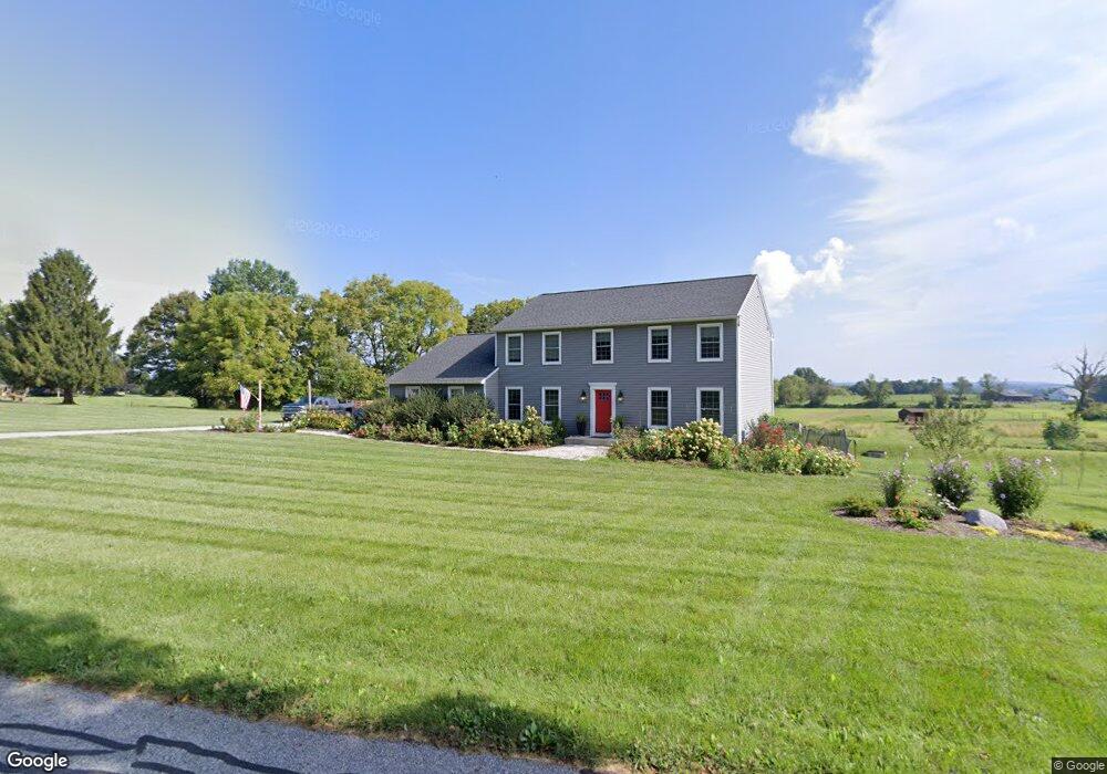
141 Keen Rd Spring City, PA 19475
East Vincent Township NeighborhoodEstimated Value: $623,000 - $783,096
4
Beds
3
Baths
2,832
Sq Ft
$241/Sq Ft
Est. Value
About This Home
This home is located at 141 Keen Rd, Spring City, PA 19475 and is currently estimated at $683,024, approximately $241 per square foot. 141 Keen Rd is a home with nearby schools including East Coventry Elementary School, Owen J Roberts Middle School, and Owen J Roberts High School.
Ownership History
Date
Name
Owned For
Owner Type
Purchase Details
Closed on
Jun 30, 2014
Sold by
Jacobs Jane P
Bought by
Schondra Matthew C and Schondra Elizabeth K
Current Estimated Value
Home Financials for this Owner
Home Financials are based on the most recent Mortgage that was taken out on this home.
Original Mortgage
$319,678
Outstanding Balance
$243,134
Interest Rate
4.12%
Mortgage Type
Construction
Estimated Equity
$439,890
Purchase Details
Closed on
Jun 2, 1995
Sold by
Jacobs Richard S and Jacobs Jane P
Bought by
Jacobs Jane P
Create a Home Valuation Report for This Property
The Home Valuation Report is an in-depth analysis detailing your home's value as well as a comparison with similar homes in the area
Home Values in the Area
Average Home Value in this Area
Purchase History
| Date | Buyer | Sale Price | Title Company |
|---|---|---|---|
| Schondra Matthew C | $118,000 | None Available | |
| Jacobs Jane P | -- | -- |
Source: Public Records
Mortgage History
| Date | Status | Borrower | Loan Amount |
|---|---|---|---|
| Open | Schondra Matthew C | $319,678 |
Source: Public Records
Tax History Compared to Growth
Tax History
| Year | Tax Paid | Tax Assessment Tax Assessment Total Assessment is a certain percentage of the fair market value that is determined by local assessors to be the total taxable value of land and additions on the property. | Land | Improvement |
|---|---|---|---|---|
| 2025 | $7,608 | $238,680 | $58,590 | $180,090 |
| 2024 | $7,608 | $238,680 | $58,590 | $180,090 |
| 2023 | $7,295 | $233,670 | $58,590 | $175,080 |
| 2022 | $7,176 | $233,670 | $58,590 | $175,080 |
| 2021 | $7,053 | $233,670 | $58,590 | $175,080 |
| 2020 | $6,870 | $233,670 | $58,590 | $175,080 |
| 2019 | $6,741 | $233,670 | $58,590 | $175,080 |
| 2018 | $8,640 | $233,670 | $58,590 | $175,080 |
| 2017 | $8,435 | $233,670 | $58,590 | $175,080 |
| 2016 | $1,804 | $233,670 | $58,590 | $175,080 |
| 2015 | $1,804 | $58,590 | $58,590 | $0 |
| 2014 | $1,804 | $58,590 | $58,590 | $0 |
Source: Public Records
Map
Nearby Homes
- 723 Saylors Mill Rd
- 25 Hastings Ln
- 109 Alackness Rd
- 1112 W Bridge St
- 26 Kolb Rd
- 120 Alackness Rd
- 891 Brown Dr
- 10 Ashwood Dr
- Welsh Plan at Riverstone Crossing
- 618 Hoffman Blvd
- 621 Hoffman Blvd
- 5 Madison Dr
- 33 Mulberry Green
- 801 Heckel Ave
- 104 Badalamenti Dr
- 865 Cypress Ave
- 857 Buttonwood Ave
- 440 King St
- 885 Buttonwood Ave
- 841 Cypress Ave