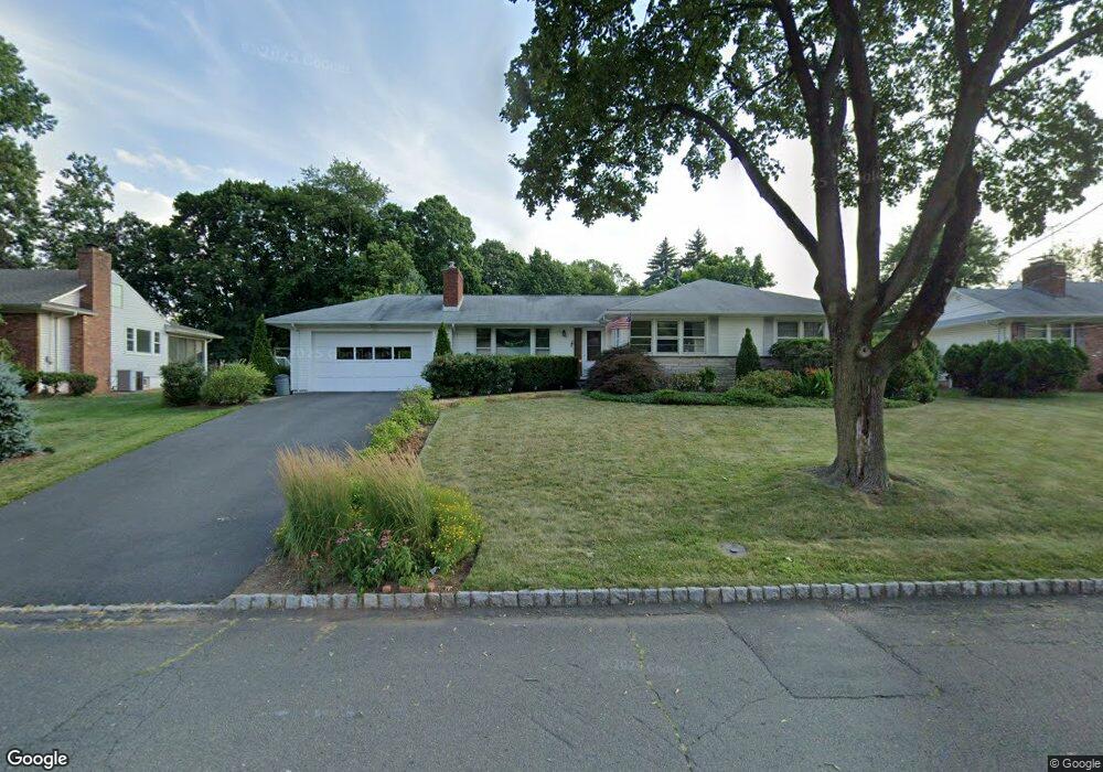
141 Mali Dr North Plainfield, NJ 07062
Estimated Value: $465,000 - $607,000
--
Bed
--
Bath
1,504
Sq Ft
$355/Sq Ft
Est. Value
About This Home
This home is located at 141 Mali Dr, North Plainfield, NJ 07062 and is currently estimated at $534,054, approximately $355 per square foot. 141 Mali Dr is a home located in Somerset County with nearby schools including Somerset Intermediate School, North Plainfield Middle/High School, and North Plainfield Middle School.
Ownership History
Date
Name
Owned For
Owner Type
Purchase Details
Closed on
May 22, 2019
Sold by
Kaplan Arnone Barbara Ann and Estate Of Sanford Kaplan
Bought by
Reading Martha L
Current Estimated Value
Home Financials for this Owner
Home Financials are based on the most recent Mortgage that was taken out on this home.
Original Mortgage
$248,000
Outstanding Balance
$217,599
Interest Rate
4.1%
Mortgage Type
New Conventional
Estimated Equity
$316,455
Purchase Details
Closed on
Nov 29, 2007
Sold by
Kaplan Sanford and Kaplan Arnone Barbara
Bought by
Kaplan Sanford
Create a Home Valuation Report for This Property
The Home Valuation Report is an in-depth analysis detailing your home's value as well as a comparison with similar homes in the area
Home Values in the Area
Average Home Value in this Area
Purchase History
| Date | Buyer | Sale Price | Title Company |
|---|---|---|---|
| Reading Martha L | $310,000 | Fidelity National Ttl Ins Co | |
| Kaplan Sanford | -- | None Available |
Source: Public Records
Mortgage History
| Date | Status | Borrower | Loan Amount |
|---|---|---|---|
| Open | Reading Martha L | $248,000 |
Source: Public Records
Tax History Compared to Growth
Tax History
| Year | Tax Paid | Tax Assessment Tax Assessment Total Assessment is a certain percentage of the fair market value that is determined by local assessors to be the total taxable value of land and additions on the property. | Land | Improvement |
|---|---|---|---|---|
| 2025 | $11,985 | $275,000 | $110,000 | $165,000 |
| 2024 | $11,985 | $275,000 | $110,000 | $165,000 |
| 2023 | $11,685 | $275,000 | $110,000 | $165,000 |
| 2022 | $11,223 | $275,000 | $110,000 | $165,000 |
| 2021 | $11,080 | $275,000 | $110,000 | $165,000 |
| 2020 | $10,758 | $275,000 | $110,000 | $165,000 |
| 2019 | $10,472 | $275,000 | $110,000 | $165,000 |
| 2018 | $10,249 | $275,000 | $110,000 | $165,000 |
| 2017 | $10,381 | $275,000 | $110,000 | $165,000 |
| 2016 | $9,870 | $275,000 | $110,000 | $165,000 |
| 2015 | $9,452 | $275,000 | $110,000 | $165,000 |
| 2014 | $9,017 | $275,000 | $110,000 | $165,000 |
Source: Public Records
Map
Nearby Homes
- 935 E Front St Unit C
- 1003 E Front St Unit A
- 14-16 Netherwood Ave
- 104 Graybar Dr
- 959 E Front St Unit D
- 949 E Front St
- 949 E Front St Unit A
- 95 Farragut Rd
- 361 Richard Way
- 303 Muriel Ave
- 1243 E Front St Unit 49
- 125 Leland Ave Unit 27
- 93 Raymond Ave
- 99 Raymond Ave
- 24 Shady Ct
- 116 Sumner Ave Unit 18
- 327 Manning Ave
- 11 Raymond Ave Unit 13
- 1254 E Front St
- 234 N Jackson Ave
- 137 Mali Dr
- 145 Mali Dr
- 154 Meadowbrook Dr
- 160 Meadowbrook Dr
- 148 Meadowbrook Dr
- 146 Mali Dr
- 149 Mali Dr
- 133 Mali Dr
- 170 Meadowbrook Dr
- 150 Mali Dr
- 138 Meadowbrook Dr
- 138 Mali Dr
- 178 Meadowbrook Dr
- 176 Meadowbrook Dr
- 153 Mali Dr
- 129 Mali Dr
- 154 Mali Dr
- 175 Meadowbrook Dr
- 113 Netherwood Ave
- 134 Mali Dr