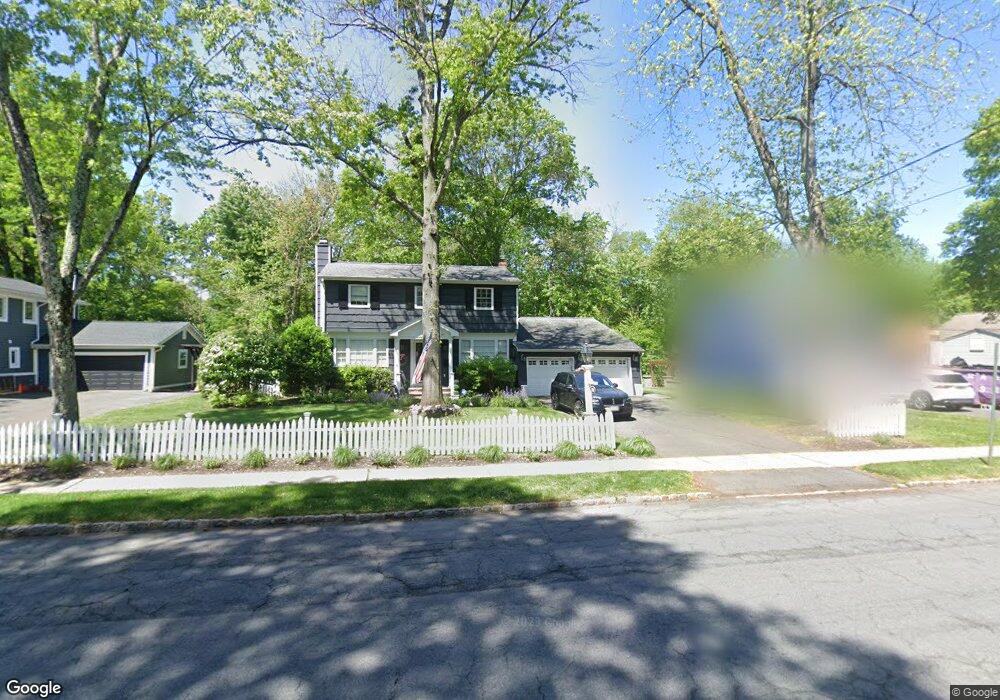
141 Maple St New Providence, NJ 07974
New Providence AreaEstimated Value: $1,080,535 - $1,254,000
Studio
--
Bath
2,221
Sq Ft
$521/Sq Ft
Est. Value
About This Home
This home is located at 141 Maple St, New Providence, NJ 07974 and is currently estimated at $1,158,134, approximately $521 per square foot. 141 Maple St is a home located in Union County with nearby schools including New Providence High School, The Academy of Our Lady of Peace, and Oak Knoll School of the Holy Child.
Create a Home Valuation Report for This Property
The Home Valuation Report is an in-depth analysis detailing your home's value as well as a comparison with similar homes in the area
Home Values in the Area
Average Home Value in this Area
Tax History
We collect this data history from publicly available records. To have your information removed, we recommend requesting removal directly through your county’s website.
| Year | Tax Paid | Tax Assessment Tax Assessment Total Assessment is a certain percentage of the fair market value that is determined by local assessors to be the total taxable value of land and additions on the property. | Land | Improvement |
|---|---|---|---|---|
| 2026 | $17,555 | $334,900 | $133,100 | $201,800 |
| 2025 | $17,555 | $334,900 | $133,100 | $201,800 |
| 2024 | $16,348 | $334,900 | $133,100 | $201,800 |
| 2023 | $16,348 | $326,500 | $133,100 | $193,400 |
| 2022 | $16,123 | $326,500 | $133,100 | $193,400 |
| 2021 | $16,005 | $326,500 | $133,100 | $193,400 |
| 2020 | $15,886 | $324,200 | $133,100 | $191,100 |
| 2019 | $15,789 | $324,200 | $133,100 | $191,100 |
| 2018 | $15,707 | $324,200 | $133,100 | $191,100 |
| 2017 | $15,451 | $324,200 | $133,100 | $191,100 |
| 2016 | $15,234 | $324,200 | $133,100 | $191,100 |
| 2015 | $15,023 | $324,200 | $133,100 | $191,100 |
| 2014 | $14,796 | $324,200 | $133,100 | $191,100 |
Source: Public Records
Map
Nearby Homes
- 158 Maple St
- 179 Grant Ave
- 21 Woodruff Ct
- 18 W 5th St
- 18 Kings Hill Ct
- 1131 Springfield Ave
- 29 Bradford St
- 21 Gloucester Rd
- 167 Mountain Ave
- 38 Valley View Ave
- 768 Springfield Ave Unit B3
- 42 Sherwood Dr
- 232 South St
- 777 Springfield Ave Unit 1
- 55 Tanglewood Dr
- 6 Deerfield Rd
- 718 Springfield Ave
- 39 Gallinson Dr
- 4A Foley Square Unit 4A
- 197 Woodbine Cir
Your Personal Tour Guide
Ask me questions while you tour the home.