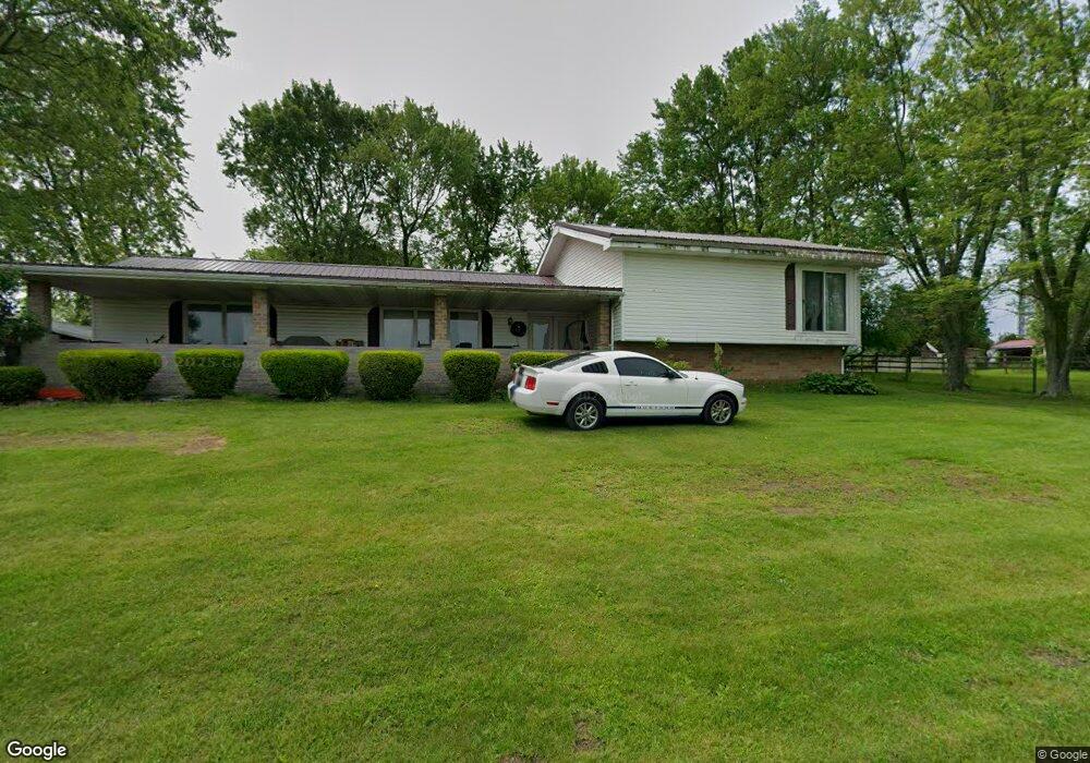
141 May View Dr Somerset, PA 15501
Estimated Value: $210,590 - $333,000
3
Beds
2
Baths
2,924
Sq Ft
$85/Sq Ft
Est. Value
About This Home
This home is located at 141 May View Dr, Somerset, PA 15501 and is currently estimated at $248,648, approximately $85 per square foot. 141 May View Dr is a home located in Somerset County with nearby schools including Maple Ridge Elementary School, Eagle View Elementary School, and Somerset Area Junior/Senior High School.
Ownership History
Date
Name
Owned For
Owner Type
Purchase Details
Closed on
Apr 3, 2020
Sold by
Shaffer David E and Shaffer Donald E
Bought by
Livengood Cindy L
Current Estimated Value
Purchase Details
Closed on
Jun 9, 2005
Sold by
Shaffer Stewart Wayne and Shaffer George E
Bought by
Livengood Cindy L
Home Financials for this Owner
Home Financials are based on the most recent Mortgage that was taken out on this home.
Original Mortgage
$118,800
Interest Rate
5.82%
Mortgage Type
New Conventional
Create a Home Valuation Report for This Property
The Home Valuation Report is an in-depth analysis detailing your home's value as well as a comparison with similar homes in the area
Home Values in the Area
Average Home Value in this Area
Purchase History
| Date | Buyer | Sale Price | Title Company |
|---|---|---|---|
| Livengood Cindy L | -- | None Available | |
| Livengood Cindy L | $132,000 | None Available |
Source: Public Records
Mortgage History
| Date | Status | Borrower | Loan Amount |
|---|---|---|---|
| Previous Owner | Livengood Cindy L | $118,800 |
Source: Public Records
Tax History Compared to Growth
Tax History
| Year | Tax Paid | Tax Assessment Tax Assessment Total Assessment is a certain percentage of the fair market value that is determined by local assessors to be the total taxable value of land and additions on the property. | Land | Improvement |
|---|---|---|---|---|
| 2025 | $3,222 | $52,160 | $0 | $0 |
| 2024 | $3,222 | $52,160 | $0 | $0 |
| 2023 | $3,131 | $52,160 | $0 | $0 |
| 2022 | $3,036 | $52,160 | $0 | $0 |
| 2021 | $2,956 | $52,160 | $0 | $0 |
| 2020 | $2,907 | $51,300 | $0 | $0 |
| 2019 | $2,907 | $51,300 | $0 | $0 |
| 2018 | $2,907 | $51,300 | $7,110 | $44,190 |
| 2017 | $2,907 | $51,300 | $7,110 | $44,190 |
| 2016 | -- | $51,300 | $7,110 | $44,190 |
| 2015 | -- | $51,300 | $7,110 | $44,190 |
| 2014 | -- | $51,300 | $7,110 | $44,190 |
Source: Public Records
Map
Nearby Homes
- 102 Lillian Ln
- 575 Stoystown Rd
- 403 Rebecca St
- 218 Missoura St
- 213 Stoystown Rd
- 129 Missoura St
- 120 W Catherine St
- 726 Stoystown Rd
- 527 N Edgewood Ave
- 711 E Main St
- 158 W Union St
- 127 W Main St
- 100 Burgess St
- Lot 32 Gilmour Rd
- Lot 31 Gilmour Rd
- Lot 33 Gilmour Rd
- Lot 36 Gilmour Rd
- Lot 35 Gilmour Rd
- Lot 34 Gilmour Rd
- 248 Plank Rd
- 123 May View Dr
- 469 Stoystown Rd
- 475 Stoystown Rd
- 475 Stoystown Rd Unit 110 KL
- 475 Stoystown Rd Unit 112 KL
- 475 Stoystown Rd Unit 120 LL
- 475 Stoystown Rd Unit 118 LL
- 475 Stoystown Rd Unit 116 LL
- 475 Stoystown Rd Unit 112 LL
- 475 Stoystown Rd Unit 108 LL
- 475 Stoystown Rd Unit 106 LL
- 475 Stoystown Rd Unit 114 EA
- 475 Stoystown Rd Unit 112 EA
- 475 Stoystown Rd Unit 106 KL
- 463 Stoystown Rd
- 457 Stoystown Rd
- 128 W Arlington Dr
- 118 Don Ln
- 501 Stoystown Rd
- 114 Don Ln