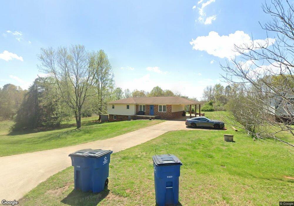
141 Michael Dr Forest City, NC 28043
Estimated Value: $258,232 - $518,000
4
Beds
3
Baths
1,680
Sq Ft
$208/Sq Ft
Est. Value
About This Home
This home is located at 141 Michael Dr, Forest City, NC 28043 and is currently estimated at $349,808, approximately $208 per square foot. 141 Michael Dr is a home located in Rutherford County with nearby schools including Forrest W. Hunt Elementary School, Chase Middle School, and Chase High School.
Ownership History
Date
Name
Owned For
Owner Type
Purchase Details
Closed on
Jul 28, 2006
Sold by
Hill Cindy M and Hill Jeffrey
Bought by
Wheeler Tory S and Wheeler Virginia S
Current Estimated Value
Home Financials for this Owner
Home Financials are based on the most recent Mortgage that was taken out on this home.
Original Mortgage
$110,300
Outstanding Balance
$65,645
Interest Rate
6.6%
Mortgage Type
New Conventional
Estimated Equity
$284,163
Create a Home Valuation Report for This Property
The Home Valuation Report is an in-depth analysis detailing your home's value as well as a comparison with similar homes in the area
Home Values in the Area
Average Home Value in this Area
Purchase History
| Date | Buyer | Sale Price | Title Company |
|---|---|---|---|
| Wheeler Tory S | $138,000 | Na |
Source: Public Records
Mortgage History
| Date | Status | Borrower | Loan Amount |
|---|---|---|---|
| Open | Wheeler Tory S | $110,300 |
Source: Public Records
Tax History Compared to Growth
Tax History
| Year | Tax Paid | Tax Assessment Tax Assessment Total Assessment is a certain percentage of the fair market value that is determined by local assessors to be the total taxable value of land and additions on the property. | Land | Improvement |
|---|---|---|---|---|
| 2025 | $1,422 | $222,300 | $16,500 | $205,800 |
| 2024 | $1,354 | $222,300 | $16,500 | $205,800 |
| 2023 | $1,053 | $215,200 | $16,500 | $198,700 |
| 2022 | $1,053 | $132,700 | $16,500 | $116,200 |
| 2021 | $1,035 | $132,700 | $16,500 | $116,200 |
| 2020 | $1,022 | $132,700 | $16,500 | $116,200 |
| 2019 | $1,014 | $132,700 | $16,500 | $116,200 |
| 2018 | $1,046 | $137,600 | $11,100 | $126,500 |
| 2016 | $1,024 | $137,600 | $11,100 | $126,500 |
| 2013 | -- | $137,600 | $11,100 | $126,500 |
Source: Public Records
Map
Nearby Homes
- 0 Whispering Pines Cir Unit CAR4275447
- 0 Shady Nook
- 281 N Quail Run
- 178 Watkins Dr
- Lot 11 Mcdade Rd
- Lot 12 Mcdade Rd
- Lot 10 Mcdade Rd
- 1180 Piney Ridge Rd
- 148 Westhaven St
- 179 Sedgefield Dr
- 311 Franklin Dr
- Lot 34 Line Dr
- Lot 32 Line Dr
- Lot 31 Line Dr
- Lot 20 Line Dr
- Lot 19 Line Dr
- 00 Sunset Dr
- 183 Caldwell St
- 168 Collins Ave
- 0000 Butler Rd
- 151 Michael Dr
- 159 Michael Dr
- 150 Michael Dr
- 171 Michael Dr
- 160 Michael Dr
- 170 Michael Dr
- 184 Michael Dr
- 223 McDonald Rd
- 190 McDonald Rd
- 220 McDonald Rd
- 204 McDonald Rd
- 170 McDonald Rd
- 422 Doggett Rd
- 114 McDonald Rd
- 371 Bethany Church Rd Unit 373
- 151 Whispering Pines Cir
- 163 Whispering Pines Cir
- 511 Bethany Church Rd
- 200 Whispering Pines Dr
- 139 Grayson Bostic Rd