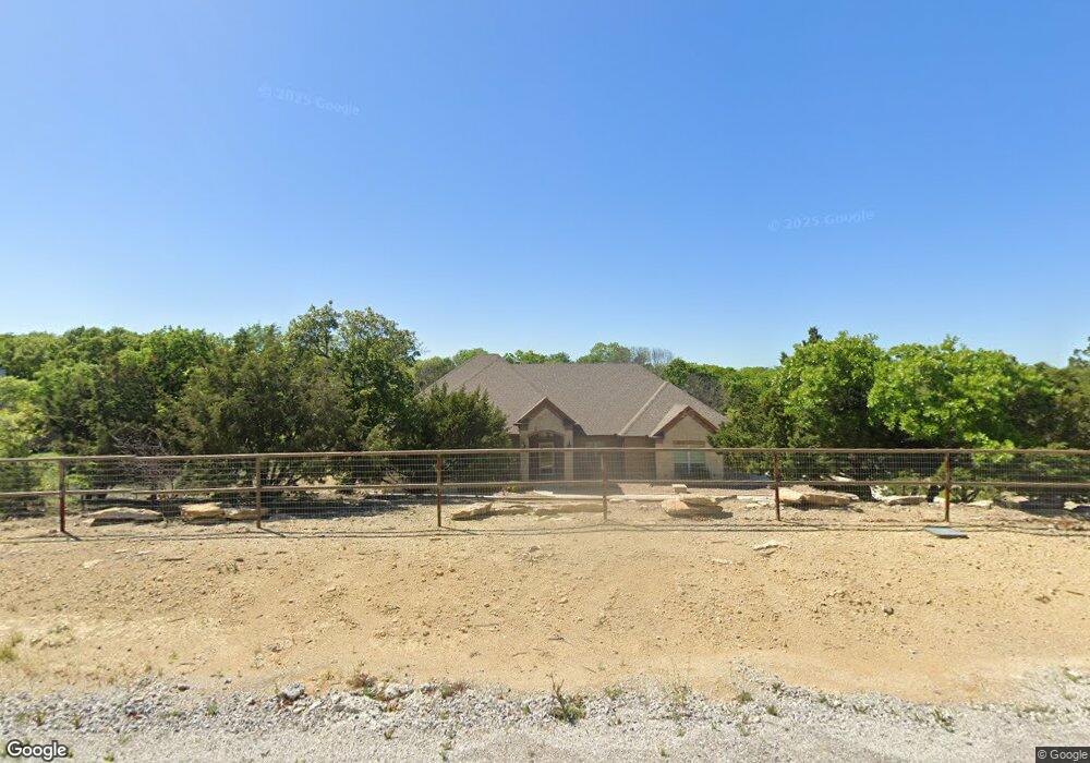
141 Mike Thornton Ct Weatherford, TX 76088
Estimated Value: $543,751 - $659,000
--
Bed
--
Bath
2,362
Sq Ft
$257/Sq Ft
Est. Value
About This Home
This home is located at 141 Mike Thornton Ct, Weatherford, TX 76088 and is currently estimated at $606,188, approximately $256 per square foot. 141 Mike Thornton Ct is a home with nearby schools including Millsap Elementary School, Millsap Middle School, and Millsap High School.
Ownership History
Date
Name
Owned For
Owner Type
Purchase Details
Closed on
Sep 28, 2018
Sold by
Premier Home & Land Llc
Bought by
Weirich Anthony S and Weirich Susan
Current Estimated Value
Home Financials for this Owner
Home Financials are based on the most recent Mortgage that was taken out on this home.
Original Mortgage
$332,666
Outstanding Balance
$288,907
Interest Rate
4.5%
Mortgage Type
VA
Estimated Equity
$317,281
Purchase Details
Closed on
Sep 9, 2018
Sold by
Macanudo Llc
Bought by
Premier Home & Land Llc
Home Financials for this Owner
Home Financials are based on the most recent Mortgage that was taken out on this home.
Original Mortgage
$332,666
Outstanding Balance
$288,907
Interest Rate
4.5%
Mortgage Type
VA
Estimated Equity
$317,281
Create a Home Valuation Report for This Property
The Home Valuation Report is an in-depth analysis detailing your home's value as well as a comparison with similar homes in the area
Home Values in the Area
Average Home Value in this Area
Purchase History
| Date | Buyer | Sale Price | Title Company |
|---|---|---|---|
| Weirich Anthony S | -- | Fidelity National Title Azle | |
| Premier Home & Land Llc | -- | Fidelity National Title Azle |
Source: Public Records
Mortgage History
| Date | Status | Borrower | Loan Amount |
|---|---|---|---|
| Open | Weirich Anthony S | $332,666 | |
| Closed | Premier Home & Land Llc | $275,467 |
Source: Public Records
Tax History Compared to Growth
Tax History
| Year | Tax Paid | Tax Assessment Tax Assessment Total Assessment is a certain percentage of the fair market value that is determined by local assessors to be the total taxable value of land and additions on the property. | Land | Improvement |
|---|---|---|---|---|
| 2025 | $6,301 | $487,436 | -- | -- |
| 2024 | $6,301 | $443,124 | -- | -- |
| 2023 | $6,301 | $402,840 | $0 | $0 |
| 2022 | $6,949 | $366,220 | $58,000 | $308,220 |
| 2021 | $7,228 | $366,220 | $58,000 | $308,220 |
| 2020 | $6,755 | $313,980 | $58,000 | $255,980 |
| 2019 | $7,244 | $313,980 | $58,000 | $255,980 |
| 2018 | $677 | $29,000 | $29,000 | $0 |
| 2017 | $701 | $29,000 | $29,000 | $0 |
Source: Public Records
Map
Nearby Homes
- 124 Mike Thornton Ct
- 1027 Oak Bend Ln
- 112 Bruce Crandall Ct
- 1019 Oak Bend Ln
- 4710 Mineral Wells Hwy
- TBD Old Mineral Wells Hwy
- 1061 Salvation Dr
- 1033 Salvation Dr
- 1009 Salvation Dr
- 1057 Salvation Dr
- 1017 Salvation Dr
- 103 Saddle Club Rd
- 4025 Life Dr
- 4024 Life Dr
- 2097 Redemption Dr
- 2068 Redemption Dr
- 1001 Salvation
- 3024 Truth Ct
- Brazos Plan at Freeman Ranch
- Longhorn Plan at Freeman Ranch
- 147 Mike Thornton Ct
- 137 Mike Thornton Ct
- 144 Mike Thornton Ct
- 152 Mike Thornton Ct
- 140 Mike Thornton Ct
- 136 Mike Thornton Ct
- 134 Mike Thornton Ct
- 133 Mike Thornton Ct
- 116 Woody Williams Ct
- 125 Woody Williams Ct
- 132 Mike Thornton Ct
- 110 Woody Williams Ct
- 117 Woody Williams Ct
- 121 Woody Williams Ct
- 128 Mike Thornton Ct
- 113 Woody Williams Ct
- 109 Woody Williams Ct
- 123 Mike Thornton Ct
- 106 Tommy Norris Ct
- 1055 Oak Bend Ln