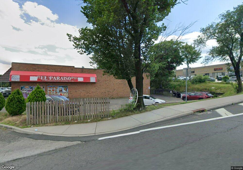
141 Nys Rte 59 Ramapo, NY 10952
Estimated Value: $2,114,306
--
Bed
--
Bath
--
Sq Ft
0.89
Acres
About This Home
This home is located at 141 Nys Rte 59, Ramapo, NY 10952 and is currently estimated at $2,114,306. 141 Nys Rte 59 is a home located in Rockland County with nearby schools including Margetts Elementary School, Chestnut Ridge Middle School, and Spring Valley High School.
Ownership History
Date
Name
Owned For
Owner Type
Purchase Details
Closed on
Mar 18, 2014
Sold by
Lask Developers Llc
Bought by
141 Rt59 Llc
Current Estimated Value
Home Financials for this Owner
Home Financials are based on the most recent Mortgage that was taken out on this home.
Original Mortgage
$450,000
Interest Rate
4.33%
Mortgage Type
New Conventional
Purchase Details
Closed on
Jan 20, 2010
Sold by
Lask Developers Llc
Bought by
Lask Developers Llc
Purchase Details
Closed on
Jun 19, 2007
Sold by
New Mountain Estates Inc
Bought by
Lask Developers Llc
Purchase Details
Closed on
Apr 30, 2002
Sold by
Lagana Joseph R and Kaplan Sandra
Bought by
Gross Lesser and Ostreicher Zvi
Create a Home Valuation Report for This Property
The Home Valuation Report is an in-depth analysis detailing your home's value as well as a comparison with similar homes in the area
Home Values in the Area
Average Home Value in this Area
Purchase History
| Date | Buyer | Sale Price | Title Company |
|---|---|---|---|
| 141 Rt59 Llc | $1,100,000 | None Available | |
| Lask Developers Llc | -- | American Title Insurance Co | |
| Lask Developers Llc | -- | None Available | |
| Gross Lesser | $210,000 | -- |
Source: Public Records
Mortgage History
| Date | Status | Borrower | Loan Amount |
|---|---|---|---|
| Closed | 141 Rt59 Llc | $450,000 |
Source: Public Records
Tax History Compared to Growth
Tax History
| Year | Tax Paid | Tax Assessment Tax Assessment Total Assessment is a certain percentage of the fair market value that is determined by local assessors to be the total taxable value of land and additions on the property. | Land | Improvement |
|---|---|---|---|---|
| 2024 | $16,503 | $70,000 | $70,000 | -- |
| 2023 | $16,503 | $70,000 | $70,000 | $0 |
| 2022 | $16,269 | $70,000 | $70,000 | $0 |
| 2021 | $16,269 | $70,000 | $70,000 | $0 |
| 2020 | $16,222 | $70,000 | $70,000 | $0 |
| 2019 | $16,650 | $70,000 | $70,000 | $0 |
| 2018 | $16,650 | $70,000 | $70,000 | $0 |
| 2017 | $16,407 | $70,000 | $70,000 | $0 |
| 2016 | $25,542 | $70,000 | $70,000 | $0 |
| 2015 | -- | $70,000 | $70,000 | $0 |
| 2014 | -- | $70,000 | $70,000 | $0 |
Source: Public Records
Map
Nearby Homes
- 105 Grove St Unit 202
- 24 Suffern Place Unit 202
- 24 Suffern Place Unit 201
- 6 Rose Garden Way Unit 203
- 5 Rose Garden Way Unit 302
- 17 Johanna Ln
- 45 Grove St Unit 201
- 45 Grove St Unit 111
- 6 Lanzut Ct Unit 214
- 9 Country Club Ln
- 11 Emes Ln
- 32 Saddle River Rd Unit 111
- 4 Farmer Ln
- 8 Harvest Ct
- 1 Lane St Unit 101
- 7 Kile Ct
- 305 S Grandview Ave
- 8 Dunn Rd
- 13 Thomsen Dr
- 31 Dolson Rd
