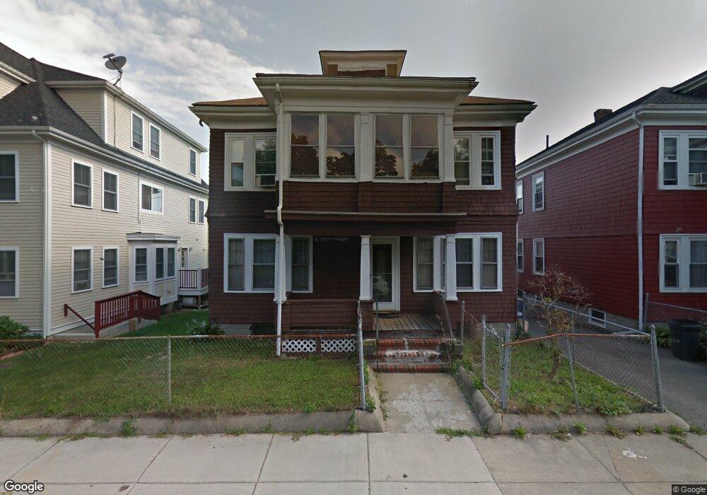
141 Ormond St Mattapan, MA 02126
Wellington Hill NeighborhoodEstimated Value: $767,000 - $918,000
6
Beds
2
Baths
3,072
Sq Ft
$273/Sq Ft
Est. Value
About This Home
This home is located at 141 Ormond St, Mattapan, MA 02126 and is currently estimated at $839,286, approximately $273 per square foot. 141 Ormond St is a home located in Suffolk County with nearby schools including KIPP Academy Boston Charter School and Berea Sda Academy.
Ownership History
Date
Name
Owned For
Owner Type
Purchase Details
Closed on
Jan 8, 2015
Sold by
Donnalson Donald S
Bought by
Boston Real Estate Dev
Current Estimated Value
Purchase Details
Closed on
Mar 5, 2014
Sold by
Sylvester Betty J and Sylvester Frank
Bought by
Donnalson Donald S and Gumbs Dwayne
Home Financials for this Owner
Home Financials are based on the most recent Mortgage that was taken out on this home.
Original Mortgage
$170,000
Interest Rate
4.39%
Mortgage Type
New Conventional
Create a Home Valuation Report for This Property
The Home Valuation Report is an in-depth analysis detailing your home's value as well as a comparison with similar homes in the area
Home Values in the Area
Average Home Value in this Area
Purchase History
| Date | Buyer | Sale Price | Title Company |
|---|---|---|---|
| Boston Real Estate Dev | -- | -- | |
| Donnalson Donald S | $104,000 | -- |
Source: Public Records
Mortgage History
| Date | Status | Borrower | Loan Amount |
|---|---|---|---|
| Previous Owner | Donnalson Donald S | $170,000 |
Source: Public Records
Tax History Compared to Growth
Tax History
| Year | Tax Paid | Tax Assessment Tax Assessment Total Assessment is a certain percentage of the fair market value that is determined by local assessors to be the total taxable value of land and additions on the property. | Land | Improvement |
|---|---|---|---|---|
| 2025 | $8,329 | $719,300 | $243,200 | $476,100 |
| 2024 | $7,809 | $716,400 | $214,000 | $502,400 |
| 2023 | $7,192 | $669,600 | $200,000 | $469,600 |
| 2022 | $6,872 | $631,600 | $188,700 | $442,900 |
| 2021 | $6,240 | $584,800 | $174,700 | $410,100 |
| 2020 | $5,919 | $560,500 | $183,000 | $377,500 |
| 2019 | $5,229 | $496,100 | $131,500 | $364,600 |
| 2018 | $4,726 | $451,000 | $131,500 | $319,500 |
| 2017 | $4,776 | $451,000 | $131,500 | $319,500 |
| 2016 | $3,482 | $316,500 | $131,500 | $185,000 |
| 2015 | $3,480 | $287,400 | $94,100 | $193,300 |
| 2014 | $3,228 | $256,600 | $94,100 | $162,500 |
Source: Public Records
Map
Nearby Homes
- 30-32 Westmore Rd
- 95 Deering Rd
- 17 Greendale Rd Unit 2F
- 4 Gilmer St
- 29 Havelock St
- 27 Havelock St
- 67 Wildwood St
- 16 Clarkwood St Unit 2
- 16 Clarkwood St Unit 3
- 84 W Main St Unit 84
- 5 Sutton St
- 5 Sutton St Unit 3B
- 12 Finch St Unit 12
- 28 Hansborough St Unit 2
- 28 Hansborough St Unit 4
- 28 Hansborough St Unit Five
- 10 Sutton St
- 21 Ashton St Unit 1
- 23 Fessenden St
- 24 Marden Ave
- 137 Ormond St
- 145 Ormond St Unit 1
- 145 Ormond St
- 133 Ormond St
- 149 Ormond St
- 149 Ormond St Unit 1
- 72 Goodale Rd
- 76 Goodale Rd
- 76 Goodale Rd Unit 3
- 76 Goodale Rd Unit 2
- 64 Goodale Rd
- 129 Ormond St
- 63 Hillsboro Rd
- 153 Ormond St
- 80 Goodale Rd
- 104 Ormond St
- 68 Hillsboro Rd
- 68 Hillsboro Rd
- 60 Goodale Rd
- 125 Ormond St