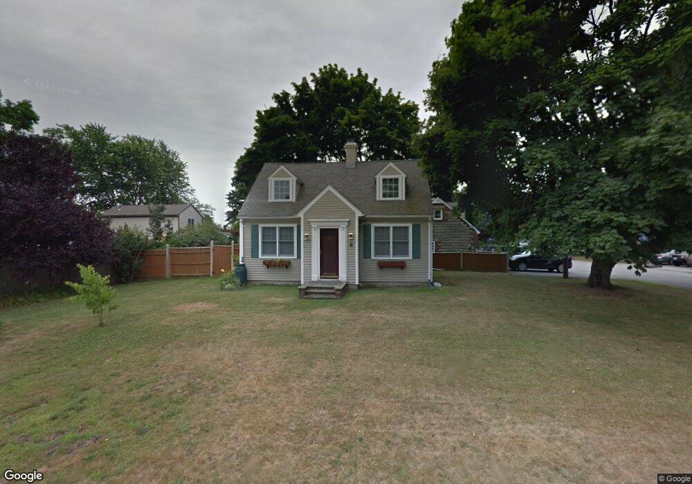
141 Rhode Island Blvd Portsmouth, RI 02871
Common Fence Point NeighborhoodEstimated Value: $671,000 - $916,000
3
Beds
2
Baths
1,944
Sq Ft
$420/Sq Ft
Est. Value
About This Home
This home is located at 141 Rhode Island Blvd, Portsmouth, RI 02871 and is currently estimated at $817,133, approximately $420 per square foot. 141 Rhode Island Blvd is a home located in Newport County with nearby schools including Portsmouth High School.
Ownership History
Date
Name
Owned For
Owner Type
Purchase Details
Closed on
Apr 21, 2020
Sold by
Davis Raymond D and Davis Patrice S
Bought by
Davis Raymond D
Current Estimated Value
Home Financials for this Owner
Home Financials are based on the most recent Mortgage that was taken out on this home.
Original Mortgage
$115,000
Outstanding Balance
$101,234
Interest Rate
3.3%
Mortgage Type
New Conventional
Estimated Equity
$715,899
Purchase Details
Closed on
May 1, 2001
Sold by
Krall Debra C
Bought by
Davis Raymond D and Davis Patrick
Home Financials for this Owner
Home Financials are based on the most recent Mortgage that was taken out on this home.
Original Mortgage
$218,916
Interest Rate
6.88%
Mortgage Type
Purchase Money Mortgage
Purchase Details
Closed on
Sep 25, 1998
Sold by
Barrett Holby W and Doble Elizabeth A
Bought by
Krall Debra C
Home Financials for this Owner
Home Financials are based on the most recent Mortgage that was taken out on this home.
Original Mortgage
$112,000
Interest Rate
6.87%
Mortgage Type
Purchase Money Mortgage
Create a Home Valuation Report for This Property
The Home Valuation Report is an in-depth analysis detailing your home's value as well as a comparison with similar homes in the area
Home Values in the Area
Average Home Value in this Area
Purchase History
| Date | Buyer | Sale Price | Title Company |
|---|---|---|---|
| Davis Raymond D | -- | None Available | |
| Davis Raymond D | $240,000 | -- | |
| Krall Debra C | $140,000 | -- |
Source: Public Records
Mortgage History
| Date | Status | Borrower | Loan Amount |
|---|---|---|---|
| Open | Davis Raymond D | $115,000 | |
| Previous Owner | Krall Debra C | $20,000 | |
| Previous Owner | Krall Debra C | $55,000 | |
| Previous Owner | Krall Debra C | $218,916 | |
| Previous Owner | Krall Debra C | $112,000 | |
| Closed | Krall Debra C | $14,000 |
Source: Public Records
Tax History Compared to Growth
Tax History
| Year | Tax Paid | Tax Assessment Tax Assessment Total Assessment is a certain percentage of the fair market value that is determined by local assessors to be the total taxable value of land and additions on the property. | Land | Improvement |
|---|---|---|---|---|
| 2025 | $6,493 | $488,900 | $154,500 | $334,400 |
| 2024 | $6,444 | $488,900 | $154,500 | $334,400 |
| 2023 | $6,248 | $488,900 | $154,500 | $334,400 |
| 2022 | $5,804 | $373,000 | $123,300 | $249,700 |
| 2021 | $5,711 | $373,000 | $123,300 | $249,700 |
| 2020 | $5,621 | $373,000 | $123,300 | $249,700 |
| 2019 | $5,337 | $325,400 | $92,300 | $233,100 |
| 2018 | $5,197 | $325,400 | $92,300 | $233,100 |
| 2017 | $5,018 | $325,400 | $92,300 | $233,100 |
| 2016 | $4,482 | $280,100 | $85,700 | $194,400 |
| 2015 | $4,426 | $280,100 | $85,700 | $194,400 |
| 2014 | $4,426 | $280,100 | $85,700 | $194,400 |
Source: Public Records
Map
Nearby Homes
- 134 Greenfield Ave
- 72 Rhode Island Blvd
- 0 Common Fence Blvd Unit 1364650
- 0 Common Fence Blvd Unit 1397142
- 0 Dighton Ave
- 0 Island Rd
- 10 Mount Hope Ave
- 1055 Anthony Rd
- 169 Narragansett Blvd
- 1350 Anthony Rd
- 8 Tucker Ave
- 42 Lewis St
- 50 Stevens St
- 83 Waters Edge Unit 24
- 87 Waters Edge
- 9 Cutter Ln
- 1660 Main Rd
- 47 Watermark Dr
- 171 Leeshore Ln
- 132 Highland Ave
- 65 Holliston Ave
- 74 Islington Ave
- 0 Holliston Ave
- 66 Islington Ave
- 150 Rhode Island Blvd
- 144 Rhode Island Blvd
- 61 Holliston Ave
- 64 Holliston Ave
- 135 Rhode Island Blvd
- 84 Holliston Ave
- 58 Islington Ave
- 62 Holliston Ave
- 91 Holliston Ave
- 121 Rhode Island Blvd
- 115 Holliston Ave
- 120 Rhode Island Blvd
- 118 Rhode Island Blvd
- 47 Holliston Ave
- 71 Islington Ave
- 59 Greenfield Ave