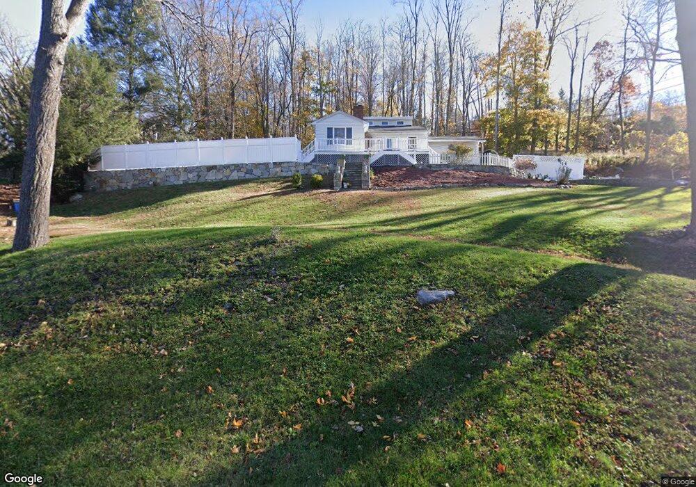
141 Route 39 N Sherman, CT 06784
Estimated Value: $616,573 - $648,000
4
Beds
3
Baths
2,080
Sq Ft
$305/Sq Ft
Est. Value
About This Home
This home is located at 141 Route 39 N, Sherman, CT 06784 and is currently estimated at $633,524, approximately $304 per square foot. 141 Route 39 N is a home located in Fairfield County with nearby schools including Sherman School.
Ownership History
Date
Name
Owned For
Owner Type
Purchase Details
Closed on
Jul 13, 1999
Sold by
Gadiel Peter
Bought by
Silk Matthew J and Silk Lynn M
Current Estimated Value
Create a Home Valuation Report for This Property
The Home Valuation Report is an in-depth analysis detailing your home's value as well as a comparison with similar homes in the area
Home Values in the Area
Average Home Value in this Area
Purchase History
| Date | Buyer | Sale Price | Title Company |
|---|---|---|---|
| Silk Matthew J | $70,000 | -- |
Source: Public Records
Mortgage History
| Date | Status | Borrower | Loan Amount |
|---|---|---|---|
| Open | Silk Matthew J | $111,147 | |
| Open | Silk Matthew J | $192,139 | |
| Closed | Silk Matthew J | $219,000 | |
| Closed | Silk Matthew J | $245,000 |
Source: Public Records
Tax History Compared to Growth
Tax History
| Year | Tax Paid | Tax Assessment Tax Assessment Total Assessment is a certain percentage of the fair market value that is determined by local assessors to be the total taxable value of land and additions on the property. | Land | Improvement |
|---|---|---|---|---|
| 2025 | $4,744 | $284,600 | $75,900 | $208,700 |
| 2024 | $4,656 | $284,600 | $75,900 | $208,700 |
| 2023 | $5,072 | $284,600 | $75,900 | $208,700 |
| 2022 | $5,174 | $284,600 | $75,900 | $208,700 |
| 2021 | $0 | $284,600 | $75,900 | $208,700 |
| 2020 | $5,439 | $284,600 | $75,900 | $208,700 |
| 2019 | $5,638 | $284,600 | $75,900 | $208,700 |
| 2018 | $0 | $292,700 | $79,800 | $212,900 |
| 2017 | $5,953 | $292,800 | $79,900 | $212,900 |
| 2016 | $5,951 | $292,740 | $79,870 | $212,870 |
| 2015 | $5,867 | $292,740 | $79,870 | $212,870 |
| 2014 | $5,808 | $292,740 | $79,870 | $212,870 |
Source: Public Records
Map
Nearby Homes
- 00 Anderson Rd
- 1 Cloverleaf Farm S
- 49 Quaker Ridge Rd
- 55 Colonial Ridge Dr
- 107 Church Rd
- 1 Hoyt Rd
- 48 Gaylord Rd
- 16 Gaylord Rd
- 43 Gaylord Rd
- 31 Cedar Hill Rd
- 685 Kent Rd
- 696 Kent Rd
- 612 Kent Rd
- 41 Long River Rd
- 60 Long River Rd
- 42 Long River Rd
- 73 Long River Rd
- 27 Meadowland Dr
- 36 Byrds Hill Rd
- 34 Front of the Mountain Rd
- 139 Route 39 N
- 4 Wimisink Rd
- 10 Anderson Rd
- 6 Wimisink Rd
- 137 Route 39 N
- 143 Route 39 N
- 2 Wimisink Rd
- 2 Anderson Road Extension
- 4 Anderson Road Extension
- 8 Wimisink Rd
- 145 Connecticut 39
- 145 Route 39 N
- 15 Anderson Rd
- 13 Circle Drive Extension
- 128 Route 39 N
- 10 Wimisink Rd
- 25A Anderson Rd Unit A
- 5A Anderson Rd
- 16 Anderson Rd
- 1 Wimisink Rd