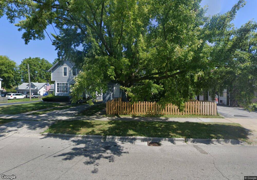
141 S Butrick St Waukegan, IL 60085
West Waukegan NeighborhoodEstimated Value: $159,000 - $210,000
3
Beds
2
Baths
924
Sq Ft
$207/Sq Ft
Est. Value
About This Home
This home is located at 141 S Butrick St, Waukegan, IL 60085 and is currently estimated at $190,957, approximately $206 per square foot. 141 S Butrick St is a home located in Lake County with nearby schools including Washington Elementary School, Robert E. Abbott Middle School, and Waukegan High School.
Ownership History
Date
Name
Owned For
Owner Type
Purchase Details
Closed on
Sep 26, 2005
Sold by
Miranda Jose and Pina Alejandra
Bought by
Pina Filiberto and Pescador Ofelia
Current Estimated Value
Home Financials for this Owner
Home Financials are based on the most recent Mortgage that was taken out on this home.
Original Mortgage
$123,250
Outstanding Balance
$74,560
Interest Rate
7.9%
Mortgage Type
Purchase Money Mortgage
Estimated Equity
$116,397
Purchase Details
Closed on
Apr 10, 1997
Sold by
Ortiz David and Zagal Maria
Bought by
Miranda Jose and Pina Alejandra
Home Financials for this Owner
Home Financials are based on the most recent Mortgage that was taken out on this home.
Original Mortgage
$83,180
Interest Rate
7.74%
Mortgage Type
FHA
Create a Home Valuation Report for This Property
The Home Valuation Report is an in-depth analysis detailing your home's value as well as a comparison with similar homes in the area
Home Values in the Area
Average Home Value in this Area
Purchase History
| Date | Buyer | Sale Price | Title Company |
|---|---|---|---|
| Pina Filiberto | -- | Lawyers Title Ins | |
| Miranda Jose | $83,500 | Attorneys Natl Title Network |
Source: Public Records
Mortgage History
| Date | Status | Borrower | Loan Amount |
|---|---|---|---|
| Open | Pina Filiberto | $123,250 | |
| Closed | Miranda Jose | $83,180 |
Source: Public Records
Tax History Compared to Growth
Tax History
| Year | Tax Paid | Tax Assessment Tax Assessment Total Assessment is a certain percentage of the fair market value that is determined by local assessors to be the total taxable value of land and additions on the property. | Land | Improvement |
|---|---|---|---|---|
| 2024 | $3,137 | $46,131 | $9,577 | $36,554 |
| 2023 | $3,137 | $41,265 | $8,567 | $32,698 |
| 2022 | $2,936 | $36,037 | $7,605 | $28,432 |
| 2021 | $2,523 | $30,203 | $6,541 | $23,662 |
| 2020 | $2,509 | $28,138 | $6,094 | $22,044 |
| 2019 | $2,473 | $25,784 | $5,584 | $20,200 |
| 2018 | $2,547 | $26,083 | $11,857 | $14,226 |
| 2017 | $2,429 | $23,076 | $10,490 | $12,586 |
| 2016 | $2,171 | $20,052 | $9,115 | $10,937 |
| 2015 | $2,018 | $17,947 | $8,158 | $9,789 |
| 2014 | $2,986 | $23,189 | $9,863 | $13,326 |
| 2012 | $3,921 | $25,124 | $10,686 | $14,438 |
Source: Public Records
Map
Nearby Homes
- 1521 Catalpa Ave
- 446 S Jackson St
- 304 Powell Ave
- 1416 Hamilton Ct
- 23 N Jackson St
- 305 Besley Place
- 408 Besley Place
- 613 Clarke Ave
- 49 S Lewis Ave
- 610 Bluff St
- 215 S Park Ave
- 613 Washington St
- 557 W Water St
- 28 N Saint James St
- 502 Belvidere Rd
- 600 Sunderlin St
- 522 George Ave
- 910 Cummings Ave
- 515 George Ave
- 12601 W Atlantic Ave
- 139 S Butrick St
- 1312 Melrose Ave Unit 212
- 1312 Melrose Ave Unit 211
- 1312 Melrose Ave Unit 210
- 1312 Melrose Ave Unit 209
- 1312 Melrose Ave Unit 208
- 1312 Melrose Ave Unit 207
- 1312 Melrose Ave Unit 206
- 1312 Melrose Ave Unit 205
- 1312 Melrose Ave Unit 204
- 1312 Melrose Ave Unit 203
- 1312 Melrose Ave Unit 202
- 1312 Melrose Ave Unit 201
- 1312 Melrose Ave Unit 200
- 1312 Melrose Ave Unit 112
- 1312 Melrose Ave Unit 110
- 1312 Melrose Ave Unit 109
- 1312 Melrose Ave Unit 108
- 1312 Melrose Ave Unit 107
- 1312 Melrose Ave Unit 106