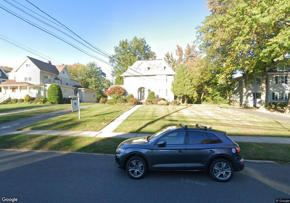
141 S Euclid Ave Unit 1 Westfield, NJ 07090
Estimated Value: $1,263,799
--
Bed
--
Bath
4,200
Sq Ft
$301/Sq Ft
Est. Value
About This Home
This home is located at 141 S Euclid Ave Unit 1, Westfield, NJ 07090 and is currently estimated at $1,263,799, approximately $300 per square foot. 141 S Euclid Ave Unit 1 is a home located in Union County with nearby schools including Washington Elementary School, Roosevelt Intermediate School, and Westfield Senior High School.
Ownership History
Date
Name
Owned For
Owner Type
Purchase Details
Closed on
Feb 24, 2021
Sold by
Nowicki David E and Swingle Nowicki Elaine
Bought by
170 Vineyard Llc
Current Estimated Value
Home Financials for this Owner
Home Financials are based on the most recent Mortgage that was taken out on this home.
Original Mortgage
$640,500
Interest Rate
3.1%
Mortgage Type
Purchase Money Mortgage
Purchase Details
Closed on
Mar 10, 1992
Bought by
Nowicki David E
Create a Home Valuation Report for This Property
The Home Valuation Report is an in-depth analysis detailing your home's value as well as a comparison with similar homes in the area
Home Values in the Area
Average Home Value in this Area
Purchase History
| Date | Buyer | Sale Price | Title Company |
|---|---|---|---|
| 170 Vineyard Llc | $915,000 | Register Abstract Co Inc | |
| Nowicki David E | -- | -- |
Source: Public Records
Mortgage History
| Date | Status | Borrower | Loan Amount |
|---|---|---|---|
| Previous Owner | 170 Vineyard Llc | $640,500 |
Source: Public Records
Tax History Compared to Growth
Tax History
| Year | Tax Paid | Tax Assessment Tax Assessment Total Assessment is a certain percentage of the fair market value that is determined by local assessors to be the total taxable value of land and additions on the property. | Land | Improvement |
|---|---|---|---|---|
| 2025 | $22,509 | $999,500 | $829,600 | $169,900 |
| 2024 | $22,049 | $999,500 | $829,600 | $169,900 |
| 2023 | $22,049 | $999,500 | $829,600 | $169,900 |
| 2022 | $21,589 | $999,500 | $829,600 | $169,900 |
| 2021 | $21,619 | $999,500 | $829,600 | $169,900 |
| 2020 | $21,569 | $999,500 | $829,600 | $169,900 |
| 2019 | $21,489 | $999,500 | $829,600 | $169,900 |
| 2018 | $15,414 | $165,800 | $107,900 | $57,900 |
| 2017 | $15,330 | $165,800 | $107,900 | $57,900 |
| 2016 | $14,970 | $165,800 | $107,900 | $57,900 |
| 2015 | $14,672 | $165,800 | $107,900 | $57,900 |
| 2014 | $14,188 | $165,800 | $107,900 | $57,900 |
Source: Public Records
Map
Nearby Homes
- 149 Harrison Ave
- 629 Tremont Ave
- 112 Linden Ave
- 203 Ross Place
- 415 Highland Ave
- 215 Ross Place Unit J
- 645 Kimball Ave
- 260 Prospect St Unit C15
- 304 E Dudley Ave
- 522 Boulevard
- 529 Benson Place
- 131 Wells St
- 603 Carleton Rd
- 303 Prospect St
- 508 N Chestnut St
- 820 E Broad St
- 519 3rd Ave
- 538 Westfield Ave
- 112 Windsor Ave
- 613 Maple Ct Unit 613
- 131 S Euclid Ave Unit 1,2,3
- 134 S Euclid Ave Unit 7
- 134 S Euclid Ave Unit 4
- 134 S Euclid Ave Unit 5
- 134 S Euclid Ave
- 501 Lenox Ave Unit 5
- 501 Lenox Ave
- 138 S Euclid Ave
- 138 S Euclid Ave Unit 1
- 138 S Euclid Ave Unit 1/2
- 130 Archbold Place
- 128 S Euclid Ave
- 128 S Euclid Ave Unit 2C
- 128 S Euclid Ave Unit 2B
- 128 S Euclid Ave Unit 2A
- 128 S Euclid Ave Unit 1
- 128 S Euclid Ave Unit 128
- 128 Archbold Place
- 146 S Euclid Ave
- 523 Lenox Ave