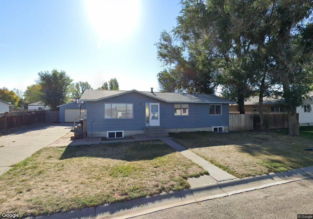
141 Snapper Dr Forsyth, MT 59327
Estimated Value: $160,000 - $224,210
3
Beds
1
Bath
1,104
Sq Ft
$182/Sq Ft
Est. Value
About This Home
This home is located at 141 Snapper Dr, Forsyth, MT 59327 and is currently estimated at $201,053, approximately $182 per square foot. 141 Snapper Dr is a home with nearby schools including Forsyth Elementary School, Forsyth Junior High School, and Forsyth High School.
Ownership History
Date
Name
Owned For
Owner Type
Purchase Details
Closed on
Dec 4, 2015
Sold by
Nickisch Terry G and Nickisch Yvette L
Bought by
Jill Dana
Current Estimated Value
Home Financials for this Owner
Home Financials are based on the most recent Mortgage that was taken out on this home.
Original Mortgage
$96,662
Outstanding Balance
$75,143
Interest Rate
3.37%
Mortgage Type
FHA
Estimated Equity
$125,910
Purchase Details
Closed on
Apr 12, 2015
Sold by
Nickisch Terry G and Nickisch Yvette Lynn
Bought by
Dana Jill
Home Financials for this Owner
Home Financials are based on the most recent Mortgage that was taken out on this home.
Original Mortgage
$96,662
Interest Rate
3.73%
Mortgage Type
FHA
Create a Home Valuation Report for This Property
The Home Valuation Report is an in-depth analysis detailing your home's value as well as a comparison with similar homes in the area
Purchase History
| Date | Buyer | Sale Price | Title Company |
|---|---|---|---|
| Jill Dana | $97,629 | Other | |
| Dana Jill | -- | None Available |
Source: Public Records
Mortgage History
| Date | Status | Borrower | Loan Amount |
|---|---|---|---|
| Open | Jill Dana | $96,662 | |
| Previous Owner | Dana Jill | $96,662 |
Source: Public Records
Tax History
| Year | Tax Paid | Tax Assessment Tax Assessment Total Assessment is a certain percentage of the fair market value that is determined by local assessors to be the total taxable value of land and additions on the property. | Land | Improvement |
|---|---|---|---|---|
| 2025 | $1,575 | $178,000 | $0 | $0 |
| 2024 | $2,077 | $163,200 | $0 | $0 |
| 2023 | $1,942 | $163,200 | $0 | $0 |
| 2022 | $1,683 | $133,700 | $0 | $0 |
| 2021 | $1,612 | $133,700 | $0 | $0 |
| 2020 | $1,412 | $118,500 | $0 | $0 |
| 2019 | $1,379 | $118,500 | $0 | $0 |
| 2018 | $1,276 | $105,900 | $0 | $0 |
| 2017 | $889 | $105,900 | $0 | $0 |
| 2016 | $1,293 | $115,400 | $0 | $0 |
| 2015 | $1,164 | $127,900 | $0 | $0 |
| 2014 | $1,001 | $62,699 | $0 | $0 |
Source: Public Records
Map
Nearby Homes
Your Personal Tour Guide
Ask me questions while you tour the home.