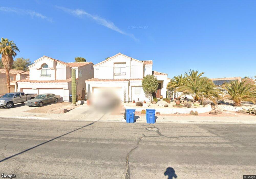
1410 Broad Arrow Dr North Las Vegas, NV 89032
Cheyenne NeighborhoodEstimated Value: $439,000 - $457,000
5
Beds
3
Baths
2,317
Sq Ft
$193/Sq Ft
Est. Value
About This Home
This home is located at 1410 Broad Arrow Dr, North Las Vegas, NV 89032 and is currently estimated at $447,897, approximately $193 per square foot. 1410 Broad Arrow Dr is a home located in Clark County with nearby schools including Dr. Claude G Perkins Elementary School, Elizabeth Wilhelm Elementary School, and Marvin M Sedway Middle School.
Ownership History
Date
Name
Owned For
Owner Type
Purchase Details
Closed on
May 14, 2001
Sold by
Price Gregory Benton and Price Claudia Carranza
Bought by
Dodd John F and Dodd Clara A
Current Estimated Value
Home Financials for this Owner
Home Financials are based on the most recent Mortgage that was taken out on this home.
Original Mortgage
$156,060
Outstanding Balance
$58,273
Interest Rate
7.03%
Mortgage Type
VA
Estimated Equity
$389,624
Purchase Details
Closed on
Sep 1, 2000
Sold by
Price Gregory Benton and Price Claudia Carranza
Bought by
Price Gregory Benton and Price Claudia Carranza
Purchase Details
Closed on
May 31, 1996
Sold by
S B A Development
Bought by
Price Gregory B and Price Claudia C
Home Financials for this Owner
Home Financials are based on the most recent Mortgage that was taken out on this home.
Original Mortgage
$120,000
Interest Rate
7.97%
Create a Home Valuation Report for This Property
The Home Valuation Report is an in-depth analysis detailing your home's value as well as a comparison with similar homes in the area
Home Values in the Area
Average Home Value in this Area
Purchase History
| Date | Buyer | Sale Price | Title Company |
|---|---|---|---|
| Dodd John F | $153,000 | Lawyers Title | |
| Price Gregory Benton | -- | -- | |
| Price Gregory B | $140,500 | Old Republic Title Company |
Source: Public Records
Mortgage History
| Date | Status | Borrower | Loan Amount |
|---|---|---|---|
| Open | Dodd John F | $156,060 | |
| Previous Owner | Price Gregory B | $120,000 | |
| Closed | Price Gregory B | $15,000 |
Source: Public Records
Tax History Compared to Growth
Tax History
| Year | Tax Paid | Tax Assessment Tax Assessment Total Assessment is a certain percentage of the fair market value that is determined by local assessors to be the total taxable value of land and additions on the property. | Land | Improvement |
|---|---|---|---|---|
| 2025 | $1,643 | $97,965 | $27,300 | $70,665 |
| 2024 | $1,596 | $97,965 | $27,300 | $70,665 |
| 2023 | $1,596 | $95,910 | $28,700 | $67,210 |
| 2022 | $1,550 | $84,696 | $23,100 | $61,596 |
| 2021 | $1,505 | $80,423 | $21,700 | $58,723 |
| 2020 | $1,458 | $79,007 | $20,650 | $58,357 |
| 2019 | $1,415 | $74,107 | $16,450 | $57,657 |
| 2018 | $1,374 | $69,141 | $14,000 | $55,141 |
| 2017 | $2,288 | $68,206 | $12,250 | $55,956 |
| 2016 | $1,302 | $55,148 | $9,100 | $46,048 |
| 2015 | $1,299 | $43,612 | $7,000 | $36,612 |
| 2014 | $1,261 | $36,810 | $5,250 | $31,560 |
Source: Public Records
Map
Nearby Homes
- 1608 Knoll Heights Ct
- 3317 Spinet Dr
- 3228 Trinitero St
- 0 June Unit 2706697
- 0 June Unit 2692591
- 0 Tamerind St Unit 2685915
- 0 0 Cheyenne & Englestad Unit 1536141
- 0 0 Englestad Cheyenne Unit 1635643
- 1822 Trigger Way
- 3644 Quail Creek Dr
- 1854 Oak Bluffs Ave
- 728 Twilight Blue Ave
- 3743 Nairobi Ln
- 0 Revere St
- 0 W Brooks Ave
- 3839 Dusty Glen Ct
- 3355 Clayton St
- 0 Plymouth St
- 01 Brooks St
- 0 W Mayflower
- 1420 Broad Arrow Dr
- 1307 Basin Brook Dr
- 1401 Basin Brook Dr
- 1405 Basin Brook Dr
- 1303 Basin Brook Dr
- 1430 Broad Arrow Dr
- 1411 Broad Arrow Dr
- 1341 Broad Arrow Dr
- 1440 Broad Arrow Dr
- 1413 Basin Brook Dr
- 1331 Broad Arrow Dr
- 1227 Basin Brook Dr
- 1450 Broad Arrow Dr Unit 1
- 3421 Samsara Cir
- 1310 Basin Brook Dr
- 1306 Basin Brook Dr
- 1417 Basin Brook Dr
- 3420 Skinner Cir
- 1406 Basin Brook Dr
- 1302 Basin Brook Dr
