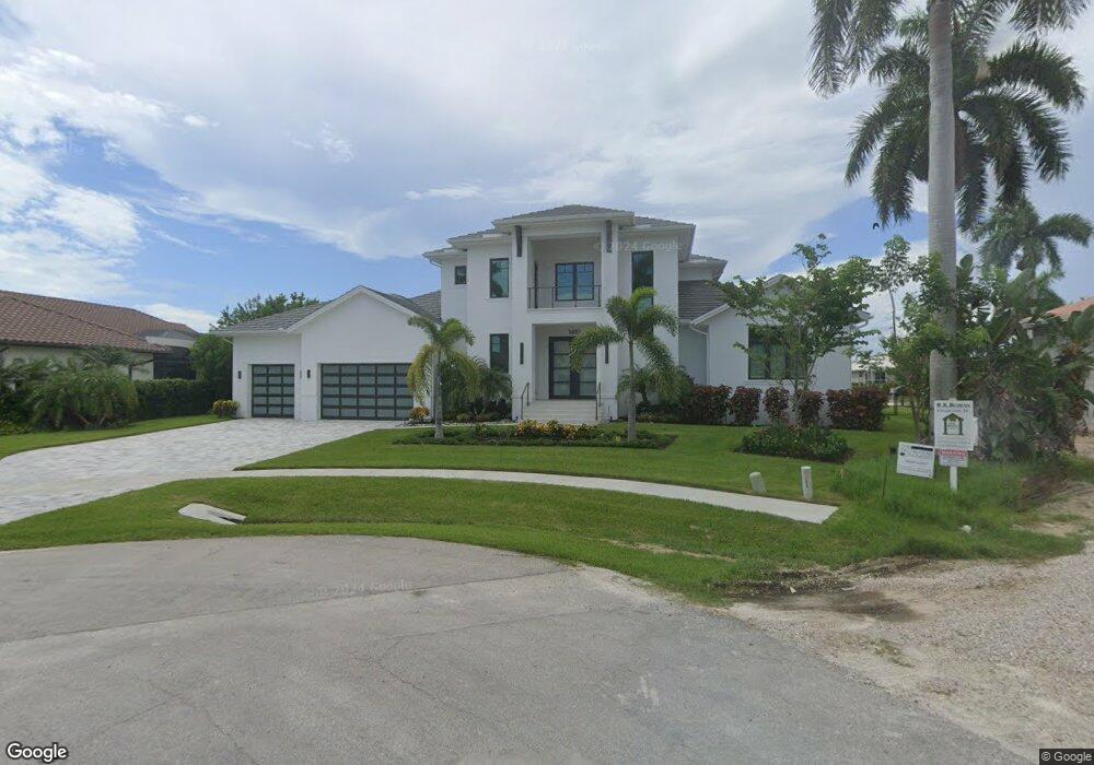
1410 Forrest Ct Unit 13 Marco Island, FL 34145
Estimated Value: $4,874,000 - $7,243,000
--
Bed
--
Bath
3,028
Sq Ft
$1,974/Sq Ft
Est. Value
About This Home
This home is located at 1410 Forrest Ct Unit 13, Marco Island, FL 34145 and is currently estimated at $5,976,202, approximately $1,973 per square foot. 1410 Forrest Ct Unit 13 is a home located in Collier County with nearby schools including Tommie Barfield Elementary School, Manatee Middle School, and Marco Island Charter Middle School.
Ownership History
Date
Name
Owned For
Owner Type
Purchase Details
Closed on
May 1, 2023
Sold by
Kuredjian Raffi
Bought by
Plunkett Michael and Plunkett Dana
Current Estimated Value
Purchase Details
Closed on
Oct 13, 2020
Sold by
The Poletti Family Limited Partnership
Bought by
Kuredjian Raffi
Purchase Details
Closed on
Feb 28, 2005
Sold by
Poletti Elizabeth M
Bought by
The Poletti Family Lp
Purchase Details
Closed on
Mar 29, 2004
Sold by
Poletti Elizabeth
Bought by
Poletti Elizabeth M and The Declaration Of Revocable Trust Of El
Create a Home Valuation Report for This Property
The Home Valuation Report is an in-depth analysis detailing your home's value as well as a comparison with similar homes in the area
Home Values in the Area
Average Home Value in this Area
Purchase History
| Date | Buyer | Sale Price | Title Company |
|---|---|---|---|
| Plunkett Michael | $6,900,000 | None Listed On Document | |
| Kuredjian Raffi | $919,000 | Attorney Only | |
| The Poletti Family Lp | -- | -- | |
| Poletti Elizabeth M | -- | -- |
Source: Public Records
Tax History Compared to Growth
Tax History
| Year | Tax Paid | Tax Assessment Tax Assessment Total Assessment is a certain percentage of the fair market value that is determined by local assessors to be the total taxable value of land and additions on the property. | Land | Improvement |
|---|---|---|---|---|
| 2025 | $43,981 | $5,270,632 | -- | -- |
| 2024 | $14,610 | $4,791,484 | $2,092,340 | $2,699,144 |
| 2023 | $14,610 | $1,112,463 | $0 | $0 |
| 2022 | $11,895 | $1,011,330 | $0 | $0 |
| 2021 | $9,948 | $919,391 | $919,391 | $0 |
| 2020 | $10,761 | $999,828 | $999,828 | $0 |
| 2019 | $11,292 | $912,747 | $0 | $0 |
| 2018 | $11,119 | $829,770 | $0 | $0 |
| 2017 | $8,435 | $754,336 | $0 | $0 |
| 2016 | $8,133 | $685,760 | $0 | $0 |
| 2015 | $8,840 | $623,418 | $0 | $0 |
| 2014 | $7,431 | $566,744 | $0 | $0 |
Source: Public Records
Map
Nearby Homes
- 1411 Quintara Ct
- 800 Arcadia Ct
- 1410 Quintara Ct
- 810 Arcadia Ct
- 1370 Quintara Ct
- 840 S Heathwood Dr
- 872 S Heathwood Dr
- 1241 Mimosa Ct
- 1429 Collingswood Ave
- 580 S Heathwood Dr
- 1631 N Copeland Dr
- 1639 McIlvaine Ct
- 1355 Caxambas Ct
- 897 Collier Ct Unit 4-705
- 897 Collier Ct Unit 705
- 893 Collier Ct Unit 3-301
- 1410 Forrest Ct
- 1400 Forrest Ct
- 1390 Forrest Ct
- 800 S Heathwood Dr
- 808 S Heathwood Dr
- 1411 Forrest Ct
- 1380 Forrest Ct
- 1421 Forrest Ct
- 1420 Forrest Ct
- 817 S Heathwood Dr
- 816 S Heathwood Dr
- 1401 Quintara Ct
- 1391 Quintara Ct
- 1370 Forrest Ct
- 809 Arcadia Ct
- 1381 Quintara Ct
- 0 Quintara Ct
- 801 Arcadia Ct
- 825 S Heathwood Dr