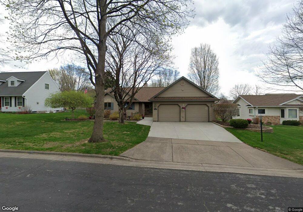
1410 Knox St Wausau, WI 54401
Estimated Value: $281,000 - $378,000
3
Beds
2
Baths
--
Sq Ft
10,454
Sq Ft Lot
About This Home
This home is located at 1410 Knox St, Wausau, WI 54401 and is currently estimated at $324,139. 1410 Knox St is a home located in Marathon County with nearby schools including Thomas Jefferson Elementary School, John Muir Middle School, and West High School.
Ownership History
Date
Name
Owned For
Owner Type
Purchase Details
Closed on
Jul 19, 2017
Sold by
Lewandowski Michael F and Lewandowski Karen F
Bought by
Ottoson Lisa M and Rusch Stephen R
Current Estimated Value
Purchase Details
Closed on
Aug 3, 2005
Sold by
Emerson Jeanne A
Bought by
Lewandowski Michael F and Rusch Karen F
Home Financials for this Owner
Home Financials are based on the most recent Mortgage that was taken out on this home.
Original Mortgage
$105,000
Outstanding Balance
$55,335
Interest Rate
5.71%
Mortgage Type
Unknown
Estimated Equity
$268,804
Create a Home Valuation Report for This Property
The Home Valuation Report is an in-depth analysis detailing your home's value as well as a comparison with similar homes in the area
Home Values in the Area
Average Home Value in this Area
Purchase History
| Date | Buyer | Sale Price | Title Company |
|---|---|---|---|
| Ottoson Lisa M | -- | None Available | |
| Lewandowski Michael F | -- | None Available | |
| Lewandowski Michael F | $147,000 | None Available |
Source: Public Records
Mortgage History
| Date | Status | Borrower | Loan Amount |
|---|---|---|---|
| Open | Lewandowski Michael F | $105,000 |
Source: Public Records
Tax History Compared to Growth
Tax History
| Year | Tax Paid | Tax Assessment Tax Assessment Total Assessment is a certain percentage of the fair market value that is determined by local assessors to be the total taxable value of land and additions on the property. | Land | Improvement |
|---|---|---|---|---|
| 2024 | $4,522 | $248,200 | $31,600 | $216,600 |
| 2023 | $4,075 | $173,600 | $31,600 | $142,000 |
| 2022 | $4,109 | $173,600 | $31,600 | $142,000 |
| 2021 | $3,955 | $173,600 | $31,600 | $142,000 |
| 2020 | $3,939 | $166,800 | $31,600 | $135,200 |
| 2019 | $3,661 | $146,600 | $26,700 | $119,900 |
| 2018 | $3,819 | $146,600 | $26,700 | $119,900 |
| 2017 | $3,552 | $146,600 | $26,700 | $119,900 |
| 2016 | $3,443 | $146,600 | $26,700 | $119,900 |
| 2015 | $3,675 | $146,600 | $26,700 | $119,900 |
| 2014 | $3,730 | $156,200 | $28,500 | $127,700 |
Source: Public Records
Map
Nearby Homes
- 1505 Graham St
- 802 N 9th Ave
- 614 N 10th Ave
- 1504 N 15th Ave
- 706 N 9th Ave
- 501 N 12th Ave
- 1104 Holub St
- 1508 Merrill Ave Unit 311
- 1508 Merrill Ave Unit 213
- 1111 Pine St
- 515 N 8th Ave
- 328 N 11th Ave
- 314 N 10th Ave
- 1311 N 4th Ave
- 213 N 17th Ave
- 427 N 6th Ave
- 817 N 2nd Ave
- 108 W Strowbridge St
- 102 E Strowbridge St
- 1509 N 1st Ave