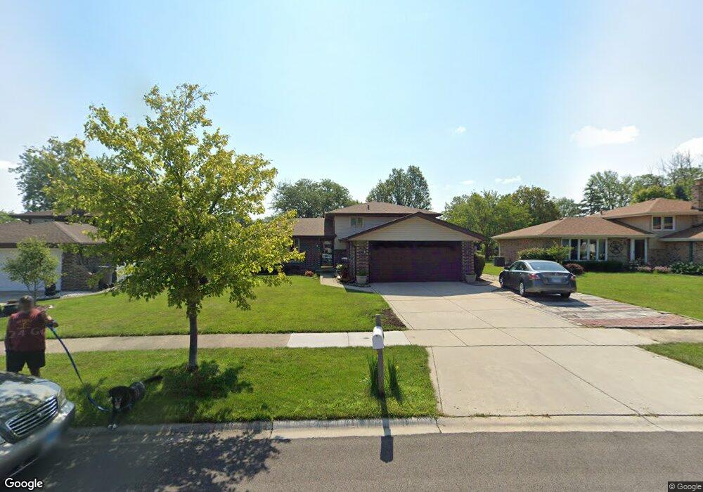
14101 Clearview Dr Orland Park, IL 60462
Silver Lake North NeighborhoodEstimated Value: $379,456 - $415,000
3
Beds
2
Baths
1,269
Sq Ft
$313/Sq Ft
Est. Value
About This Home
This home is located at 14101 Clearview Dr, Orland Park, IL 60462 and is currently estimated at $397,114, approximately $312 per square foot. 14101 Clearview Dr is a home located in Cook County with nearby schools including Orland Park Elementary School, High Point Elementary School, and Orland Jr High School.
Ownership History
Date
Name
Owned For
Owner Type
Purchase Details
Closed on
May 28, 2008
Sold by
Wisniewski Cynthia A and Wisniewski Kenneth S
Bought by
Monday David and Frydrych Anne M
Current Estimated Value
Home Financials for this Owner
Home Financials are based on the most recent Mortgage that was taken out on this home.
Original Mortgage
$203,000
Outstanding Balance
$130,530
Interest Rate
6.09%
Mortgage Type
Unknown
Estimated Equity
$266,584
Create a Home Valuation Report for This Property
The Home Valuation Report is an in-depth analysis detailing your home's value as well as a comparison with similar homes in the area
Home Values in the Area
Average Home Value in this Area
Purchase History
| Date | Buyer | Sale Price | Title Company |
|---|---|---|---|
| Monday David | $298,000 | Attorneys Title Guaranty Fun |
Source: Public Records
Mortgage History
| Date | Status | Borrower | Loan Amount |
|---|---|---|---|
| Open | Monday David | $203,000 |
Source: Public Records
Tax History Compared to Growth
Tax History
| Year | Tax Paid | Tax Assessment Tax Assessment Total Assessment is a certain percentage of the fair market value that is determined by local assessors to be the total taxable value of land and additions on the property. | Land | Improvement |
|---|---|---|---|---|
| 2024 | $6,912 | $30,937 | $5,595 | $25,342 |
| 2023 | $5,262 | $32,231 | $5,595 | $26,636 |
| 2022 | $5,262 | $20,986 | $4,832 | $16,154 |
| 2021 | $5,753 | $23,214 | $4,831 | $18,383 |
| 2020 | $5,600 | $23,214 | $4,831 | $18,383 |
| 2019 | $4,613 | $20,236 | $4,323 | $15,913 |
| 2018 | $4,485 | $20,236 | $4,323 | $15,913 |
| 2017 | $5,115 | $22,977 | $4,323 | $18,654 |
| 2016 | $4,801 | $19,702 | $3,814 | $15,888 |
| 2015 | $4,720 | $19,702 | $3,814 | $15,888 |
| 2014 | $4,665 | $19,702 | $3,814 | $15,888 |
| 2013 | $5,066 | $22,396 | $3,814 | $18,582 |
Source: Public Records
Map
Nearby Homes
- 14111 Tod William Dr
- 14216 Clearview Dr
- 14040 Boxwood Ln
- 8820 W 140th St Unit 2A
- 14304 Clearview Ct Unit 8904
- 8700 Berkley Ct
- 14325 Clearview Dr Unit 14325
- 8932 Pebble Beach Ln
- 8810 Clearview Dr Unit 8810
- 9114 W 140th St Unit 204
- 14345 S 87th Ave
- 14340 Mason Ln
- 14402 S 90th Ct Unit 1A
- 14350 Mason Ln
- 14453 S 88th Ave
- 9146 W 140th St Unit 3NE
- 14508 Maycliff Dr
- 13904 Virginia Ct
- 14440 Brentwood St
- 14602 Beech St
- 14105 Clearview Dr
- 14045 Clearview Dr
- 14109 Clearview Dr
- 14100 Tod William Dr
- 14106 Tod William Dr
- 14039 Clearview Dr Unit 14309
- 14044 Tod William Dr
- 14108 Tod William Dr
- 14113 Clearview Dr
- 14100 Clearview Dr
- 14040 Clearview Dr
- 14038 Tod William Dr
- 14033 Clearview Dr
- 14108 Clearview Dr
- 14032 Clearview Dr
- 14032 Tod William Dr
- 8848 Lori Ln
- 8904 Lori Ln
- 14110 Tod William Dr
