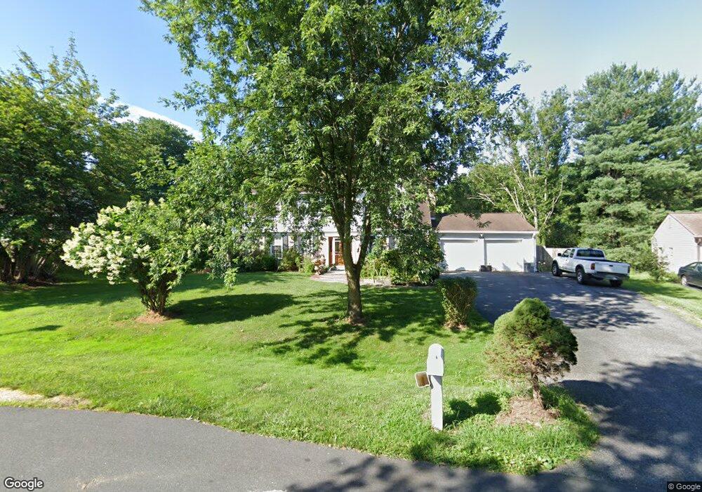
14104 Ansted Rd Silver Spring, MD 20905
Estimated Value: $634,000 - $696,000
--
Bed
3
Baths
2,265
Sq Ft
$294/Sq Ft
Est. Value
About This Home
This home is located at 14104 Ansted Rd, Silver Spring, MD 20905 and is currently estimated at $665,906, approximately $293 per square foot. 14104 Ansted Rd is a home located in Montgomery County with nearby schools including North Aurelius Elementary School, Fairland Elementary School, and Benjamin Banneker Middle School.
Ownership History
Date
Name
Owned For
Owner Type
Purchase Details
Closed on
Jul 13, 2004
Sold by
Keshaiah Somaram
Bought by
Obando Maria and Obando Victor
Current Estimated Value
Purchase Details
Closed on
Feb 10, 2003
Sold by
Cannon Winifred E
Bought by
Keshaiah Somaram and Keshaiah Sulochana Kamalaker
Purchase Details
Closed on
Apr 14, 1998
Sold by
Frances A Buckeridge Tr
Bought by
Cannon Winifred E
Purchase Details
Closed on
Nov 20, 1995
Sold by
J Francis A and J Buckeridge B
Bought by
Frances A Buckeridge Et Al Tr
Create a Home Valuation Report for This Property
The Home Valuation Report is an in-depth analysis detailing your home's value as well as a comparison with similar homes in the area
Home Values in the Area
Average Home Value in this Area
Purchase History
| Date | Buyer | Sale Price | Title Company |
|---|---|---|---|
| Obando Maria | $430,000 | -- | |
| Obando Maria | $430,000 | -- | |
| Keshaiah Somaram | $270,000 | -- | |
| Cannon Winifred E | $206,500 | -- | |
| Frances A Buckeridge Et Al Tr | -- | -- |
Source: Public Records
Tax History Compared to Growth
Tax History
| Year | Tax Paid | Tax Assessment Tax Assessment Total Assessment is a certain percentage of the fair market value that is determined by local assessors to be the total taxable value of land and additions on the property. | Land | Improvement |
|---|---|---|---|---|
| 2025 | $5,331 | $453,467 | -- | -- |
| 2024 | $5,331 | $424,233 | $0 | $0 |
| 2023 | $4,278 | $395,000 | $229,300 | $165,700 |
| 2022 | $3,919 | $380,867 | $0 | $0 |
| 2021 | $3,528 | $366,733 | $0 | $0 |
| 2020 | $3,528 | $352,600 | $229,300 | $123,300 |
| 2019 | $3,514 | $352,600 | $229,300 | $123,300 |
| 2018 | $3,513 | $352,600 | $229,300 | $123,300 |
| 2017 | $3,624 | $356,200 | $0 | $0 |
| 2016 | $4,234 | $352,200 | $0 | $0 |
| 2015 | $4,234 | $348,200 | $0 | $0 |
| 2014 | $4,234 | $344,200 | $0 | $0 |
Source: Public Records
Map
Nearby Homes
- 1615 Spottsworth Way
- 14308 Ansted Rd
- 2129 Countryside Dr
- 14530 Sturtevant Rd
- 2312 Nees Ln
- 1261 Cavendish Dr
- 13721 Hobart Dr
- 1458 Farmcrest Way
- 14612 Fairacres Rd
- 3092 Fairland Rd
- 3096 Fairland Rd
- 1271 Twig Terrace
- 13607 Jacqueline Ct
- 2501 Countryside Dr
- 2519 Briggs Chaney Rd
- 17 Locustwood Ct
- 2017 Serpentine Terrace
- 1407 Northcrest Dr
- 1701 Maydale Dr
- 901 Hobbs Dr
- 14108 Ansted Rd
- 14100 Ansted Rd
- 14101 Sturtevant Rd
- 14101 Ansted Rd
- 14112 Ansted Rd
- 14100 Sturtevant Rd
- 14111 Ansted Rd
- 14116 Ansted Rd
- 14115 Ansted Rd
- 14109 Sturtevant Rd
- 14112 Sturtevant Rd
- 14120 Ansted Rd
- 14120 Sturtevant Rd
- 14121 Ansted Rd
- 14113 Sturtevant Rd
- 14205 Cantrell Rd
- 14124 Ansted Rd
- 14117 Sturtevant Rd
- 14124 Sturtevant Rd
- 14209 Cantrell Rd