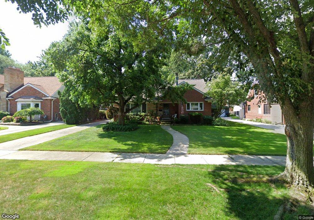
1411 Hawthorne Rd Grosse Pointe Woods, MI 48236
Estimated Value: $399,000 - $438,486
3
Beds
2
Baths
1,858
Sq Ft
$224/Sq Ft
Est. Value
About This Home
This home is located at 1411 Hawthorne Rd, Grosse Pointe Woods, MI 48236 and is currently estimated at $416,872, approximately $224 per square foot. 1411 Hawthorne Rd is a home located in Wayne County with nearby schools including Stevens T. Mason Elementary School, Parcells Middle School, and Grosse Pointe North High School.
Ownership History
Date
Name
Owned For
Owner Type
Purchase Details
Closed on
Jan 26, 2021
Sold by
Landgraf Richard Carl and Landgraf Richard Carl
Bought by
Landgraf Richard Carl and Landgraf Richard Carl
Current Estimated Value
Purchase Details
Closed on
Jan 21, 2021
Sold by
Landgraf Richard C and Landgraf Richard Carl
Bought by
Landgraf Richard C and Zwicker Melissa Ann
Purchase Details
Closed on
Feb 5, 2014
Sold by
Landgraf Richard C and Landgraf Dorothy J
Bought by
Revocabl Landgraf Richard C and Richard Carl Landgraf Revocable Living T
Create a Home Valuation Report for This Property
The Home Valuation Report is an in-depth analysis detailing your home's value as well as a comparison with similar homes in the area
Home Values in the Area
Average Home Value in this Area
Purchase History
| Date | Buyer | Sale Price | Title Company |
|---|---|---|---|
| Landgraf Richard Carl | -- | Land Title | |
| Landgraf Richard C | -- | None Available | |
| Revocabl Landgraf Richard C | -- | None Available |
Source: Public Records
Tax History Compared to Growth
Tax History
| Year | Tax Paid | Tax Assessment Tax Assessment Total Assessment is a certain percentage of the fair market value that is determined by local assessors to be the total taxable value of land and additions on the property. | Land | Improvement |
|---|---|---|---|---|
| 2025 | $4,129 | $236,600 | $0 | $0 |
| 2024 | $4,129 | $223,000 | $0 | $0 |
| 2023 | $3,971 | $194,700 | $0 | $0 |
| 2022 | $7,737 | $181,200 | $0 | $0 |
| 2021 | $5,928 | $185,500 | $0 | $0 |
| 2020 | $6,104 | $174,300 | $0 | $0 |
| 2019 | $5,975 | $163,500 | $0 | $0 |
| 2018 | $3,552 | $146,700 | $0 | $0 |
| 2017 | $4,128 | $140,800 | $0 | $0 |
| 2016 | $5,628 | $127,000 | $0 | $0 |
| 2015 | $9,754 | $112,100 | $0 | $0 |
| 2013 | $9,450 | $96,500 | $0 | $0 |
| 2012 | -- | $97,600 | $21,800 | $75,800 |
Source: Public Records
Map
Nearby Homes
- 1463 Hollywood Ave
- 1374 Anita Ave
- 1291 Roslyn Rd
- 1381 Brys Dr
- 20740 Marter Rd
- 1528 Roslyn Rd
- 1641 Hampton Rd
- 1158 Hawthorne Rd
- 1552 Brys Dr
- 1677 Brys Dr
- 1750 Vernier Rd Unit 6
- 1750 Vernier Rd Unit 22
- 1768 Hampton Rd
- 1039 Hawthorne Rd
- 1793 Roslyn Rd
- 1817 Hawthorne Rd
- 1781 Brys Dr
- 1000 Vernier Rd
- 935 S Brys Dr
- 926 Lochmoor Place
- 1425 Hawthorne Rd
- 1397 Hawthorne Rd
- 1398 Anita Ave
- 1410 Anita Ave
- 1383 Hawthorne Rd
- 1420 Anita Ave
- 1390 Anita Ave
- 1430 Anita Ave
- 1439 Hawthorne Rd
- 1382 Anita Ave
- 1410 Hawthorne Rd
- 1453 Hawthorne Rd
- 1396 Hawthorne Rd
- 1424 Hawthorne Rd
- 1448 Anita Ave
- 1369 Hawthorne Rd
- 1382 Hawthorne Rd
- 1438 Hawthorne Rd
- 1366 Anita Ave
- 1452 Anita Ave