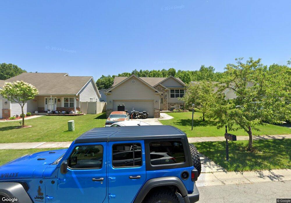
1411 Maximilian Dr Chesterton, IN 46304
Estimated Value: $350,193 - $383,000
4
Beds
3
Baths
2,448
Sq Ft
$151/Sq Ft
Est. Value
About This Home
This home is located at 1411 Maximilian Dr, Chesterton, IN 46304 and is currently estimated at $368,798, approximately $150 per square foot. 1411 Maximilian Dr is a home located in Porter County with nearby schools including Westchester Intermediate School, Bailly Elementary School, and Chesterton Middle School.
Ownership History
Date
Name
Owned For
Owner Type
Purchase Details
Closed on
Dec 16, 2009
Sold by
Jones Jeffrey C
Bought by
Dolatowski John E and Dolatowski Josephine E
Current Estimated Value
Purchase Details
Closed on
Apr 30, 2008
Sold by
Hancock James D and Hancock Sarah J
Bought by
Jones Jeffrey C
Purchase Details
Closed on
Sep 1, 2005
Sold by
Luxor Homes Ii Inc
Bought by
Hancock James D and Hancock Sara J
Home Financials for this Owner
Home Financials are based on the most recent Mortgage that was taken out on this home.
Original Mortgage
$154,050
Interest Rate
5.89%
Mortgage Type
Fannie Mae Freddie Mac
Purchase Details
Closed on
Feb 25, 2005
Sold by
Rose Hill Estates Ii Llc
Bought by
Luxor Homes Ii Inc
Create a Home Valuation Report for This Property
The Home Valuation Report is an in-depth analysis detailing your home's value as well as a comparison with similar homes in the area
Home Values in the Area
Average Home Value in this Area
Purchase History
| Date | Buyer | Sale Price | Title Company |
|---|---|---|---|
| Dolatowski John E | -- | Ticor Title Insurance Co | |
| Jones Jeffrey C | -- | Meridian Title Corp | |
| Hancock James D | -- | Chicago Title Insurance Comp | |
| Luxor Homes Ii Inc | -- | Chicago Title Insurance Comp |
Source: Public Records
Mortgage History
| Date | Status | Borrower | Loan Amount |
|---|---|---|---|
| Previous Owner | Hancock James D | $154,050 |
Source: Public Records
Tax History Compared to Growth
Tax History
| Year | Tax Paid | Tax Assessment Tax Assessment Total Assessment is a certain percentage of the fair market value that is determined by local assessors to be the total taxable value of land and additions on the property. | Land | Improvement |
|---|---|---|---|---|
| 2024 | $6,245 | $294,000 | $37,000 | $257,000 |
| 2023 | $5,747 | $280,100 | $34,300 | $245,800 |
| 2022 | $5,727 | $257,400 | $34,300 | $223,100 |
| 2021 | $4,895 | $219,600 | $34,300 | $185,300 |
| 2020 | $4,607 | $206,600 | $29,800 | $176,800 |
| 2019 | $4,143 | $185,700 | $29,800 | $155,900 |
| 2018 | $3,980 | $178,400 | $29,800 | $148,600 |
| 2017 | $4,289 | $192,300 | $29,800 | $162,500 |
| 2016 | $4,131 | $185,200 | $29,700 | $155,500 |
| 2014 | $3,994 | $179,000 | $28,200 | $150,800 |
| 2013 | -- | $169,600 | $28,400 | $141,200 |
Source: Public Records
Map
Nearby Homes
- 1501 Maximilian Dr
- 2091 Texas St
- 2023 Hawthorne Ln
- 1915 David Dr
- 1887 Jacob Ln
- 2119 Dogwood Ln
- 2121 Dogwood Ln
- 2111 Tupelo Ln
- 2302 Texas St
- 2132 Pradera Trail
- 2121 Tupelo Ln
- 1108 Saratoga Ln
- 2166 Pradera Trail
- 1019-1021 S 18th St
- 2218 Pradera Trail
- 2179 W 1100 N
- The Willow Plan at The 1100 Woods
- The Revere Plan at The 1100 Woods
- The Prescott Plan at The 1100 Woods
- The Madeleine Plan at The 1100 Woods
- 1421 Maximilian Dr
- 1401 Maximilian Dr
- 1933 Cory Ln
- 1431 Maximilian Dr
- 1927 Cory Ln
- 1441 Maximilian Dr
- 1410 Maximilian Dr
- 1921 Cory Ln
- 1400 Maximilian Dr
- 1449 Maximilian Dr
- 1430 Maximilian Dr
- 1380 Maximilian Dr
- 1938 Cory Ln
- 1915 Cory Ln
- 1932 Cory Ln
- 1451 Maximilian Dr
- 1370 Maximilian Dr
- 1440 Maximilian Dr
- 1926 Cory Ln
- 1920 Cory Ln