Estimated Value: $74,467 - $110,000
--
Bed
--
Bath
884
Sq Ft
$101/Sq Ft
Est. Value
About This Home
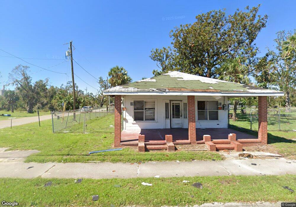
This home is located at 1411 S Byron Butler Pkwy, Perry, FL 32348 and is currently estimated at $88,867, approximately $100 per square foot. 1411 S Byron Butler Pkwy is a home located in Taylor County with nearby schools including Steinhatchee School, Perry Primary School, and Taylor County Elementary School.
Ownership History
Date
Name
Owned For
Owner Type
Purchase Details
Closed on
Jul 25, 2018
Sold by
The City Of Perry Florida
Bought by
Rollings William L and Rollings Estic
Current Estimated Value
Purchase Details
Closed on
Feb 14, 2014
Sold by
Ramnath Lauren Nicole
Bought by
Rollings William L and Rollings Estic L
Purchase Details
Closed on
Feb 7, 2014
Sold by
Ramnath Simeon and Ramnath Subhadra
Bought by
Ramnath Lauren Nicole
Purchase Details
Closed on
Mar 17, 2006
Sold by
Poppell Rebecca R and Poppell Randel F
Bought by
Rabnath Simeon and Rabnath Subhadra
Create a Home Valuation Report for This Property
The Home Valuation Report is an in-depth analysis detailing your home's value as well as a comparison with similar homes in the area
Home Values in the Area
Average Home Value in this Area
Purchase History
| Date | Buyer | Sale Price | Title Company |
|---|---|---|---|
| Rollings William L | -- | Attorney | |
| Rollings William L | $43,000 | Frith Abstract & Title Co | |
| Ramnath Lauren Nicole | -- | Frith Abstract & Title Co | |
| Rabnath Simeon | $45,000 | Frith Abstract & Title Co |
Source: Public Records
Tax History Compared to Growth
Tax History
| Year | Tax Paid | Tax Assessment Tax Assessment Total Assessment is a certain percentage of the fair market value that is determined by local assessors to be the total taxable value of land and additions on the property. | Land | Improvement |
|---|---|---|---|---|
| 2024 | $911 | $55,990 | $14,350 | $41,640 |
| 2023 | $911 | $45,060 | $0 | $0 |
| 2022 | $842 | $47,600 | $14,350 | $33,250 |
| 2021 | $774 | $40,530 | $14,350 | $26,180 |
| 2020 | $692 | $33,870 | $14,350 | $19,520 |
| 2019 | $696 | $33,870 | $14,350 | $19,520 |
| 2018 | $662 | $32,480 | $13,100 | $19,380 |
| 2017 | $668 | $32,250 | $13,100 | $19,150 |
| 2016 | $672 | $32,670 | $13,100 | $19,570 |
| 2015 | $678 | $32,674 | $13,104 | $19,570 |
| 2014 | -- | $33,255 | $0 | $0 |
Source: Public Records
Map
Nearby Homes
- 0 U S Highway 19 Unit 390248
- 0 U S Highway 19 Unit 795534
- 00 U S Highway 19
- 607 U S Highway 19
- 1100 S Wilder St
- 914 W Malloy Ave
- 105 Goff St
- 302 Goff St
- 0 U S 27
- 302 W Spring Place
- 1124 S Orange St
- 1124 S Orange St Unit 2
- 1212 S Center St
- 1341 Us Highway 98 W
- 823 S Warner Ave
- 611 W Green St
- 1118 W Green St
- 315 W Green St
- 205 Susan St
- 1407 W Main St
- 906 Short St
- 907 Short St
- 903 W Duval St
- 907 W Duval St
- 908 W Short St
- 1402 Parker St
- 1502 Parker St
- 0 Front St (In Front of Lance Potatoe Chip) Unit 1 223579
- 710 W Duval St
- 1503 Parker St
- 1405 Parker St
- 907 W Union St
- 705 W Duval St
- W Union St Unit 1
- W Union St
- 703 W Duval St
- 707 W Union St Unit 1
- 707 W Union St
- 1507 Parker St
- 1008 W Duval St