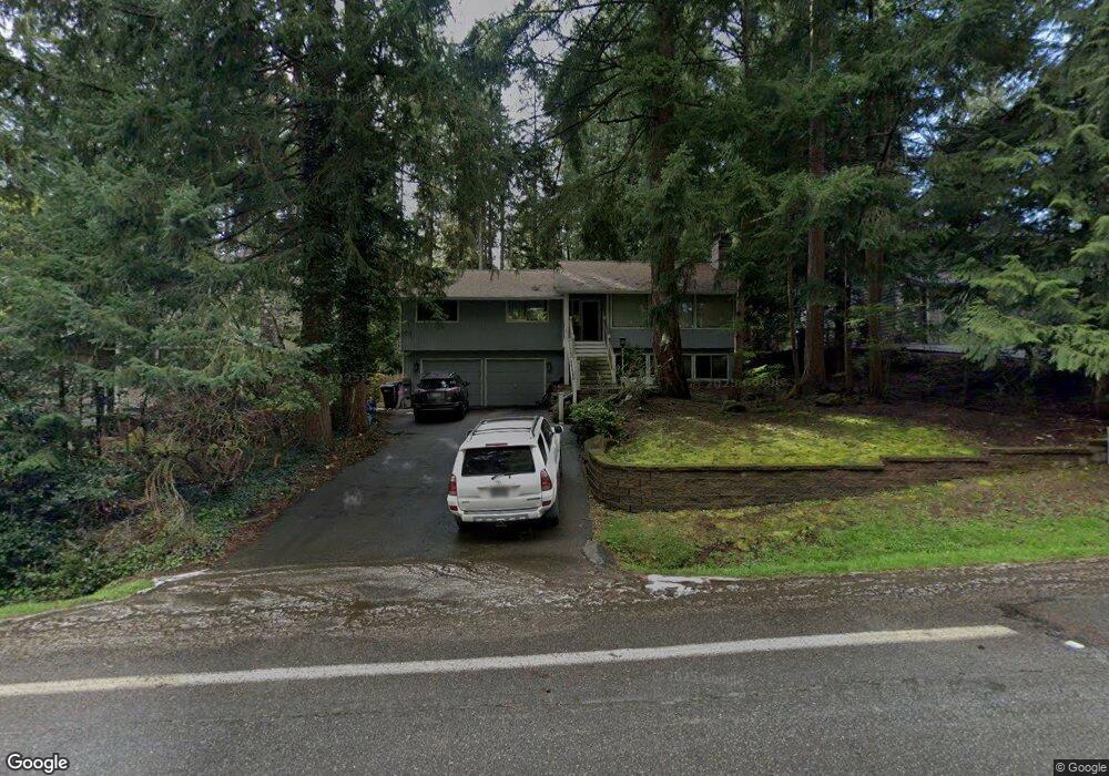
14116 60th Ave W Edmonds, WA 98026
Estimated Value: $861,887 - $939,000
4
Beds
3
Baths
2,007
Sq Ft
$447/Sq Ft
Est. Value
About This Home
This home is located at 14116 60th Ave W, Edmonds, WA 98026 and is currently estimated at $897,222, approximately $447 per square foot. 14116 60th Ave W is a home located in Snohomish County with nearby schools including Picnic Point Elementary School, Harbour Pointe Middle School, and Kamiak High School.
Ownership History
Date
Name
Owned For
Owner Type
Purchase Details
Closed on
Oct 5, 2011
Sold by
Carlson Linda Husby and Carlson Linda H
Bought by
Wittenberg Thomas and Paskiewicz Emily
Current Estimated Value
Home Financials for this Owner
Home Financials are based on the most recent Mortgage that was taken out on this home.
Original Mortgage
$308,727
Outstanding Balance
$206,978
Interest Rate
3.75%
Mortgage Type
FHA
Estimated Equity
$690,245
Purchase Details
Closed on
Jun 20, 2008
Sold by
Carlson Linda H
Bought by
Carlson Linda Husby
Create a Home Valuation Report for This Property
The Home Valuation Report is an in-depth analysis detailing your home's value as well as a comparison with similar homes in the area
Home Values in the Area
Average Home Value in this Area
Purchase History
| Date | Buyer | Sale Price | Title Company |
|---|---|---|---|
| Wittenberg Thomas | $320,206 | Chicago Title | |
| Carlson Linda Husby | $786 | None Available |
Source: Public Records
Mortgage History
| Date | Status | Borrower | Loan Amount |
|---|---|---|---|
| Open | Wittenberg Thomas | $308,727 |
Source: Public Records
Tax History Compared to Growth
Tax History
| Year | Tax Paid | Tax Assessment Tax Assessment Total Assessment is a certain percentage of the fair market value that is determined by local assessors to be the total taxable value of land and additions on the property. | Land | Improvement |
|---|---|---|---|---|
| 2025 | $5,925 | $728,300 | $479,500 | $248,800 |
| 2024 | $5,925 | $700,400 | $451,600 | $248,800 |
| 2023 | $6,149 | $760,800 | $474,600 | $286,200 |
| 2022 | $5,220 | $544,400 | $303,300 | $241,100 |
| 2020 | $4,624 | $469,700 | $259,600 | $210,100 |
| 2019 | $4,383 | $446,900 | $238,700 | $208,200 |
| 2018 | $4,376 | $389,000 | $202,600 | $186,400 |
| 2017 | $4,358 | $397,500 | $197,000 | $200,500 |
| 2016 | $4,048 | $366,400 | $174,000 | $192,400 |
| 2015 | $4,140 | $343,500 | $161,000 | $182,500 |
| 2013 | $3,424 | $265,200 | $118,000 | $147,200 |
Source: Public Records
Map
Nearby Homes
- 6306 141st St SW
- 6122 144th St SW
- 13802 60th Ave W
- 6104 145th St SW
- 6420 141st St SW
- 13813 68th Ave W
- 6520 146th St SW
- 6519 148th Place SW
- 14019 52nd Ave W Unit B
- 14714 53rd Ave W Unit 116
- 14714 53rd Ave W Unit 119
- 6625 136th Place SW
- 5114 Picnic Point Rd
- 5015 144th St SW Unit B1
- 5015 144th St SW Unit A4
- 5015 144th St SW Unit B3
- 5015 144th St SW Unit C1
- 5119 136th St SW
- 5020 148th St SW Unit E1
- 14224 Beverly Park Rd Unit A
- 14110 60th Ave W
- 14106 60th Ave W
- 14130 60th Ave W
- 14117 61st Place W
- 14115 60th Ave W
- 14123 61st Place W
- 14111 60th Ave W
- 14121 60th Ave W
- 14030 60th Ave W
- 14204 60th Ave W
- 14105 60th Ave W
- 14129 60th Ave W
- 14131 61st Place W
- 14109 61st Place W
- 14022 60th Ave W
- 14212 60th Ave W
- 14205 60th Ave W
- 14025 61st Place W
- 14029 61st Place W Unit A