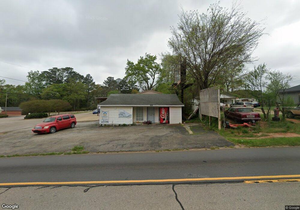
1412 Whitesville Rd Lagrange, GA 30240
Estimated Value: $165,696
--
Bed
1
Bath
2,718
Sq Ft
$61/Sq Ft
Est. Value
About This Home
This home is located at 1412 Whitesville Rd, Lagrange, GA 30240 and is currently estimated at $165,696, approximately $60 per square foot. 1412 Whitesville Rd is a home located in Troup County with nearby schools including Whitesville Road Elementary School, Berta Weathersbee Elementary School, and Rosemont Elementary School.
Ownership History
Date
Name
Owned For
Owner Type
Purchase Details
Closed on
Jun 5, 2012
Sold by
Cronin Fred
Bought by
Community Bank & Trust West Ge
Current Estimated Value
Purchase Details
Closed on
Aug 17, 1995
Sold by
Wilson Garner
Bought by
Marie Liles Mccann Etal
Purchase Details
Closed on
Nov 12, 1984
Sold by
Liles
Bought by
Wilson Garner
Purchase Details
Closed on
Jan 1, 1945
Bought by
Liles
Create a Home Valuation Report for This Property
The Home Valuation Report is an in-depth analysis detailing your home's value as well as a comparison with similar homes in the area
Home Values in the Area
Average Home Value in this Area
Purchase History
| Date | Buyer | Sale Price | Title Company |
|---|---|---|---|
| Community Bank & Trust West Ge | -- | -- | |
| Marie Liles Mccann Etal | -- | -- | |
| Wilson Garner | -- | -- | |
| Liles | -- | -- |
Source: Public Records
Tax History Compared to Growth
Tax History
| Year | Tax Paid | Tax Assessment Tax Assessment Total Assessment is a certain percentage of the fair market value that is determined by local assessors to be the total taxable value of land and additions on the property. | Land | Improvement |
|---|---|---|---|---|
| 2024 | $1,779 | $65,240 | $14,480 | $50,760 |
| 2023 | $1,726 | $63,280 | $14,480 | $48,800 |
| 2022 | $1,766 | $63,280 | $14,480 | $48,800 |
| 2021 | $1,100 | $36,480 | $4,320 | $32,160 |
| 2020 | $1,100 | $36,480 | $4,320 | $32,160 |
| 2019 | $1,086 | $36,020 | $3,900 | $32,120 |
| 2018 | $1,086 | $36,020 | $3,900 | $32,120 |
| 2017 | $1,086 | $36,020 | $3,900 | $32,120 |
| 2016 | $1,125 | $37,287 | $3,900 | $33,387 |
| 2015 | $1,140 | $37,742 | $4,355 | $33,387 |
| 2014 | $847 | $28,000 | $3,230 | $24,770 |
| 2013 | -- | $48,240 | $6,492 | $41,748 |
Source: Public Records
Map
Nearby Homes
- 1191 Whitesville St
- LOT 33 E Hillside Dr
- LOT 34 E Hillside Dr
- 0 Bagley St
- 304 Butler St
- 1404 Hamilton Rd
- 0 Boggs St Unit 10550243
- 0 Boggs St Unit 10550231
- 0 Boggs St Unit 10550239
- 0 Boggs St Unit 10550250
- 1301 Polk St
- 101 Cedar St
- 0 Hamilton Rd Unit 10577713
- 1315 Hamilton Rd
- 1216 Hamilton Rd
- 114 Brenda Blvd
- 109 Bell St
- 130 Edgewood Ave
- 901 Whiteline St
- 1300 Murphy Ave
- 1412 Whitesville St
- 1410 Whitesville St
- 1305 Whitesville St
- 1413 Whitesville Rd
- 1502 Whitesville St
- 1502 Whitesville Rd
- 801 Tuggle St
- 107 Webster St
- 101 Lashley St
- 117 Tuggle St
- 1506 Whitesville Rd
- 1400 Whitesville St
- 1506 Whitesville St
- 109 Webster St
- 1207 Whitesville St
- 111 Webster St
- 111 Webster St Unit 15
- 67 AC - TRACT 3 Whitesville Rd
- 1508 Whitesville Rd
- 1508 Whitesville St