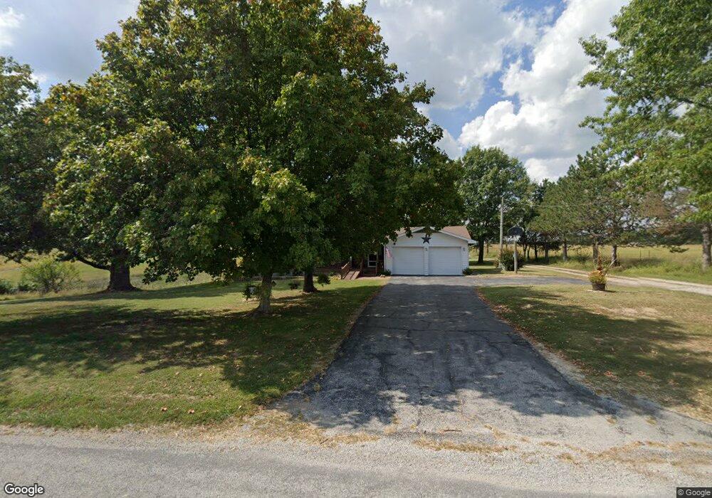
14123 Farm Road 1095 Cassville, MO 65625
Estimated Value: $247,000 - $511,000
3
Beds
2
Baths
2,174
Sq Ft
$159/Sq Ft
Est. Value
About This Home
This home is located at 14123 Farm Road 1095, Cassville, MO 65625 and is currently estimated at $344,835, approximately $158 per square foot. 14123 Farm Road 1095 is a home with nearby schools including Eunice Thomas Elementary School, Cassville Intermediate School, and Cassville Middle School.
Ownership History
Date
Name
Owned For
Owner Type
Purchase Details
Closed on
May 22, 2024
Sold by
Louise Jerry R and Louise Nickle
Bought by
Rose Loye Russell and Rose Kendal
Current Estimated Value
Home Financials for this Owner
Home Financials are based on the most recent Mortgage that was taken out on this home.
Original Mortgage
$300,000
Outstanding Balance
$295,793
Interest Rate
6.88%
Mortgage Type
New Conventional
Estimated Equity
$49,042
Create a Home Valuation Report for This Property
The Home Valuation Report is an in-depth analysis detailing your home's value as well as a comparison with similar homes in the area
Home Values in the Area
Average Home Value in this Area
Purchase History
| Date | Buyer | Sale Price | Title Company |
|---|---|---|---|
| Rose Loye Russell | -- | Meridian Title |
Source: Public Records
Mortgage History
| Date | Status | Borrower | Loan Amount |
|---|---|---|---|
| Open | Rose Loye Russell | $300,000 |
Source: Public Records
Tax History Compared to Growth
Tax History
| Year | Tax Paid | Tax Assessment Tax Assessment Total Assessment is a certain percentage of the fair market value that is determined by local assessors to be the total taxable value of land and additions on the property. | Land | Improvement |
|---|---|---|---|---|
| 2025 | $1,111 | $24,586 | $2,527 | $22,059 |
| 2024 | $1,111 | $21,299 | $2,527 | $18,772 |
| 2023 | $1,019 | $22,181 | $3,703 | $18,478 |
| 2022 | $1,010 | $21,991 | $3,513 | $18,478 |
| 2021 | $997 | $21,611 | $3,133 | $18,478 |
| 2020 | $997 | $21,611 | $3,133 | $18,478 |
| 2018 | $975 | $21,623 | $3,145 | $18,478 |
| 2017 | $973 | $21,623 | $3,145 | $18,478 |
| 2016 | $885 | $19,492 | $2,955 | $16,537 |
| 2015 | -- | $19,492 | $2,955 | $16,537 |
| 2014 | -- | $19,396 | $2,859 | $16,537 |
| 2012 | -- | $0 | $0 | $0 |
Source: Public Records
Map
Nearby Homes
- 000-B Farm Road 1090
- 000-A Farm Road 1090
- 10106 N Maple St
- 15223 State Highway 37
- 10603 N Main St
- 13915 Farm Road 1115
- 000 Farm Road 2140
- 3110 Main St
- 106 Rosedale St
- 1408 Nottingham Dr
- 1407 Nottingham Dr
- 1002 Lake Road Dr
- 303 Melton Way
- 1421 Oakhill Dr
- 301 Blackberry Ct
- 000 Luney Dr
- 1605 N Main St
- 1102 Sapp St
- 1400 Old Exeter Rd
- 000 Townsend West 9th
- 9598 Farm Road 2140
- 10402 W 5th St
- 9480 Farm Road 2140
- 13579 Farm Road 1095
- 9389 Farm Road 2140
- 13873 Farm Road 1095
- 9766 Farm Road 2140
- 9317 Farm Road 2140
- 13653 Farm Road 1095
- 9238 Farm Road 2140
- 13550 Farm Road 1095
- 10021 Farm Road 2140
- 14389 Farm Road 1095
- 13511 Farm Road 1095
- 10097 Farm Road 2140
- 10169 Farm Road 2140
- 13660 Farm Road 1090
- 9125 Farm Road 2140
- 10193 Farm Road 2140
- 14403 State Highway 37