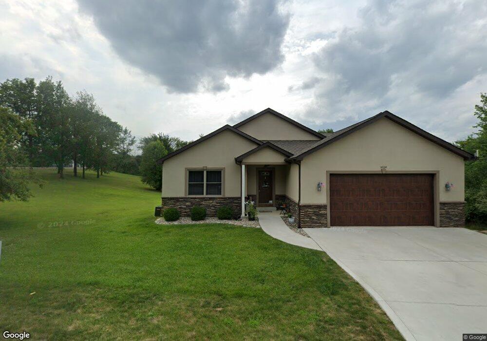
14124 E Diane Dr Unit 14124 Diane Drive E Camden, MI 49232
Estimated Value: $175,000 - $429,000
5
Beds
3
Baths
1,662
Sq Ft
$190/Sq Ft
Est. Value
About This Home
This home is located at 14124 E Diane Dr Unit 14124 Diane Drive E, Camden, MI 49232 and is currently estimated at $316,118, approximately $190 per square foot. 14124 E Diane Dr Unit 14124 Diane Drive E is a home located in Hillsdale County with nearby schools including Camden-Frontier K-8 School and Camden-Frontier High School.
Ownership History
Date
Name
Owned For
Owner Type
Purchase Details
Closed on
Sep 10, 2024
Sold by
Kramer Scott Allen and Dresden Marie
Bought by
Robinson William and Robinson Victoria
Current Estimated Value
Purchase Details
Closed on
Feb 17, 2020
Sold by
Prowse Kenny C and Prowse Robyn S
Bought by
Kramer Scott Allen and Kramer Dresden Marie
Home Financials for this Owner
Home Financials are based on the most recent Mortgage that was taken out on this home.
Original Mortgage
$130,000
Interest Rate
3.72%
Mortgage Type
New Conventional
Purchase Details
Closed on
Nov 24, 2015
Sold by
Bonney David and Bonney Margaret A
Bought by
Prowse Ii Kenny C and Prowse Robyn S
Purchase Details
Closed on
Dec 8, 1994
Bought by
Bonney David
Create a Home Valuation Report for This Property
The Home Valuation Report is an in-depth analysis detailing your home's value as well as a comparison with similar homes in the area
Home Values in the Area
Average Home Value in this Area
Purchase History
| Date | Buyer | Sale Price | Title Company |
|---|---|---|---|
| Robinson William | $400,000 | Midstate Title | |
| Kramer Scott Allen | $238,000 | Midstate Title Agency Of | |
| Prowse Ii Kenny C | $29,000 | None Available | |
| Bonney David | $1,500 | -- |
Source: Public Records
Mortgage History
| Date | Status | Borrower | Loan Amount |
|---|---|---|---|
| Previous Owner | Kramer Scott Allen | $130,000 |
Source: Public Records
Tax History Compared to Growth
Tax History
| Year | Tax Paid | Tax Assessment Tax Assessment Total Assessment is a certain percentage of the fair market value that is determined by local assessors to be the total taxable value of land and additions on the property. | Land | Improvement |
|---|---|---|---|---|
| 2025 | -- | $56,414 | $6,620 | $49,794 |
| 2024 | -- | $65,342 | $5,516 | $59,826 |
| 2023 | -- | $48,370 | $4,854 | $43,516 |
| 2022 | -- | $38,670 | $2,824 | $35,846 |
| 2021 | $0 | $38,923 | $3,001 | $35,922 |
Source: Public Records
Map
Nearby Homes
- 13857 E Diane Dr
- 13791 E Diane Dr
- 14600 W Diane Dr
- 14401 Woodbridge Rd
- 13551 Hillsdale Rd
- 14934 Heather Ct
- 623-624 Yuma Trail
- 362 Wasco Trail
- 11794 Clark Rd
- 199 Shoshone Trail
- 155 Navajo Trail
- 988-989 Seneca Dr
- 207 Modoc Trail
- 14165 Crampton Rd
- 4002 & 4014 Meadowlawn Dr
- 213 Navajo Trail
- 14621 Laura Ln
- 0 W Territorial Rd Unit 25043960
- 131 Choctaw Trail
- 0 Seneca Dr
- 14124 E Diane Dr
- 1620 Hilltop Dr
- 1628 Hilltop Dr
- 14077 View Dr
- 14117 E Diane Dr
- 14089 View Dr
- 14212 E Diane Dr
- 1636 Hilltop Dr
- 1625 Hilltop Dr
- 14103 E Diane Dr
- 14091 E Diane Dr
- 1669 Hilltop Dr
- 0 Hilltop Dr
- 1677 Hilltop Dr
- 14109 E Diane Dr
- 14069 E Diane Dr
- 1633 Hilltop Dr
- 14209 E Diane Dr
- 14189 View Dr
- 14072 View Dr