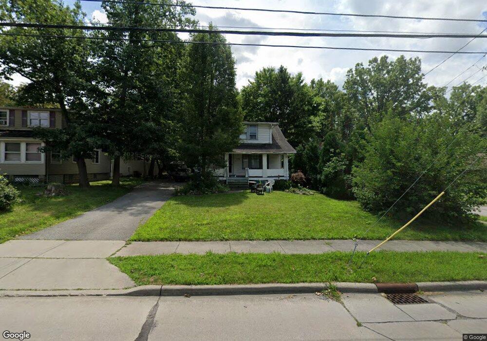
14126 Pease Rd Maple Heights, OH 44137
Estimated Value: $86,000 - $134,000
2
Beds
1
Bath
1,221
Sq Ft
$95/Sq Ft
Est. Value
About This Home
This home is located at 14126 Pease Rd, Maple Heights, OH 44137 and is currently estimated at $116,305, approximately $95 per square foot. 14126 Pease Rd is a home located in Cuyahoga County with nearby schools including Abraham Lincoln Elementary School, Rockside/ J.F. Kennedy School, and Barack Obama School.
Ownership History
Date
Name
Owned For
Owner Type
Purchase Details
Closed on
Jun 24, 2015
Sold by
Piecuch Phyllis and Piecuch Joseph
Bought by
Piecuch Michael and Piecuch Phyllis
Current Estimated Value
Purchase Details
Closed on
Jun 21, 2005
Sold by
Boyas Tony
Bought by
Piecuch Phyllis
Purchase Details
Closed on
Sep 29, 1995
Sold by
Hull Thomas A
Bought by
Boyas Tony
Purchase Details
Closed on
Dec 29, 1977
Sold by
Yarish Richard F
Bought by
Hull Thomas Andrew
Purchase Details
Closed on
Jan 1, 1975
Bought by
Yarish Richard F
Create a Home Valuation Report for This Property
The Home Valuation Report is an in-depth analysis detailing your home's value as well as a comparison with similar homes in the area
Home Values in the Area
Average Home Value in this Area
Purchase History
| Date | Buyer | Sale Price | Title Company |
|---|---|---|---|
| Piecuch Michael | -- | Attorney | |
| Piecuch Phyllis | $83,000 | Mountaineer Title Agency | |
| Boyas Tony | $67,000 | -- | |
| Hull Thomas Andrew | $38,400 | -- | |
| Yarish Richard F | -- | -- |
Source: Public Records
Tax History
| Year | Tax Paid | Tax Assessment Tax Assessment Total Assessment is a certain percentage of the fair market value that is determined by local assessors to be the total taxable value of land and additions on the property. | Land | Improvement |
|---|---|---|---|---|
| 2024 | $3,927 | $43,225 | $12,250 | $30,975 |
| 2023 | $2,848 | $26,390 | $6,790 | $19,600 |
| 2022 | $2,838 | $26,390 | $6,790 | $19,600 |
| 2021 | $3,023 | $26,390 | $6,790 | $19,600 |
| 2020 | $3,193 | $19,990 | $5,150 | $14,840 |
| 2019 | $2,568 | $57,100 | $14,700 | $42,400 |
| 2018 | $2,555 | $19,990 | $5,150 | $14,840 |
| 2017 | $2,816 | $21,950 | $6,440 | $15,510 |
| 2016 | $2,718 | $21,950 | $6,440 | $15,510 |
| 2015 | $2,645 | $21,950 | $6,440 | $15,510 |
| 2014 | $2,645 | $22,610 | $6,650 | $15,960 |
Source: Public Records
Map
Nearby Homes
- 13719 Wolf Ave
- 13704 Linn Ave
- 5408 Roland Dr
- 14512 Granger Rd
- 14510 Granger Rd
- 14305 Granger Rd
- 5179 Milo Ave
- 5220 Forest Ave
- 13417 Granger Rd
- 15095 Granger Rd
- 5270 E 135th St
- 13116 Oak Park Blvd
- 13206 Shady Oak Blvd
- 13009 Willard Ave
- 5380 E 131st St
- 13008 Willard Ave
- 13616 Oakview Blvd
- 14413 Krems Ave
- 13109 Oakview Blvd
- 13905 Thraves Ave
- 14144 Pease Rd
- 14158 Pease Rd
- 14012 Pease Rd
- 14061 Pease Rd
- 14117 Pease Rd
- 14166 Pease Rd
- 14147 Pease Rd
- 13916 Bangor Ave
- 14167 Pease Rd
- 14037 Pease Rd
- 5349 E 141st St
- 14183 Pease Rd
- 13912 Bangor Ave
- 5348 E 141st St
- 5425 E 139th St
- 13908 Bangor Ave
- 5345 E 141st St
- 5421 E 139th St
- 14324 Pease Rd
- 14201 Pease Rd
Your Personal Tour Guide
Ask me questions while you tour the home.