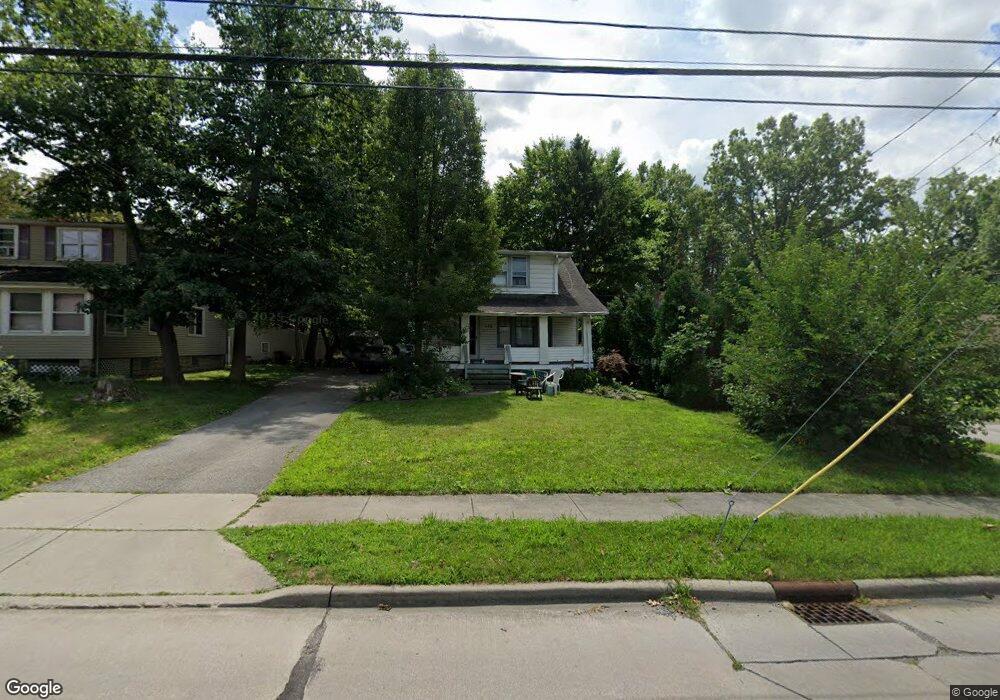
14126 Pease Rd Maple Heights, OH 44137
Estimated Value: $84,000 - $129,810
About This Home
This home is located at 14126 Pease Rd, Maple Heights, OH 44137 and is currently estimated at $110,953, approximately $90 per square foot. 14126 Pease Rd is a home located in Cuyahoga County with nearby schools including Abraham Lincoln Elementary School, Rockside/ J.F. Kennedy School, and Barack Obama School.
Ownership History
We collect this data history from publicly available records. To have your information removed, we recommend requesting removal directly through your county’s website.
Purchase Details
Purchase Details
Purchase Details
Purchase Details
Purchase Details
Home Values in the Area
Average Home Value in this Area
Purchase History
We collect this data history from publicly available records. To have your information removed, we recommend requesting removal directly through your county’s website.
| Date | Buyer | Sale Price | Title Company |
|---|---|---|---|
| -- | Attorney | ||
| $83,000 | Mountaineer Title Agency | ||
| $67,000 | -- | ||
| $38,400 | -- | ||
| -- | -- |
Tax History
We collect this data history from publicly available records. To have your information removed, we recommend requesting removal directly through your county’s website.
| Year | Tax Paid | Tax Assessment Tax Assessment Total Assessment is a certain percentage of the fair market value that is determined by local assessors to be the total taxable value of land and additions on the property. | Land | Improvement |
|---|---|---|---|---|
| 2025 | $3,538 | $43,225 | $12,250 | $30,975 |
| 2024 | $3,927 | $43,225 | $12,250 | $30,975 |
| 2023 | $2,848 | $26,390 | $6,790 | $19,600 |
| 2022 | $2,838 | $26,390 | $6,790 | $19,600 |
| 2021 | $3,023 | $26,390 | $6,790 | $19,600 |
| 2020 | $3,193 | $19,990 | $5,150 | $14,840 |
| 2019 | $2,568 | $57,100 | $14,700 | $42,400 |
| 2018 | $2,555 | $19,990 | $5,150 | $14,840 |
| 2017 | $2,816 | $21,950 | $6,440 | $15,510 |
| 2016 | $2,718 | $21,950 | $6,440 | $15,510 |
| 2015 | $2,645 | $21,950 | $6,440 | $15,510 |
| 2014 | $2,645 | $22,610 | $6,650 | $15,960 |
Map
- 13917 Wolf Ave
- 14522 Granger Rd
- 14512 Granger Rd
- 14510 Granger Rd
- 13629 Granger Rd
- 14417 Maple Ave
- 13629 Woodward Blvd
- 13708 Woodward Blvd
- 5197 Milo Ave
- 13402 Shady Oak Blvd
- 14118 Kennerdown Ave
- 13009 Darlington Ave
- 13701 Maple Leaf Dr
- 13508 Oakview Blvd
- 14112 Krems Ave
- 13500 Oakview Blvd
- 12910 Shady Oak Blvd
- 13504 Maple Leaf Dr
- 13909 Thraves Ave
- 14404 Tokay Ave
- 14144 Pease Rd
- 14158 Pease Rd
- 14012 Pease Rd
- 14061 Pease Rd
- 14117 Pease Rd
- 14129 Pease Rd
- 14166 Pease Rd
- 14147 Pease Rd
- 13916 Bangor Ave
- 14167 Pease Rd
- 14037 Pease Rd
- 5349 E 141st St
- 14183 Pease Rd
- 13912 Bangor Ave
- 5348 E 141st St
- 5425 E 139th St
- 13908 Bangor Ave
- 5345 E 141st St
- 5421 E 139th St
- 14324 Pease Rd
Ask me questions while you tour the home.