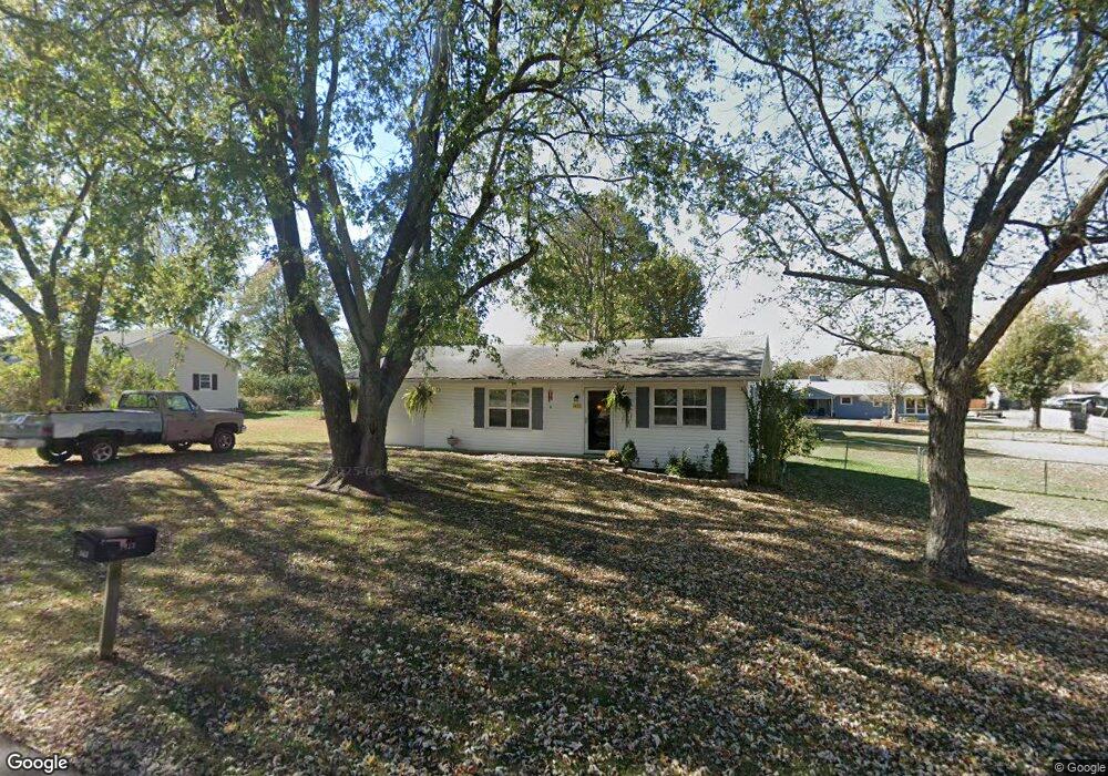
1413 Cedar Dr Lebanon, MO 65536
Estimated Value: $107,597 - $173,000
2
Beds
--
Bath
1,039
Sq Ft
$145/Sq Ft
Est. Value
About This Home
This home is located at 1413 Cedar Dr, Lebanon, MO 65536 and is currently estimated at $150,649, approximately $144 per square foot. 1413 Cedar Dr is a home with nearby schools including Joe D. Esther Elementary School, Boswell Elementary School, and Maplecrest Elementary School.
Ownership History
Date
Name
Owned For
Owner Type
Purchase Details
Closed on
Feb 24, 2020
Sold by
Berkich Joe and Berkich Linda
Bought by
Hamilton Wanda
Current Estimated Value
Purchase Details
Closed on
Aug 25, 2016
Sold by
Brook Leona and Brook Hensley Leona
Bought by
Berkich Joe and Berkich Linda
Purchase Details
Closed on
Sep 14, 2007
Sold by
Dismang Robert Eugene
Bought by
Brook Lance C and Brook Deborah K
Home Financials for this Owner
Home Financials are based on the most recent Mortgage that was taken out on this home.
Original Mortgage
$54,150
Interest Rate
6.7%
Mortgage Type
New Conventional
Create a Home Valuation Report for This Property
The Home Valuation Report is an in-depth analysis detailing your home's value as well as a comparison with similar homes in the area
Home Values in the Area
Average Home Value in this Area
Purchase History
| Date | Buyer | Sale Price | Title Company |
|---|---|---|---|
| Hamilton Wanda | -- | Hogan Land Title | |
| Berkich Joe | -- | Hogan | |
| Brook Lance C | -- | None Available |
Source: Public Records
Mortgage History
| Date | Status | Borrower | Loan Amount |
|---|---|---|---|
| Previous Owner | Brook Lance C | $54,150 |
Source: Public Records
Tax History Compared to Growth
Tax History
| Year | Tax Paid | Tax Assessment Tax Assessment Total Assessment is a certain percentage of the fair market value that is determined by local assessors to be the total taxable value of land and additions on the property. | Land | Improvement |
|---|---|---|---|---|
| 2025 | $505 | $9,900 | $0 | $0 |
| 2024 | $505 | $8,850 | $0 | $0 |
| 2023 | $520 | $8,850 | $0 | $0 |
| 2022 | $484 | $8,850 | $0 | $0 |
| 2021 | $534 | $8,854 | $1,748 | $7,106 |
| 2020 | $536 | $8,854 | $1,748 | $7,106 |
| 2019 | $472 | $8,130 | $1,750 | $6,380 |
| 2018 | $443 | $8,130 | $1,750 | $6,380 |
| 2017 | $381 | $8,130 | $0 | $0 |
| 2016 | $381 | $8,130 | $0 | $0 |
| 2015 | $381 | $8,130 | $0 | $0 |
| 2014 | $381 | $7,370 | $0 | $0 |
| 2013 | -- | $7,370 | $0 | $0 |
Source: Public Records
Map
Nearby Homes
- 708 Herndon Rd
- 1040 Daytona Dr
- TBD Honeysuckle Cir
- 000 Gateway Rd
- 18826 Highway 64
- 605 Hunters Creek Dr
- 600 Hunters Creek Dr
- 1491 Brice St
- 460 Sunset Dr
- 25611 Open Ridge Ln
- 376 Sunset Dr
- 100 S Bend Rd
- 1250 N Jefferson Ave
- 274 Cornelison St
- 175 Walser St
- 105 S King St
- 750 Lynn St
- 1075 Lynn St
- 829 Lynn St
- 116 Smith Rd