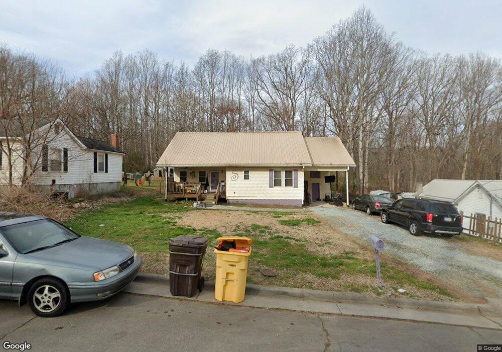
1413 Elm St Roxboro, NC 27573
Estimated Value: $185,000 - $228,792
3
Beds
2
Baths
1,136
Sq Ft
$188/Sq Ft
Est. Value
About This Home
This home is located at 1413 Elm St, Roxboro, NC 27573 and is currently estimated at $213,448, approximately $187 per square foot. 1413 Elm St is a home with nearby schools including Person High School, Roxboro Community School, and Roxboro Christian Academy.
Ownership History
Date
Name
Owned For
Owner Type
Purchase Details
Closed on
Jan 29, 2014
Sold by
Person County Habitat For Humanity
Bought by
Swann Curtis D and Swann Leslie P
Current Estimated Value
Home Financials for this Owner
Home Financials are based on the most recent Mortgage that was taken out on this home.
Original Mortgage
$98,000
Outstanding Balance
$51,999
Interest Rate
4.48%
Mortgage Type
New Conventional
Estimated Equity
$161,449
Create a Home Valuation Report for This Property
The Home Valuation Report is an in-depth analysis detailing your home's value as well as a comparison with similar homes in the area
Home Values in the Area
Average Home Value in this Area
Purchase History
| Date | Buyer | Sale Price | Title Company |
|---|---|---|---|
| Swann Curtis D | $98,000 | None Available |
Source: Public Records
Mortgage History
| Date | Status | Borrower | Loan Amount |
|---|---|---|---|
| Open | Swann Curtis D | $98,000 |
Source: Public Records
Tax History Compared to Growth
Tax History
| Year | Tax Paid | Tax Assessment Tax Assessment Total Assessment is a certain percentage of the fair market value that is determined by local assessors to be the total taxable value of land and additions on the property. | Land | Improvement |
|---|---|---|---|---|
| 2025 | $3,014 | $218,393 | $0 | $0 |
| 2024 | $2,340 | $153,712 | $0 | $0 |
| 2023 | $2,340 | $153,712 | $0 | $0 |
| 2022 | $2,183 | $153,712 | $0 | $0 |
| 2021 | $2,106 | $153,712 | $0 | $0 |
| 2020 | $1,712 | $123,176 | $0 | $0 |
| 2019 | $1,724 | $123,176 | $0 | $0 |
| 2018 | $1,688 | $123,176 | $0 | $0 |
| 2017 | $1,688 | $123,176 | $0 | $0 |
| 2016 | $1,688 | $123,176 | $0 | $0 |
| 2015 | $1,675 | $123,176 | $0 | $0 |
| 2014 | $1,675 | $123,176 | $0 | $0 |
Source: Public Records
Map
Nearby Homes
- 1249 Pointer St
- Lot 4 Forrestwood Dr
- 0 N Main St Unit 10114094
- 120 Denada Path
- 1901 Carver Dr
- 11 Denada Path
- 1420 John St
- 127 Lankford St
- 143 Lankford St
- 115 Kerr Dr
- 522 Providence Rd
- 1170&1380 Providence Rd
- 100 Landon Place
- 249 Landon Place
- 213 Landon Place
- 250 Landon Place
- 147 Landon Place
- 237 Landon Place
- 99 Landon Place
- 51 Landon Place