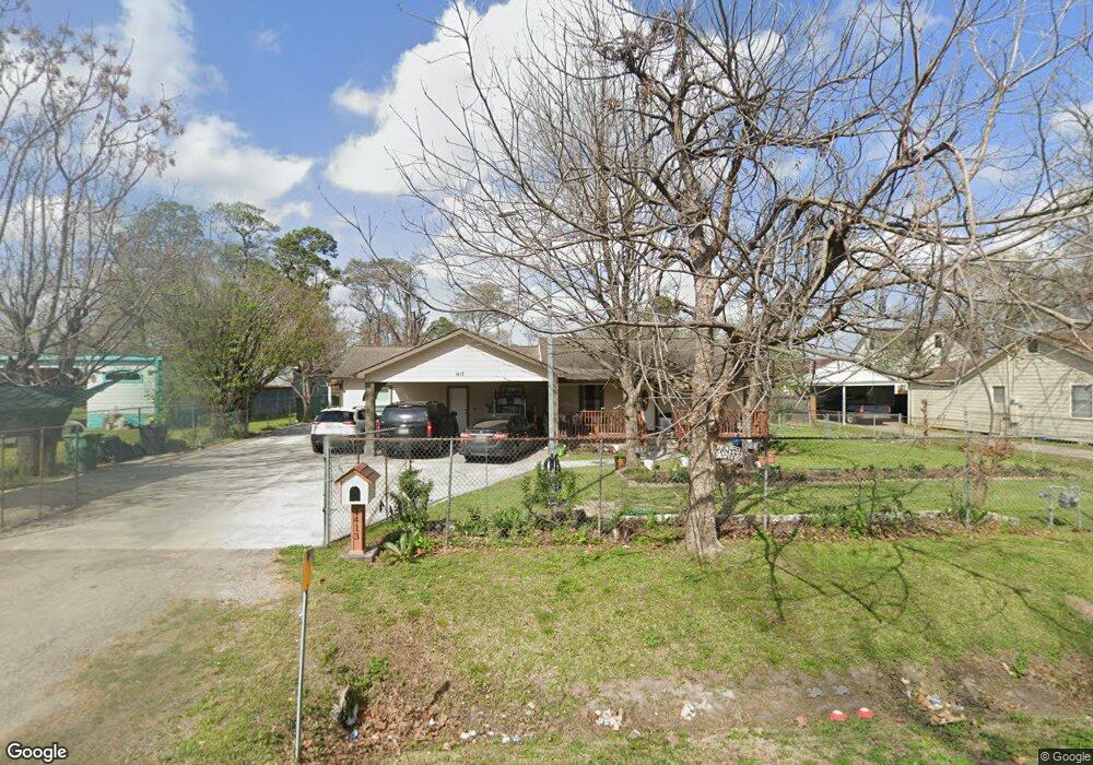
1413 Knight St Houston, TX 77022
Northside-Northline NeighborhoodEstimated Value: $296,000 - $534,000
5
Beds
4
Baths
2,872
Sq Ft
$141/Sq Ft
Est. Value
About This Home
This home is located at 1413 Knight St, Houston, TX 77022 and is currently estimated at $404,895, approximately $140 per square foot. 1413 Knight St is a home located in Harris County with nearby schools including Burbank Elementary School, Burbank Middle School, and Sam Houston Math, Science & Technology Center.
Ownership History
Date
Name
Owned For
Owner Type
Purchase Details
Closed on
Sep 23, 2003
Sold by
Delatorre Esaul and Delatorre Maria Aurora
Bought by
Martinez Jose C and Martinez Yolanda A
Current Estimated Value
Home Financials for this Owner
Home Financials are based on the most recent Mortgage that was taken out on this home.
Original Mortgage
$56,000
Interest Rate
6.24%
Mortgage Type
Seller Take Back
Create a Home Valuation Report for This Property
The Home Valuation Report is an in-depth analysis detailing your home's value as well as a comparison with similar homes in the area
Home Values in the Area
Average Home Value in this Area
Purchase History
| Date | Buyer | Sale Price | Title Company |
|---|---|---|---|
| Martinez Jose C | -- | American Title Co |
Source: Public Records
Mortgage History
| Date | Status | Borrower | Loan Amount |
|---|---|---|---|
| Closed | Martinez Jose C | $56,000 |
Source: Public Records
Tax History Compared to Growth
Tax History
| Year | Tax Paid | Tax Assessment Tax Assessment Total Assessment is a certain percentage of the fair market value that is determined by local assessors to be the total taxable value of land and additions on the property. | Land | Improvement |
|---|---|---|---|---|
| 2025 | $5,897 | $417,363 | $275,880 | $141,483 |
| 2024 | $5,897 | $403,456 | $253,193 | $150,263 |
| 2023 | $5,897 | $373,010 | $154,275 | $218,735 |
| 2022 | $4,451 | $324,467 | $154,275 | $170,192 |
| 2021 | $4,283 | $277,488 | $154,275 | $123,213 |
| 2020 | $4,046 | $261,147 | $154,275 | $106,872 |
| 2019 | $3,843 | $240,401 | $127,050 | $113,351 |
| 2018 | $2,507 | $194,048 | $106,178 | $87,870 |
| 2017 | $3,174 | $194,048 | $106,178 | $87,870 |
| 2016 | $2,885 | $140,472 | $99,825 | $40,647 |
| 2015 | $1,965 | $103,733 | $62,600 | $41,133 |
| 2014 | $1,965 | $103,733 | $62,600 | $41,133 |
Source: Public Records
Map
Nearby Homes
- 1207 Firnat St
- 1104 Charnwood St
- 807 Firnat St
- 723 Doverside St
- 8109 W Hardy Rd
- 702 Pennington St
- 8411 Berry Brush Ln
- 8718 Brannon St
- 1016 Apache St
- 8402 Berry Green Ln
- 743 Apache St
- 802 Berry Sage Ln
- 9026 Mcgallion Rd
- 631 Apache St
- 714 Apache St
- 88 Berry Rd
- 9021 Lomax St
- 741 Mcdaniel St
- 9650 E Hardy Rd
- 8205 Appleton St
- 1401 Knight St
- 1419 Knight St
- 8813 W Hardy Rd
- 1412 Firnat St
- 1321 Knight St
- 8905 W Hardy Rd
- 8811 W Hardy Rd
- 8815 W Hardy Rd
- 1410 Firnat St Unit 1
- 1406 Firnat St
- 1408 Firnat St
- 8911 W Hardy Rd
- 1313 Knight St
- 8719 W Hardy Rd
- 1309 Knight St
- 1406 Knight St
- 1414 Knight St
- 8915 W Hardy Rd
- 1402 Knight St
- 1324 Firnat St