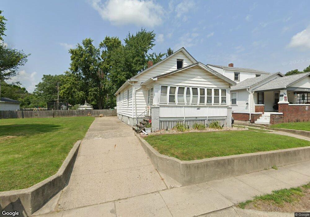
1413 N Monroe St Decatur, IL 62526
Neighborhood Empowerment NeighborhoodEstimated Value: $40,000 - $48,000
2
Beds
2
Baths
2,080
Sq Ft
$21/Sq Ft
Est. Value
About This Home
This home is located at 1413 N Monroe St, Decatur, IL 62526 and is currently estimated at $44,396, approximately $21 per square foot. 1413 N Monroe St is a home located in Macon County with nearby schools including Stephen Decatur Middle School, St. Patrick School, and Teen Challenge-Home For Girls.
Ownership History
Date
Name
Owned For
Owner Type
Purchase Details
Closed on
Jan 24, 2006
Sold by
Theobald Tiffany and Theobald Hope
Bought by
Groves Peggy J
Current Estimated Value
Home Financials for this Owner
Home Financials are based on the most recent Mortgage that was taken out on this home.
Original Mortgage
$22,000
Outstanding Balance
$12,385
Interest Rate
6.2%
Mortgage Type
Purchase Money Mortgage
Estimated Equity
$32,011
Purchase Details
Closed on
Dec 1, 1993
Create a Home Valuation Report for This Property
The Home Valuation Report is an in-depth analysis detailing your home's value as well as a comparison with similar homes in the area
Home Values in the Area
Average Home Value in this Area
Purchase History
| Date | Buyer | Sale Price | Title Company |
|---|---|---|---|
| Groves Peggy J | -- | None Available | |
| -- | $24,000 | -- |
Source: Public Records
Mortgage History
| Date | Status | Borrower | Loan Amount |
|---|---|---|---|
| Open | Groves Peggy J | $22,000 |
Source: Public Records
Tax History Compared to Growth
Tax History
| Year | Tax Paid | Tax Assessment Tax Assessment Total Assessment is a certain percentage of the fair market value that is determined by local assessors to be the total taxable value of land and additions on the property. | Land | Improvement |
|---|---|---|---|---|
| 2024 | $428 | $5,110 | $442 | $4,668 |
| 2023 | $440 | $4,929 | $426 | $4,503 |
| 2022 | $452 | $4,519 | $394 | $4,125 |
| 2021 | $434 | $4,220 | $368 | $3,852 |
| 2020 | $428 | $4,023 | $350 | $3,673 |
| 2019 | $428 | $4,023 | $350 | $3,673 |
| 2018 | $456 | $4,343 | $249 | $4,094 |
| 2017 | $463 | $4,459 | $256 | $4,203 |
| 2016 | $467 | $4,505 | $259 | $4,246 |
| 2015 | $452 | $4,809 | $225 | $4,584 |
| 2014 | $424 | $4,762 | $223 | $4,539 |
| 2013 | $422 | $4,941 | $231 | $4,710 |
Source: Public Records
Map
Nearby Homes
- 1545 N Monroe St
- 1504 N Monroe St
- 837 W Grand Ave
- 644 W Division St
- 1245 N Union St
- 1653 N Maple Ave
- 933 W Division St
- 1915 N Monroe St
- 1558 N Main St
- 1568 N Main St
- 844 N Edward St
- 141 E Packard St
- 415 W Green St
- 230 W Garfield Ave
- 875 N Monroe St
- 240 E Olive St
- 1065 W Green St
- 1319 W Waggoner St
- 917 N Wilder Ave
- 422 W William St
- 1415 N Monroe St
- 1399 N Monroe St
- 1445 N Monroe St
- 1367 N Monroe St
- 1467 N Monroe St
- 615 W Center St
- 625 W Center St
- 1428 N Huron St
- 1402 N Monroe St
- 1436 N Huron St
- 639 W Center St
- 1444 N Huron St
- 1390 N Huron St
- 1357 N Monroe St
- 1380 N Huron St
- 647 W Center St
- 1378 N Monroe St
- 1408 N Monroe St
- 1412 N Monroe St
- 1368 N Huron St