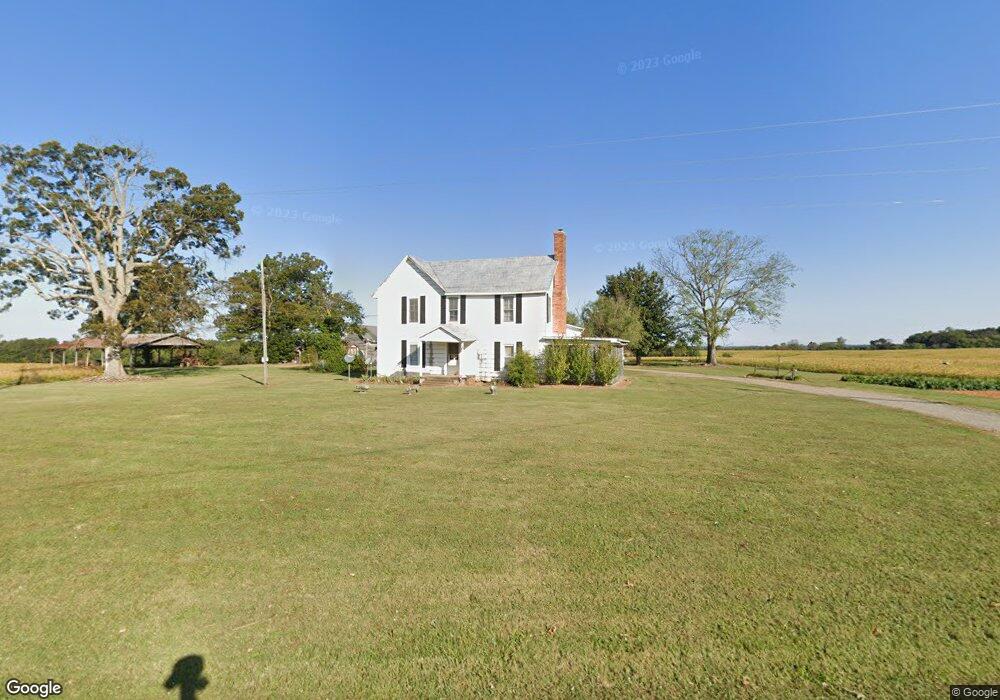
1413 Old Mocksville Rd Statesville, NC 28625
Estimated Value: $453,000 - $7,583,218
2
Beds
1
Bath
2,128
Sq Ft
$1,948/Sq Ft
Est. Value
About This Home
This home is located at 1413 Old Mocksville Rd, Statesville, NC 28625 and is currently estimated at $4,146,406, approximately $1,948 per square foot. 1413 Old Mocksville Rd is a home with nearby schools including Cool Spring Elementary School, East Iredell Middle School, and North Iredell High School.
Ownership History
Date
Name
Owned For
Owner Type
Purchase Details
Closed on
Nov 7, 2012
Sold by
Mclain Farms Inc
Bought by
Mclain Farms Inc
Current Estimated Value
Purchase Details
Closed on
Nov 3, 2012
Sold by
Don And Jo Cline Family Foundation
Bought by
Mclain Farms Inc
Purchase Details
Closed on
May 1, 1997
Purchase Details
Closed on
Apr 1, 1996
Purchase Details
Closed on
Jun 1, 1982
Purchase Details
Closed on
Jun 1, 1949
Purchase Details
Closed on
Jun 1, 1947
Purchase Details
Closed on
Jun 1, 1901
Create a Home Valuation Report for This Property
The Home Valuation Report is an in-depth analysis detailing your home's value as well as a comparison with similar homes in the area
Home Values in the Area
Average Home Value in this Area
Purchase History
| Date | Buyer | Sale Price | Title Company |
|---|---|---|---|
| Mclain Farms Inc | -- | None Available | |
| Cline J Donald | -- | None Available | |
| Mclain Farms Inc | $2,175,000 | None Available | |
| -- | $12,000 | -- | |
| -- | -- | -- | |
| -- | -- | -- | |
| -- | -- | -- | |
| -- | -- | -- | |
| -- | -- | -- |
Source: Public Records
Tax History Compared to Growth
Tax History
| Year | Tax Paid | Tax Assessment Tax Assessment Total Assessment is a certain percentage of the fair market value that is determined by local assessors to be the total taxable value of land and additions on the property. | Land | Improvement |
|---|---|---|---|---|
| 2024 | $2,477 | $409,620 | $0 | $0 |
| 2023 | $2,477 | $380,470 | $0 | $0 |
| 2022 | $2,163 | $335,110 | $0 | $0 |
| 2021 | $2,159 | $335,110 | $0 | $0 |
| 2020 | $2,159 | $335,110 | $0 | $0 |
| 2019 | $2,125 | $335,110 | $0 | $0 |
| 2018 | $1,858 | $302,230 | $0 | $0 |
| 2017 | $1,858 | $2,499,320 | $2,459,330 | $39,990 |
| 2016 | $1,858 | $2,499,320 | $2,459,330 | $39,990 |
| 2015 | $1,851 | $2,499,320 | $2,459,330 | $39,990 |
| 2014 | $1,709 | $2,499,900 | $2,459,330 | $40,570 |
Source: Public Records
Map
Nearby Homes
- 00000 Barnyard Ln
- 198 Dunlap Loop
- 166 Eastgate Dr
- 501 Chestnut Grove Rd
- 106 Seven Springs Loop
- 146 Coolwood Dr
- 138 Seven Springs Loop
- 274 Deerchase Cir
- 304 Deerchase Cir
- 173 Chestnut Grove Rd
- 475 Baymount Dr
- 192 Baymount Dr
- 155 Mcallister Rd
- 121 Wildeman Trail
- 139 Jo Creek Ln
- 129 Renaissance Place
- 114 Country Woods Ln
- 123 Swann Crossing Ln
- 157 Poplar Leaf Ln Unit 10
- 5134 Colchester Ct Unit 65
- 1177 Cool Spring Rd
- 1169 Cool Spring Rd
- 1145 Cool Spring Rd
- 190 Eight Point Dr
- 1133 Cool Spring Rd
- 164 Stone Creek Dr
- 160 Stone Creek Dr
- 172 Stone Creek Dr
- 180 Stone Creek Dr
- 1127 Cool Spring Rd
- 154 Stone Creek Dr
- 171 Stone Creek Dr
- 181 Stone Creek Dr
- 157 Stone Creek Dr
- 146 Stone Creek Dr
- 136 Stone Creek Dr
- 147 Stone Creek Dr
- 1525 Old Mocksville Rd
- 130 Stone Creek Dr
- 1298 Old Mocksville Rd
