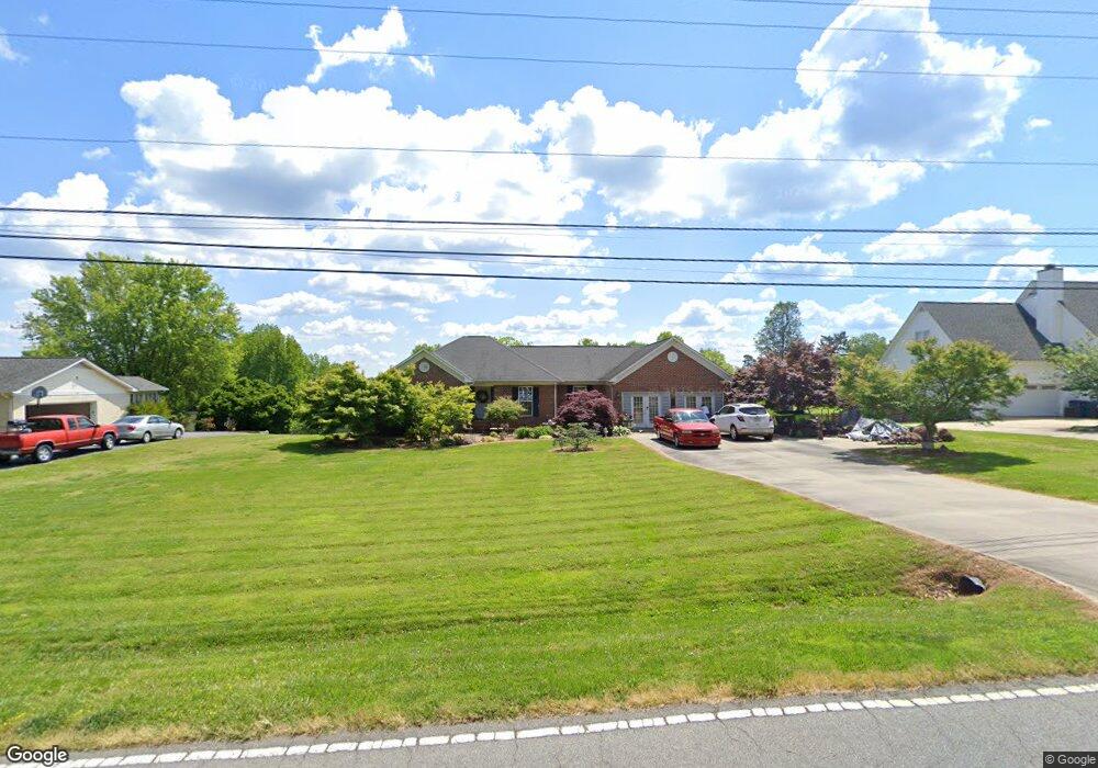
1413 Tower Rd Thomasville, NC 27360
Estimated Value: $299,000 - $467,000
3
Beds
2
Baths
2,575
Sq Ft
$142/Sq Ft
Est. Value
About This Home
This home is located at 1413 Tower Rd, Thomasville, NC 27360 and is currently estimated at $366,087, approximately $142 per square foot. 1413 Tower Rd is a home located in Davidson County with nearby schools including Fair Grove Elementary School, E. Lawson Brown Middle School, and East Davidson High School.
Ownership History
Date
Name
Owned For
Owner Type
Purchase Details
Closed on
Nov 12, 2024
Sold by
Swaim Vivian Y
Bought by
Swaim Marlowe Mitzi
Current Estimated Value
Purchase Details
Closed on
Dec 23, 2004
Sold by
Summers Konnie Thornton
Bought by
Summers Thomas Dale
Purchase Details
Closed on
Nov 1, 2004
Sold by
Hart Michael C and Hart Jamie M
Bought by
Swaim Robert T
Purchase Details
Closed on
Feb 19, 2003
Sold by
Black M L Enterprises Inc
Bought by
Hart Michael C and Hart Jamie M
Purchase Details
Closed on
May 23, 2002
Sold by
Beane Tommy L
Bought by
Black M L Enterprises Inc
Purchase Details
Closed on
Jun 1, 1997
Purchase Details
Closed on
May 1, 1991
Create a Home Valuation Report for This Property
The Home Valuation Report is an in-depth analysis detailing your home's value as well as a comparison with similar homes in the area
Home Values in the Area
Average Home Value in this Area
Purchase History
| Date | Buyer | Sale Price | Title Company |
|---|---|---|---|
| Swaim Marlowe Mitzi | -- | None Listed On Document | |
| Swaim Marlowe Mitzi | -- | None Listed On Document | |
| Swaim Marlowe Mitzi | -- | None Listed On Document | |
| Summers Thomas Dale | -- | None Available | |
| Swaim Robert T | $198,000 | -- | |
| Hart Michael C | $177,500 | -- | |
| Black M L Enterprises Inc | $27,500 | -- | |
| -- | $151,000 | -- | |
| -- | $19,000 | -- |
Source: Public Records
Tax History
| Year | Tax Paid | Tax Assessment Tax Assessment Total Assessment is a certain percentage of the fair market value that is determined by local assessors to be the total taxable value of land and additions on the property. | Land | Improvement |
|---|---|---|---|---|
| 2025 | $1,319 | $209,170 | $0 | $0 |
| 2024 | $1,319 | $209,170 | $0 | $0 |
| 2023 | $1,319 | $209,170 | $0 | $0 |
| 2022 | $1,319 | $209,170 | $0 | $0 |
| 2021 | $1,319 | $209,170 | $0 | $0 |
| 2020 | $1,189 | $188,640 | $0 | $0 |
| 2019 | $1,207 | $188,640 | $0 | $0 |
| 2018 | $1,207 | $188,640 | $0 | $0 |
| 2017 | $1,207 | $188,640 | $0 | $0 |
| 2016 | $1,170 | $188,640 | $0 | $0 |
| 2015 | $1,170 | $188,640 | $0 | $0 |
| 2014 | $1,294 | $208,700 | $0 | $0 |
Source: Public Records
Map
Nearby Homes
- 168 Game Trail
- 310 Aspen Place Ct
- 404 White Spruce Ct
- 313 Aspen Place Ct
- 308 Aspen Place Ct
- 609 Jack Pine St
- 311 Aspen Place Ct
- 607 Jack Pine St
- 7449 Old Farm Rd
- 309 Aspen Place Ct
- 304 Aspen Place Ct
- 7352 Oak Bucket Rd
- 305 Aspen Place Ct
- 300 Aspen Place Ct
- 415 Jack Pine St
- 411 Jack Pine St
- 409 Jack Pine St
- 407 Jack Pine St
- 412 Jack Pine St
- 405 Jack Pine St
Your Personal Tour Guide
Ask me questions while you tour the home.