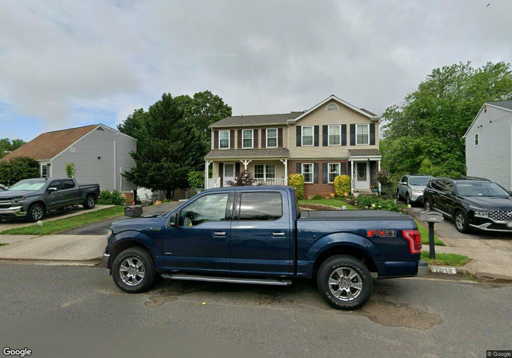
14138 Morrison Ct Woodbridge, VA 22193
Mapledale NeighborhoodEstimated Value: $400,000 - $483,119
3
Beds
2
Baths
1,300
Sq Ft
$339/Sq Ft
Est. Value
About This Home
This home is located at 14138 Morrison Ct, Woodbridge, VA 22193 and is currently estimated at $440,280, approximately $338 per square foot. 14138 Morrison Ct is a home located in Prince William County with nearby schools including Enterprise Elementary School, C.D. Hylton High School, and Stuart M. Beville Middle School.
Ownership History
Date
Name
Owned For
Owner Type
Purchase Details
Closed on
Aug 26, 1997
Sold by
Sec Of Va
Bought by
Coleman Denise G
Current Estimated Value
Home Financials for this Owner
Home Financials are based on the most recent Mortgage that was taken out on this home.
Original Mortgage
$79,750
Outstanding Balance
$12,305
Interest Rate
7.42%
Mortgage Type
FHA
Estimated Equity
$427,975
Purchase Details
Closed on
Oct 30, 1995
Sold by
Meyer Richard E
Bought by
Byrd Alvin W
Home Financials for this Owner
Home Financials are based on the most recent Mortgage that was taken out on this home.
Original Mortgage
$89,513
Interest Rate
7.6%
Create a Home Valuation Report for This Property
The Home Valuation Report is an in-depth analysis detailing your home's value as well as a comparison with similar homes in the area
Home Values in the Area
Average Home Value in this Area
Purchase History
| Date | Buyer | Sale Price | Title Company |
|---|---|---|---|
| Coleman Denise G | $80,000 | -- | |
| Byrd Alvin W | $91,600 | -- |
Source: Public Records
Mortgage History
| Date | Status | Borrower | Loan Amount |
|---|---|---|---|
| Open | Byrd Alvin W | $79,750 | |
| Previous Owner | Byrd Alvin W | $89,513 | |
| Closed | Byrd Alvin W | $1,429 |
Source: Public Records
Tax History Compared to Growth
Tax History
| Year | Tax Paid | Tax Assessment Tax Assessment Total Assessment is a certain percentage of the fair market value that is determined by local assessors to be the total taxable value of land and additions on the property. | Land | Improvement |
|---|---|---|---|---|
| 2025 | $3,886 | $427,200 | $151,200 | $276,000 |
| 2024 | $3,886 | $390,700 | $138,800 | $251,900 |
| 2023 | $3,749 | $360,300 | $127,400 | $232,900 |
| 2022 | $3,687 | $332,900 | $116,900 | $216,000 |
| 2021 | $3,672 | $298,900 | $104,400 | $194,500 |
| 2020 | $3,977 | $256,600 | $89,300 | $167,300 |
| 2019 | $3,917 | $252,700 | $89,300 | $163,400 |
| 2018 | $2,811 | $232,800 | $83,400 | $149,400 |
| 2017 | $2,736 | $219,100 | $78,000 | $141,100 |
| 2016 | $2,512 | $202,500 | $71,600 | $130,900 |
| 2015 | $2,368 | $203,600 | $71,600 | $132,000 |
| 2014 | $2,368 | $185,800 | $65,100 | $120,700 |
Source: Public Records
Map
Nearby Homes
- 14010 Mapledale Ave
- 14160 Landon Ln
- 14072 Oxbridge Inn Ct
- 13918 Lynhurst Dr
- 13871 Langstone Dr
- 5655 Roundtree Dr
- 14288 Lindendale Rd
- 5611 Roundtree Dr
- 14536 General Washington Dr
- 14591 Estate Dr
- 5322 Sentry Ln
- 13737 Moccasin Ct
- 5678 Roundtree Dr
- 14371 Salsbury Ct
- 5308 Macwood Dr
- 14297 Felty Place
- 14368 Springbrook Ct
- 13707 Mapledale Ave
- 4690 Pearson Dr
- 5242 Sudberry Ln
- 14136 Morrison Ct
- 14140 Morrison Ct
- 14134 Morrison Ct
- 14197 Mapledale Ave
- 14114 Lindendale Rd
- 14132 Morrison Ct
- 14195 Mapledale Ave
- 14139 Morrison Ct
- 14137 Morrison Ct
- 14130 Morrison Ct
- 14128 Morrison Ct
- 14135 Morrison Ct
- 14193 Mapledale Ave
- 14115 Lindendale Rd
- 14133 Morrison Ct
- 14126 Morrison Ct
- 14117 Lindendale Rd
- 14113 Lindendale Rd
- 14108 Lindendale Rd
- 14131 Morrison Ct