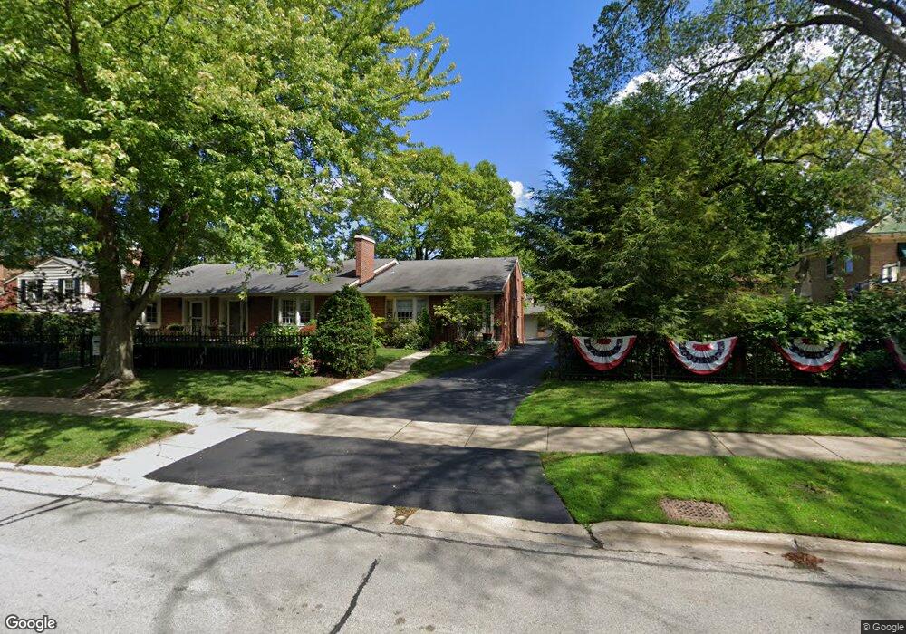
1414 10th St Wilmette, IL 60091
Estimated Value: $697,000 - $816,000
2
Beds
3
Baths
910
Sq Ft
$826/Sq Ft
Est. Value
About This Home
This home is located at 1414 10th St, Wilmette, IL 60091 and is currently estimated at $751,476, approximately $825 per square foot. 1414 10th St is a home located in Cook County with nearby schools including Central Elementary School, Highcrest Middle School, and Wilmette Junior High School.
Ownership History
Date
Name
Owned For
Owner Type
Purchase Details
Closed on
May 16, 2005
Sold by
Mcintyre Diane
Bought by
Mcintyre Diane and Revocable Living Trust Agreement Of Dian
Current Estimated Value
Purchase Details
Closed on
Apr 20, 1999
Sold by
Burch Jeffrey A and Burch Jennifer P
Bought by
Mcintyre Diane E
Home Financials for this Owner
Home Financials are based on the most recent Mortgage that was taken out on this home.
Original Mortgage
$160,000
Interest Rate
7.17%
Mortgage Type
Balloon
Purchase Details
Closed on
Apr 11, 1997
Sold by
The Northern Trust Company
Bought by
Burch Jeffrey A and Burch Jennifer P
Home Financials for this Owner
Home Financials are based on the most recent Mortgage that was taken out on this home.
Original Mortgage
$208,500
Interest Rate
7.5%
Create a Home Valuation Report for This Property
The Home Valuation Report is an in-depth analysis detailing your home's value as well as a comparison with similar homes in the area
Home Values in the Area
Average Home Value in this Area
Purchase History
We collect this data history from publicly available records. To have your information removed, we recommend requesting removal directly through your county’s website.
| Date | Buyer | Sale Price | Title Company |
|---|---|---|---|
| Mcintyre Diane | -- | -- | |
| Mcintyre Diane E | $319,000 | Chicago Title Insurance Co | |
| Burch Jeffrey A | $219,500 | Rei Title |
Source: Public Records
Mortgage History
We collect this data history from publicly available records. To have your information removed, we recommend requesting removal directly through your county’s website.
| Date | Status | Borrower | Loan Amount |
|---|---|---|---|
| Closed | Mcintyre Diane E | $160,000 | |
| Previous Owner | Burch Jeffrey A | $208,500 |
Source: Public Records
Tax History
| Year | Tax Paid | Tax Assessment Tax Assessment Total Assessment is a certain percentage of the fair market value that is determined by local assessors to be the total taxable value of land and additions on the property. | Land | Improvement |
|---|---|---|---|---|
| 2025 | $9,991 | $68,001 | $18,805 | $49,196 |
| 2024 | $9,991 | $50,000 | $8,000 | $42,000 |
| 2023 | $9,416 | $50,000 | $8,000 | $42,000 |
| 2022 | $9,416 | $50,000 | $8,000 | $42,000 |
| 2021 | $8,915 | $40,309 | $6,943 | $33,366 |
| 2020 | $8,874 | $40,309 | $6,943 | $33,366 |
| 2019 | $8,587 | $43,815 | $6,943 | $36,872 |
| 2018 | $8,649 | $42,540 | $5,786 | $36,754 |
| 2017 | $8,435 | $42,540 | $5,786 | $36,754 |
| 2016 | $8,316 | $42,540 | $5,786 | $36,754 |
| 2015 | $7,946 | $36,506 | $4,773 | $31,733 |
| 2014 | $7,843 | $36,506 | $4,773 | $31,733 |
| 2013 | $7,465 | $36,506 | $4,773 | $31,733 |
Source: Public Records
Map
Nearby Homes
- 925 Ashland Ave
- 1036 Ashland Ave
- 1625 Sheridan Rd Unit 206
- 1500 Sheridan Rd Unit 7E
- 1500 Sheridan Rd Unit 6H
- 1420 Sheridan Rd Unit 3I
- 1420 Sheridan Rd Unit 3B
- 804 Greenwood Ave
- 1630 Sheridan Rd Unit 6H
- 809 Elmwood Ave
- 123 Oxford Rd
- 224 Sheridan Rd
- 1101 Forest Ave
- 1121 Forest Ave
- 1115 Forest Ave
- 610 Forest Ave
- 730 Lake Ave
- 110 Kenilworth Ave
- 54 Kenilworth Ave
- 405 Sheridan Rd
- 920 Chestnut Ave
- 930 Chestnut Ave
- 917 Westerfield Dr
- 916 Chestnut Ave
- 916 Chestnut Ave
- 910 Chestnut Ave
- 919 Westerfield Dr
- 1418 10th St
- 909 Westerfield Dr
- 929 Westerfield Dr
- 927 Westerfield Dr
- 911 Westerfield Dr
- 923 Westerfield Dr
- 931 Westerfield Dr
- 921 Westerfield Dr
- 921 Westerfield Dr
- 904 Chestnut Ave
- 915 Westerfield Dr
- 925 Chestnut Ave
- 1000 Chestnut Ave
Your Personal Tour Guide
Ask me questions while you tour the home.