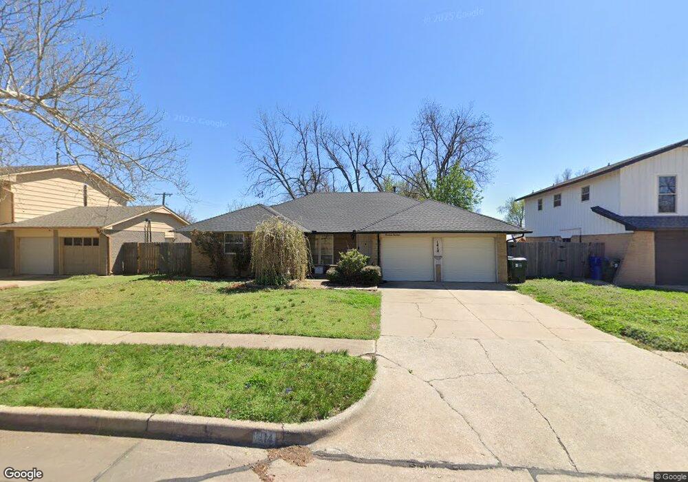
1414 Cambridge Dr Norman, OK 73069
Westwood Park NeighborhoodEstimated Value: $179,000 - $207,000
3
Beds
2
Baths
1,386
Sq Ft
$138/Sq Ft
Est. Value
About This Home
This home is located at 1414 Cambridge Dr, Norman, OK 73069 and is currently estimated at $191,845, approximately $138 per square foot. 1414 Cambridge Dr is a home located in Cleveland County with nearby schools including Cleveland Elementary School, Whittier Middle School, and Norman North High School.
Ownership History
Date
Name
Owned For
Owner Type
Purchase Details
Closed on
Sep 15, 2009
Sold by
Atkins Robert M and Atkins Kristin D
Bought by
Irvin Robin D
Current Estimated Value
Home Financials for this Owner
Home Financials are based on the most recent Mortgage that was taken out on this home.
Original Mortgage
$124,643
Outstanding Balance
$81,557
Interest Rate
5.2%
Mortgage Type
FHA
Estimated Equity
$110,288
Purchase Details
Closed on
Aug 18, 2004
Sold by
Ball Fred S and Ball Carolyn G
Bought by
Atkins Robert M
Create a Home Valuation Report for This Property
The Home Valuation Report is an in-depth analysis detailing your home's value as well as a comparison with similar homes in the area
Home Values in the Area
Average Home Value in this Area
Purchase History
| Date | Buyer | Sale Price | Title Company |
|---|---|---|---|
| Irvin Robin D | $127,500 | None Available | |
| Atkins Robert M | $94,500 | -- |
Source: Public Records
Mortgage History
| Date | Status | Borrower | Loan Amount |
|---|---|---|---|
| Open | Irvin Robin D | $124,643 |
Source: Public Records
Tax History Compared to Growth
Tax History
| Year | Tax Paid | Tax Assessment Tax Assessment Total Assessment is a certain percentage of the fair market value that is determined by local assessors to be the total taxable value of land and additions on the property. | Land | Improvement |
|---|---|---|---|---|
| 2024 | $1,408 | $12,753 | $2,643 | $10,110 |
| 2023 | $1,367 | $12,381 | $2,811 | $9,570 |
| 2022 | $1,269 | $12,021 | $2,286 | $9,735 |
| 2021 | $1,295 | $11,670 | $1,800 | $9,870 |
| 2020 | $1,268 | $11,670 | $1,800 | $9,870 |
| 2019 | $1,290 | $11,670 | $1,800 | $9,870 |
| 2018 | $1,250 | $11,671 | $1,800 | $9,871 |
| 2017 | $1,265 | $11,671 | $0 | $0 |
| 2016 | $1,285 | $11,671 | $1,800 | $9,871 |
| 2015 | $1,252 | $11,720 | $1,065 | $10,655 |
| 2014 | $1,264 | $11,720 | $1,065 | $10,655 |
Source: Public Records
Map
Nearby Homes
- 916 Canterbury Ave
- 1103 Woods Ave
- 1603 Denison Dr
- 1713 Canterbury St
- 1502 Denison Dr
- 1702 Denison Dr
- 1616 Dakota St
- 1209 Dakota St
- 1502 Iowa St
- 1213 Iowa St
- 718 Highland Pkwy
- 717 Denison Dr
- 1313 Dorchester Dr
- 1223 Kansas St
- 336 N Sherry Ave
- 713 Dakota St
- 751 Iowa St
- 627 W Acres St
- 239 Foreman Ave
- 2128 Parkland Way
- 1418 Cambridge Dr
- 1406 Cambridge Dr
- 1413 Charles St
- 1424 Cambridge Dr
- 1409 Charles St
- 1405 Charles St
- 1417 Charles St
- 1012 Woods Ave
- 1502 Cambridge Dr
- 1008 Woods Ave
- 1016 Woods Ave
- 1415 Cambridge Dr
- 1407 Cambridge Dr
- 1421 Charles St
- 1401 Charles St
- 1510 Cambridge Dr
- 1503 Charles St
- 1024 Woods Ave
- 1503 Cambridge Dr
- 1507 Camelot Dr