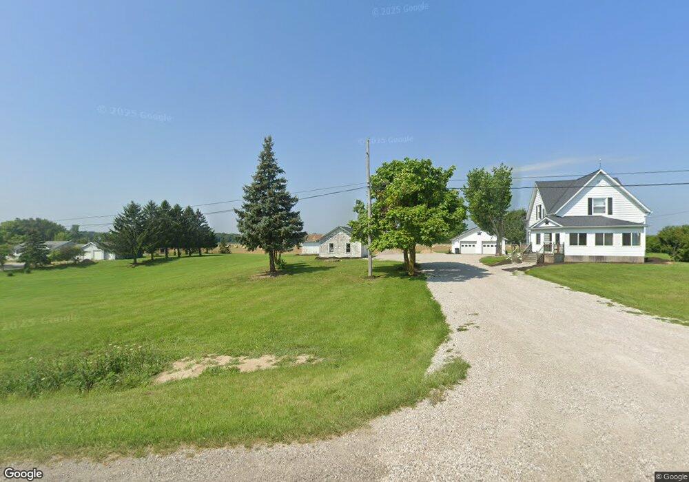
14143 State Route 15 Montpelier, OH 43543
Estimated Value: $155,000 - $213,334
4
Beds
1
Bath
1,632
Sq Ft
$114/Sq Ft
Est. Value
About This Home
This home is located at 14143 State Route 15, Montpelier, OH 43543 and is currently estimated at $186,084, approximately $114 per square foot. 14143 State Route 15 is a home located in Williams County with nearby schools including North Central Elementary School and North Central Junior/Senior High School.
Ownership History
Date
Name
Owned For
Owner Type
Purchase Details
Closed on
May 15, 2010
Sold by
Rodgers Michael C and Rodgers Shirley Jean
Bought by
Bryan Ross I and Fast Donna M
Current Estimated Value
Home Financials for this Owner
Home Financials are based on the most recent Mortgage that was taken out on this home.
Original Mortgage
$95,711
Outstanding Balance
$65,548
Interest Rate
5.5%
Mortgage Type
FHA
Estimated Equity
$120,536
Purchase Details
Closed on
Jul 17, 1997
Sold by
Ledford Bill D and Ledford Emilee
Bought by
Rodgers Michael C
Purchase Details
Closed on
Jun 1, 1995
Bought by
Ledford Bill D and Ledford Emilee
Purchase Details
Closed on
Jan 1, 1990
Bought by
Latanner
Create a Home Valuation Report for This Property
The Home Valuation Report is an in-depth analysis detailing your home's value as well as a comparison with similar homes in the area
Home Values in the Area
Average Home Value in this Area
Purchase History
| Date | Buyer | Sale Price | Title Company |
|---|---|---|---|
| Bryan Ross I | $97,000 | Upland Title Agency Llc | |
| Rodgers Michael C | $72,000 | -- | |
| Ledford Bill D | $50,000 | -- | |
| Latanner | -- | -- |
Source: Public Records
Mortgage History
| Date | Status | Borrower | Loan Amount |
|---|---|---|---|
| Open | Bryan Ross I | $95,711 |
Source: Public Records
Tax History Compared to Growth
Tax History
| Year | Tax Paid | Tax Assessment Tax Assessment Total Assessment is a certain percentage of the fair market value that is determined by local assessors to be the total taxable value of land and additions on the property. | Land | Improvement |
|---|---|---|---|---|
| 2024 | $1,919 | $47,810 | $8,540 | $39,270 |
| 2023 | $1,919 | $37,980 | $8,400 | $29,580 |
| 2022 | $1,715 | $37,980 | $8,400 | $29,580 |
| 2021 | $1,715 | $37,980 | $8,400 | $29,580 |
| 2020 | $1,477 | $31,710 | $7,070 | $24,640 |
| 2019 | $1,466 | $31,710 | $7,070 | $24,640 |
| 2018 | $1,382 | $31,710 | $7,070 | $24,640 |
| 2017 | $1,368 | $30,460 | $6,550 | $23,910 |
| 2016 | $1,300 | $30,460 | $6,550 | $23,910 |
| 2015 | $1,374 | $30,460 | $6,550 | $23,910 |
| 2014 | $1,374 | $30,460 | $6,550 | $23,910 |
| 2013 | $1,379 | $30,460 | $6,550 | $23,910 |
Source: Public Records
Map
Nearby Homes
- 15390 16 Rd
- 1454 Whitaker Way
- 16748 Us Highway 20ns
- 0 St Rt 15 Unit 10001011
- 620 E Washington St
- 16993 County Road 12
- 500 E Court St
- 16806 US Highway 20a
- 10628 Ohio 15
- 15664 County Road K
- 303 Broad St
- 400 N Rose Ln
- 408 Clear Fork Dr
- 612 S Pleasant St
- 402 Empire St
- 301 S 3rd St
- 408 S Monroe St
- 206 S Elm St
- 0 Mill Street Mill St
- 13 W Brown Rd
- 14143 Ohio 15
- 14095 State Route 15
- 14095 State Route 15
- 14095 Ohio 15
- 00000 St Rt 15
- 0 State Rt 15 R
- 0 Us 20 & Sr 15
- 0 State Route 15 State Hwy Unit 5106304
- 0 Us Highway 20a
- 000 Us Highway 20a
- 13877 County Road N65
- 14179 County Road N65
- 14683 State Route 15
- 13499 State Route 15
- 14461 County Road N65
- 14125 Selwyn
- 13513 County Road N65
- 14683 Ohio 15
- 14419 County Road N65
- 14419 County Road N65