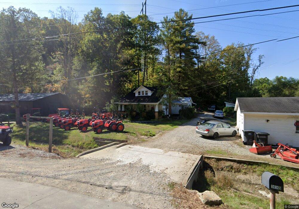
14145 State Route 691 Nelsonville, OH 45764
Estimated Value: $103,900 - $196,000
3
Beds
1
Bath
1,250
Sq Ft
$133/Sq Ft
Est. Value
About This Home
This home is located at 14145 State Route 691, Nelsonville, OH 45764 and is currently estimated at $165,975, approximately $132 per square foot. 14145 State Route 691 is a home located in Athens County with nearby schools including Nelsonville-York Elementary School, Nelsonville-York Junior High School, and Nelsonville-York High School.
Ownership History
Date
Name
Owned For
Owner Type
Purchase Details
Closed on
Nov 16, 2022
Sold by
Brown Jeffrey M and Brown Laura
Bought by
Brownies Tractors Llc
Current Estimated Value
Purchase Details
Closed on
Aug 11, 2014
Sold by
Brown Michelle I
Bought by
Brown Jeffrey M
Purchase Details
Closed on
Nov 12, 1996
Sold by
Brown Jeffrey M
Bought by
Brown Jeffrey M and Brown Michelle I
Purchase Details
Closed on
Sep 1, 1988
Create a Home Valuation Report for This Property
The Home Valuation Report is an in-depth analysis detailing your home's value as well as a comparison with similar homes in the area
Home Values in the Area
Average Home Value in this Area
Purchase History
| Date | Buyer | Sale Price | Title Company |
|---|---|---|---|
| Brownies Tractors Llc | -- | -- | |
| Brownies Tractors Llc | -- | None Listed On Document | |
| Brown Jeffrey M | -- | Attorney | |
| Brown Jeffrey M | -- | -- | |
| -- | $35,000 | -- |
Source: Public Records
Tax History Compared to Growth
Tax History
| Year | Tax Paid | Tax Assessment Tax Assessment Total Assessment is a certain percentage of the fair market value that is determined by local assessors to be the total taxable value of land and additions on the property. | Land | Improvement |
|---|---|---|---|---|
| 2024 | $1,677 | $24,750 | $1,610 | $23,140 |
| 2023 | $1,077 | $24,750 | $1,610 | $23,140 |
| 2022 | $902 | $19,720 | $1,360 | $18,360 |
| 2021 | $905 | $19,720 | $1,360 | $18,360 |
| 2020 | $876 | $19,720 | $1,360 | $18,360 |
| 2019 | $846 | $18,310 | $1,360 | $16,950 |
| 2018 | $849 | $18,310 | $1,360 | $16,950 |
| 2017 | $851 | $18,310 | $1,360 | $16,950 |
| 2016 | $828 | $16,970 | $1,240 | $15,730 |
| 2015 | $1,120 | $16,970 | $1,240 | $15,730 |
| 2014 | $1,120 | $16,970 | $1,240 | $15,730 |
| 2013 | $1,037 | $16,530 | $1,240 | $15,290 |
Source: Public Records
Map
Nearby Homes
- 14881 State Route 691
- 14946 Ohio 691
- 12981 Spice Lick Rd
- 1310 E Canal St
- 11685 State Route 691
- 1137 Poplar St
- 20 4th St
- 874 Chestnut St
- 6559 Poston Rd
- 474 Chestnut St
- 443 Chestnut St
- 480 High St
- 11250 Grass Run Rd
- 190 Myers St
- 1110 Burr Oak Blvd
- 240 Jefferson St
- 0 St Charles Unit 2433628
- 0 Ohio 278
- 0 Lemaster Rd
- 0 Lemaster Rd Unit 23368524
- 14148 State Route 691
- 14114 State Route 691
- 14106 State Route 691
- 14110 State Route 691
- 14092 State Route 691
- 4199 Matheny Rd
- 3895 Matheny Rd
- 4454 Monk Rd
- 3789 Matheny Rd
- 14672 State Route 691
- 14701 State Route 691
- 4730 Monk Rd
- 3965 Huddy Rd
- 14794 State Route 691
- 14765 State Route 691
- 3670 Matheny Rd
- 0 Huddy Rd
- 14858 State Route 691
- 3594 Matheny Rd
- 3550 Matheny Rd