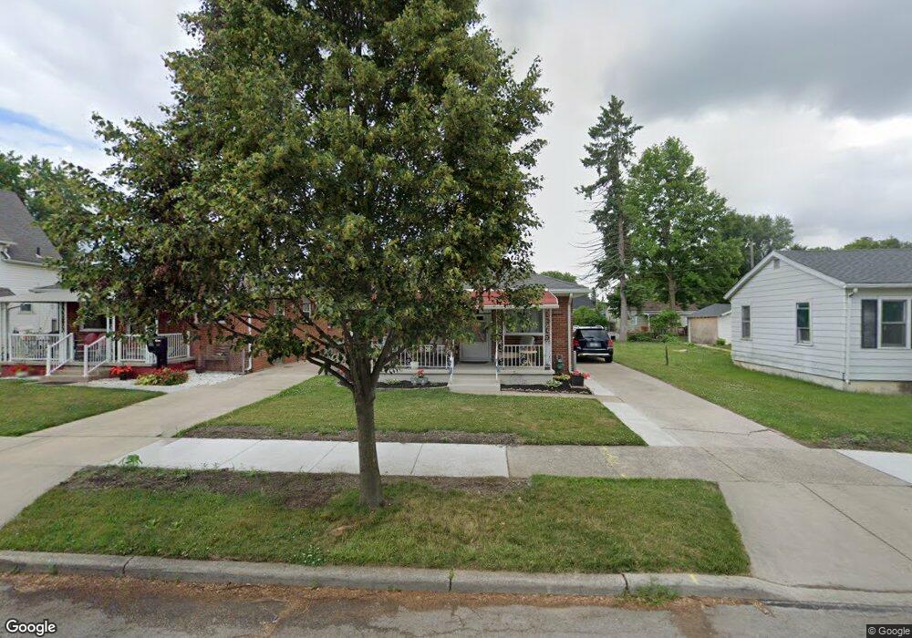
1415 Corry Ave Toledo, OH 43614
Glendale-Heatherdowns NeighborhoodEstimated Value: $95,395 - $127,000
2
Beds
1
Bath
825
Sq Ft
$133/Sq Ft
Est. Value
About This Home
This home is located at 1415 Corry Ave, Toledo, OH 43614 and is currently estimated at $109,599, approximately $132 per square foot. 1415 Corry Ave is a home located in Lucas County with nearby schools including Harvard Elementary School, Bowsher High School, and Our Lady of Perpetual Help School.
Ownership History
Date
Name
Owned For
Owner Type
Purchase Details
Closed on
Jun 19, 2023
Sold by
Whitacre Vincent J and Whitacre Rita
Bought by
Whitacre Vincent J and Whitacre Rita
Current Estimated Value
Purchase Details
Closed on
May 29, 2018
Sold by
Kujawa Wanda M
Bought by
Whitacre Vincent J
Home Financials for this Owner
Home Financials are based on the most recent Mortgage that was taken out on this home.
Original Mortgage
$57,000
Interest Rate
4.4%
Mortgage Type
New Conventional
Purchase Details
Closed on
May 8, 1995
Sold by
Est Walter O Fuller
Bought by
Kajawa Wanda M
Purchase Details
Closed on
Oct 19, 1990
Sold by
Fuller W R and J R
Create a Home Valuation Report for This Property
The Home Valuation Report is an in-depth analysis detailing your home's value as well as a comparison with similar homes in the area
Home Values in the Area
Average Home Value in this Area
Purchase History
| Date | Buyer | Sale Price | Title Company |
|---|---|---|---|
| Whitacre Vincent J | -- | None Listed On Document | |
| Whitacre Vincent J | $60,000 | None Available | |
| Kajawa Wanda M | $55,000 | -- | |
| -- | -- | -- |
Source: Public Records
Mortgage History
| Date | Status | Borrower | Loan Amount |
|---|---|---|---|
| Previous Owner | Whitacre Vincent J | $57,000 |
Source: Public Records
Tax History Compared to Growth
Tax History
| Year | Tax Paid | Tax Assessment Tax Assessment Total Assessment is a certain percentage of the fair market value that is determined by local assessors to be the total taxable value of land and additions on the property. | Land | Improvement |
|---|---|---|---|---|
| 2024 | $968 | $31,850 | $10,990 | $20,860 |
| 2023 | $1,607 | $25,130 | $8,960 | $16,170 |
| 2022 | $1,609 | $25,130 | $8,960 | $16,170 |
| 2021 | $1,647 | $25,130 | $8,960 | $16,170 |
| 2020 | $1,550 | $20,790 | $7,420 | $13,370 |
| 2019 | $1,507 | $20,790 | $7,420 | $13,370 |
| 2018 | $962 | $20,790 | $7,420 | $13,370 |
| 2017 | $996 | $21,175 | $7,350 | $13,825 |
| 2016 | $1,000 | $60,500 | $21,000 | $39,500 |
| 2015 | $993 | $60,500 | $21,000 | $39,500 |
| 2014 | $782 | $21,180 | $7,350 | $13,830 |
| 2013 | $782 | $21,180 | $7,350 | $13,830 |
Source: Public Records
Map
Nearby Homes
- 1421 Corry Ave
- 1732 Gilbert Rd
- 1644 Watova Rd
- 1288 Wildwood Rd
- 1939 Glendale Ave
- 1935 Glendale Ave
- 1919 Princeton Dr
- 1439 Vassar Dr
- 3304 Island Ave
- 1424 Kenyon Dr
- 1850 Glendale Ave
- 1854 Princeton Dr
- 3458 Beverly Dr
- 2950 Broadway St
- 1073 Atlantic Ave
- 1351 Bensch Dr
- 1043 Atlantic Ave
- 1011 National Ave
- 940 Francis Ave
- 153 University Blvd
- 1411 Corry Ave
- 1407 Corry Ave
- 1423 Corry Ave
- 1418 Abbott Ave
- 1422 Abbott Ave
- 1410 Abbott Ave
- 1408 Abbott Ave
- 1431 Corry Ave
- 1430 Abbott Ave
- 1418 Corry Ave
- 1410 Corry Ave
- 1404 Abbott Ave
- 1430 Corry Ave
- 1435 Corry Ave
- 1437 Corry Ave
- 1402 Corry Ave
- 1436 Abbott Ave
- 1434 Corry Ave
- 1363 Corry Ave
- 1439 Corry Ave