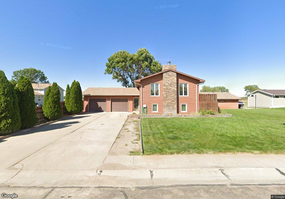
1415 Hackberry Rd North Platte, NE 69101
Estimated Value: $224,595 - $301,000
3
Beds
1
Bath
948
Sq Ft
$288/Sq Ft
Est. Value
About This Home
This home is located at 1415 Hackberry Rd, North Platte, NE 69101 and is currently estimated at $273,399, approximately $288 per square foot. 1415 Hackberry Rd is a home located in Lincoln County with nearby schools including North Platte High School, Mc Daid Elementary School, and McDaid Elementary School.
Ownership History
Date
Name
Owned For
Owner Type
Purchase Details
Closed on
Aug 22, 2005
Sold by
Elliott William P and Elliott Mary A
Bought by
Kring Greg D and Kring Michelle
Current Estimated Value
Home Financials for this Owner
Home Financials are based on the most recent Mortgage that was taken out on this home.
Original Mortgage
$155,000
Outstanding Balance
$81,180
Interest Rate
5.81%
Mortgage Type
Future Advance Clause Open End Mortgage
Estimated Equity
$192,219
Create a Home Valuation Report for This Property
The Home Valuation Report is an in-depth analysis detailing your home's value as well as a comparison with similar homes in the area
Home Values in the Area
Average Home Value in this Area
Purchase History
| Date | Buyer | Sale Price | Title Company |
|---|---|---|---|
| Kring Greg D | $155,000 | None Available |
Source: Public Records
Mortgage History
| Date | Status | Borrower | Loan Amount |
|---|---|---|---|
| Open | Kring Greg D | $155,000 |
Source: Public Records
Tax History
| Year | Tax Paid | Tax Assessment Tax Assessment Total Assessment is a certain percentage of the fair market value that is determined by local assessors to be the total taxable value of land and additions on the property. | Land | Improvement |
|---|---|---|---|---|
| 2025 | $3,224 | $227,518 | $35,460 | $192,058 |
| 2024 | $3,366 | $230,634 | $35,460 | $195,174 |
| 2023 | $3,366 | $184,585 | $20,474 | $164,111 |
| 2022 | $3,197 | $165,490 | $18,356 | $147,134 |
| 2021 | $3,087 | $159,125 | $17,650 | $141,475 |
| 2020 | $3,131 | $159,125 | $17,650 | $141,475 |
| 2019 | $3,145 | $159,125 | $17,650 | $141,475 |
| 2018 | $3,146 | $159,125 | $17,650 | $141,475 |
| 2017 | $3,058 | $154,130 | $17,650 | $136,480 |
| 2016 | $2,919 | $144,580 | $17,650 | $126,930 |
| 2014 | $3,232 | $145,110 | $17,650 | $127,460 |
Source: Public Records
Map
Nearby Homes
- 2901 S Oak St
- 3102 S Oak St
- 910 W Walker Rd
- 3366 Parker Rd
- 0 N Platte Fremont Slough Development Unit 11573268
- N Platte Unit NE 69101
- 0 Unit Lot
- 1306 William Ave
- 1401 S Buffalo Bill Ave
- 0 N Buffalo Bill Grass
- N Platte Unit NE 69101
- 1213 William Ct
- 918 W Reid Ave
- 1211 S Buffalo Bill Ave
- 0 Buffalo Triangle Frontage
- 0 State Farm Road Short Acreage W
- 0 State Farm Road Short Acreage E
- N Platte Unit NE 69101
- N Platte Unit NE 69101
- 0 S Buffalo Bill Development
- 2711 Maris Ln
- 1401 Hackberry Rd
- 3108 Hackberry Rd
- 1412 Hackberry Rd
- 1321 Hackberry Rd
- 1408 Hackberry Rd
- 1420 Hackberry Rd
- 2708 Maris Ln
- 1315 Hackberry Rd
- 2720 Maris Ln
- 1320 Hackberry Rd
- 1401 W Eugene Ave
- 1311 Hackberry Rd
- 1317 W Eugene Ave
- 1421 W Eugene Ave
- 1311 W Eugene Ave
- 1423 W Eugene Ave
- 1301 W Eugene Ave
- 1301 Hackberry Rd
- 1302 Hackberry Rd
Your Personal Tour Guide
Ask me questions while you tour the home.