Estimated Value: $124,000 - $187,000
3
Beds
1
Bath
1,000
Sq Ft
$155/Sq Ft
Est. Value
About This Home
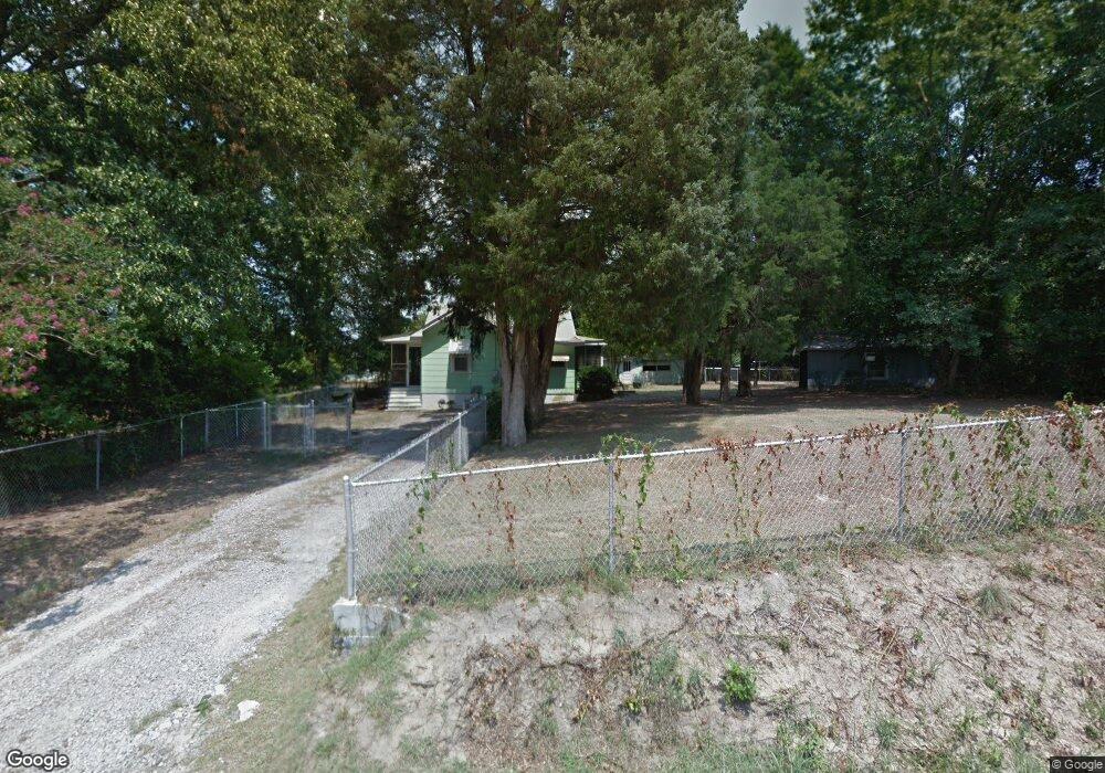
This home is located at 1415 Lowe St, Cayce, SC 29033 and is currently estimated at $154,932, approximately $154 per square foot. 1415 Lowe St is a home located in Lexington County with nearby schools including Cayce Elementary, Cyril B. Busbee Creative Arts Academy, and Brookland-Cayce High School.
Ownership History
Date
Name
Owned For
Owner Type
Purchase Details
Closed on
Feb 13, 2019
Sold by
Sanders William M
Bought by
Bishop Bradford Cliff
Current Estimated Value
Purchase Details
Closed on
Jun 1, 2006
Sold by
Wilbur Arthur W and Wilbur Mary
Bought by
Sanders William M
Home Financials for this Owner
Home Financials are based on the most recent Mortgage that was taken out on this home.
Original Mortgage
$54,000
Interest Rate
6.51%
Mortgage Type
New Conventional
Purchase Details
Closed on
Sep 27, 2002
Sold by
Wall Mildred
Bought by
Wilbur Stella W
Create a Home Valuation Report for This Property
The Home Valuation Report is an in-depth analysis detailing your home's value as well as a comparison with similar homes in the area
Home Values in the Area
Average Home Value in this Area
Purchase History
| Date | Buyer | Sale Price | Title Company |
|---|---|---|---|
| Bishop Bradford Cliff | $51,000 | None Available | |
| Sanders William M | $67,500 | None Available | |
| Wilbur Mary | -- | None Available | |
| Wilbur Stella W | $6,000 | -- |
Source: Public Records
Mortgage History
| Date | Status | Borrower | Loan Amount |
|---|---|---|---|
| Previous Owner | Sanders William M | $54,000 |
Source: Public Records
Tax History
| Year | Tax Paid | Tax Assessment Tax Assessment Total Assessment is a certain percentage of the fair market value that is determined by local assessors to be the total taxable value of land and additions on the property. | Land | Improvement |
|---|---|---|---|---|
| 2024 | -- | $3,060 | $1,200 | $1,860 |
| 2023 | $1,208 | $3,060 | $1,200 | $1,860 |
| 2022 | $1,085 | $3,060 | $1,200 | $1,860 |
| 2020 | $1,085 | $3,060 | $1,200 | $1,860 |
| 2019 | $1,044 | $2,828 | $1,308 | $1,520 |
| 2018 | $1,005 | $2,828 | $1,308 | $1,520 |
| 2017 | $986 | $2,828 | $1,308 | $1,520 |
| 2016 | $998 | $2,827 | $1,308 | $1,519 |
| 2014 | $754 | $2,459 | $828 | $1,631 |
| 2013 | -- | $2,460 | $830 | $1,630 |
Source: Public Records
Map
Nearby Homes
- 1407 Karlaney Ave
- TBD Poplar Lots A B & C St
- 527 Amick St
- 157 Cavendish Dr
- 151 Cavendish Dr
- 147 Cavendish Dr
- 1521 Benton Cir
- 1140 Karlaney Ave
- 1414 Hazel St
- 153 Cavendish Dr
- 313 Ocala Dr
- 339 Ocala Dr
- 307 Ocala Dr
- 401 Ocala Dr
- 315 Ocala Dr
- 305 Ocala Dr
- 1608 Crapps Ave
- 1040 Indigo Ave
- 1015 Naples Ave
- 117 Odell Dr
- 1517 Lafayette Ave
- 1418 Alex St
- 1412 Alex St
- 1410 Alex St
- 1416 Alex St
- 1508 Naples Ave
- 1506 Naples Ave
- 1423B Alex St
- 1409 Alex St
- 1423A Alex St
- 1413 Alex St
- 1500 Naples Ave
- 1411 Alex St
- 1407 Alex St
- 1427 Alex St
- 1421 Lafayette Ave
- 1501 Hopkins St
- 1510 Lafayette Ave
- 1419 Lafayette Ave
- 1507 Hopkins St
Your Personal Tour Guide
Ask me questions while you tour the home.