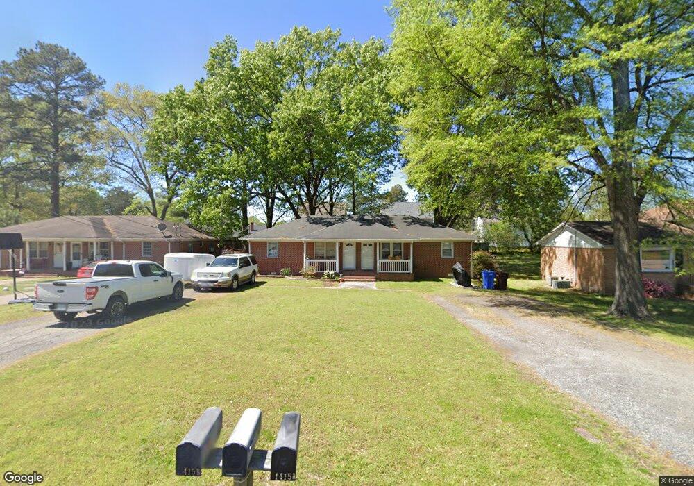
1415 Oleander Ave Unit A& B Chesapeake, VA 23325
Indian River NeighborhoodEstimated Value: $246,000 - $325,242
4
Beds
2
Baths
1,653
Sq Ft
$172/Sq Ft
Est. Value
About This Home
This home is located at 1415 Oleander Ave Unit A& B, Chesapeake, VA 23325 and is currently estimated at $284,311, approximately $171 per square foot. 1415 Oleander Ave Unit A& B is a home located in Chesapeake City with nearby schools including Norfolk Highlands Primary School, Sparrow Road Intermediate School, and Indian River Middle.
Ownership History
Date
Name
Owned For
Owner Type
Purchase Details
Closed on
Jun 8, 2023
Sold by
Bunch Donald W
Bought by
Kantowski James F
Current Estimated Value
Home Financials for this Owner
Home Financials are based on the most recent Mortgage that was taken out on this home.
Original Mortgage
$261,182
Outstanding Balance
$254,198
Interest Rate
6.39%
Mortgage Type
FHA
Estimated Equity
$30,113
Create a Home Valuation Report for This Property
The Home Valuation Report is an in-depth analysis detailing your home's value as well as a comparison with similar homes in the area
Home Values in the Area
Average Home Value in this Area
Purchase History
| Date | Buyer | Sale Price | Title Company |
|---|---|---|---|
| Kantowski James F | $266,000 | First American Title Insurance | |
| Kantowski James F | $266,000 | First American Title Insurance |
Source: Public Records
Mortgage History
| Date | Status | Borrower | Loan Amount |
|---|---|---|---|
| Open | Kantowski James F | $261,182 | |
| Closed | Kantowski James F | $261,182 |
Source: Public Records
Tax History
| Year | Tax Paid | Tax Assessment Tax Assessment Total Assessment is a certain percentage of the fair market value that is determined by local assessors to be the total taxable value of land and additions on the property. | Land | Improvement |
|---|---|---|---|---|
| 2025 | $2,698 | $282,300 | $120,000 | $162,300 |
| 2024 | $2,698 | $267,100 | $110,000 | $157,100 |
| 2023 | $2,316 | $251,300 | $105,000 | $146,300 |
| 2022 | $2,327 | $230,400 | $100,000 | $130,400 |
| 2021 | $2,073 | $197,400 | $85,000 | $112,400 |
| 2020 | $2,062 | $196,400 | $85,000 | $111,400 |
| 2019 | $2,023 | $192,700 | $85,000 | $107,700 |
| 2018 | $1,971 | $187,700 | $80,000 | $107,700 |
| 2017 | $1,928 | $183,600 | $80,000 | $103,600 |
| 2016 | $1,928 | $183,600 | $80,000 | $103,600 |
| 2015 | $1,928 | $183,600 | $80,000 | $103,600 |
| 2014 | $1,928 | $183,600 | $80,000 | $103,600 |
Source: Public Records
Map
Nearby Homes
- Lot Angora Dr
- 1509 Oleander Ave
- 3502 Cornick Ave
- 1408 Elder Ave
- 1229 Elder Ave
- 1128 Lilac Ave
- 2017 Pond Ln
- 1507 Rokeby Ave
- 2000 Plow Ln
- 3005 Mattox Dr
- 1515 Linden Ave
- 2445 Lindbergh Ave
- 1707 Willow Ave
- 2025 Phyllis Dr
- 200 Velva Dr
- 2912 Scotia Dr
- 1601 Wood Ave
- 1620 Elm Ave
- 4201 Nautilus Ave
- 2916 Doris Ave
- 1415 Oleander Ave
- 1419 Oleander Ave Unit A
- 1419 Oleander Ave
- 1419 Oleander Ave
- 1419 Oleander Ave Unit B
- 1405 Oleander Ave
- 1416 Chestnut Ave
- 1421 Oleander Ave
- 1410 Oleander Ave
- 1420 Chestnut Ave
- 1408 Oleander Ave
- 1412 Oleander Ave
- 1408 Chestnut Ave
- 1408 Chestnut Ave Unit B
- 1408 Chestnut Ave Unit A
- 3601 Cornick Ave
- 1404 Oleander Ave
- 3603 Cornick Ave
- 1412 Chestnut Ave
- 1425 Oleander Ave
Your Personal Tour Guide
Ask me questions while you tour the home.