Estimated Value: $192,000 - $199,874
3
Beds
1
Bath
1,269
Sq Ft
$155/Sq Ft
Est. Value
About This Home
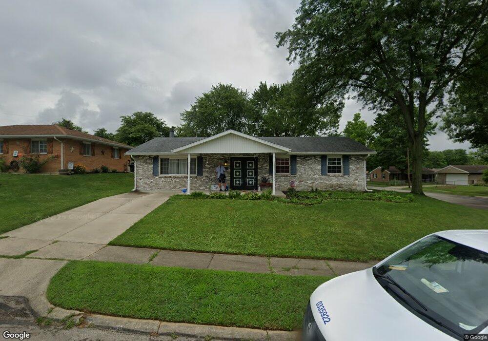
This home is located at 1415 Peacepipe Trail, Xenia, OH 45385 and is currently estimated at $196,219, approximately $154 per square foot. 1415 Peacepipe Trail is a home located in Greene County with nearby schools including Xenia High School and Summit Academy Community School for Alternative Learners - Xenia.
Ownership History
Date
Name
Owned For
Owner Type
Purchase Details
Closed on
Jan 5, 2022
Sold by
Willis Michelle R
Bought by
Gibson Robert
Current Estimated Value
Home Financials for this Owner
Home Financials are based on the most recent Mortgage that was taken out on this home.
Original Mortgage
$147,283
Outstanding Balance
$135,740
Interest Rate
3.11%
Mortgage Type
FHA
Estimated Equity
$60,479
Purchase Details
Closed on
Jan 13, 2004
Sold by
Willis Joseph M
Bought by
Willis Michelle R
Purchase Details
Closed on
Aug 2, 1995
Sold by
Payton Bonnie K
Bought by
Willis Joseph M and Willis R
Home Financials for this Owner
Home Financials are based on the most recent Mortgage that was taken out on this home.
Original Mortgage
$78,937
Interest Rate
7.56%
Mortgage Type
FHA
Create a Home Valuation Report for This Property
The Home Valuation Report is an in-depth analysis detailing your home's value as well as a comparison with similar homes in the area
Home Values in the Area
Average Home Value in this Area
Purchase History
| Date | Buyer | Sale Price | Title Company |
|---|---|---|---|
| Gibson Robert | $17,000 | Dever Jonathan T | |
| Willis Michelle R | -- | -- | |
| Willis Joseph M | $79,000 | -- |
Source: Public Records
Mortgage History
| Date | Status | Borrower | Loan Amount |
|---|---|---|---|
| Open | Gibson Robert | $147,283 | |
| Previous Owner | Willis Joseph M | $78,937 |
Source: Public Records
Tax History Compared to Growth
Tax History
| Year | Tax Paid | Tax Assessment Tax Assessment Total Assessment is a certain percentage of the fair market value that is determined by local assessors to be the total taxable value of land and additions on the property. | Land | Improvement |
|---|---|---|---|---|
| 2024 | $2,118 | $49,510 | $12,470 | $37,040 |
| 2023 | $2,118 | $49,510 | $12,470 | $37,040 |
| 2022 | $1,769 | $35,260 | $7,340 | $27,920 |
| 2021 | $1,793 | $35,260 | $7,340 | $27,920 |
| 2020 | $1,718 | $35,260 | $7,340 | $27,920 |
| 2019 | $1,560 | $30,140 | $7,200 | $22,940 |
| 2018 | $1,566 | $30,140 | $7,200 | $22,940 |
| 2017 | $1,454 | $30,140 | $7,200 | $22,940 |
| 2016 | $1,455 | $27,480 | $7,200 | $20,280 |
| 2015 | $1,459 | $27,480 | $7,200 | $20,280 |
| 2014 | $1,397 | $27,480 | $7,200 | $20,280 |
Source: Public Records
Map
Nearby Homes
- 1208 Bellbrook Ave
- 1272 Bellbrook Ave
- 1144 Rockwell Dr
- 1778 Arapaho Dr
- 1618 Navajo Dr
- 1342 Kylemore Dr
- 1568 Cheyenne Dr
- 1653 Seneca Dr
- 1223 June Dr
- 1233 June Dr
- 1283 June Dr
- 1403 Texas Dr
- 1391 June Dr
- 1769 Gayhart Dr
- 1866 Roxbury Dr
- 305-325 Bellbrook Ave
- 1829 Gayhart Dr
- 523 Newport Rd
- 453 Walnut St
- 1908 Whitt St
- 1401 Peacepipe Trail
- 1428 Arrowhead Trail
- 1387 Peacepipe Trail
- 1414 Arrowhead Trail
- 884 Buckskin Trail
- 874 Buckskin Trail
- 1416 Peacepipe Trail
- 1454 Arrowhead Trail
- 1404 Peacepipe Trail
- 1402 Arrowhead Trail
- 860 Buckskin Trail
- 1390 Peacepipe Trail
- 1375 Peacepipe Trail
- 1462 Arrowhead Trail
- 846 Buckskin Trail
- 1388 Arrowhead Trail
- 833 Buckskin Trail
- 1378 Peacepipe Trail
- 1361 Peacepipe Trail
- 1478 Arrowhead Trail