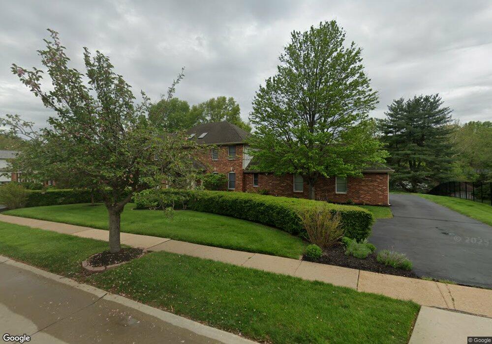
14154 Ladue Rd Chesterfield, MO 63017
Estimated Value: $632,231 - $709,000
4
Beds
3
Baths
3,112
Sq Ft
$219/Sq Ft
Est. Value
About This Home
This home is located at 14154 Ladue Rd, Chesterfield, MO 63017 and is currently estimated at $681,058, approximately $218 per square foot. 14154 Ladue Rd is a home located in St. Louis County with nearby schools including Green Trails Elementary School, Parkway Central Middle School, and Parkway Central High School.
Ownership History
Date
Name
Owned For
Owner Type
Purchase Details
Closed on
Mar 13, 2015
Sold by
Schuessler Warren E and Schuessler Marvella E
Bought by
Schuessler Warren E and Schuessler Marvella E
Current Estimated Value
Home Financials for this Owner
Home Financials are based on the most recent Mortgage that was taken out on this home.
Original Mortgage
$384,800
Outstanding Balance
$133,823
Interest Rate
2.96%
Mortgage Type
New Conventional
Estimated Equity
$547,235
Purchase Details
Closed on
Oct 27, 2000
Sold by
Fisher Martin N and Fisher Julia S
Bought by
Schuessler Warren E and Schuessler Marvella E
Home Financials for this Owner
Home Financials are based on the most recent Mortgage that was taken out on this home.
Original Mortgage
$300,000
Interest Rate
7.87%
Create a Home Valuation Report for This Property
The Home Valuation Report is an in-depth analysis detailing your home's value as well as a comparison with similar homes in the area
Home Values in the Area
Average Home Value in this Area
Purchase History
| Date | Buyer | Sale Price | Title Company |
|---|---|---|---|
| Schuessler Warren E | -- | Copper Title Llc | |
| Schuessler Warren E | $345,000 | -- |
Source: Public Records
Mortgage History
| Date | Status | Borrower | Loan Amount |
|---|---|---|---|
| Open | Schuessler Warren E | $384,800 | |
| Closed | Schuessler Warren E | $300,000 |
Source: Public Records
Tax History Compared to Growth
Tax History
| Year | Tax Paid | Tax Assessment Tax Assessment Total Assessment is a certain percentage of the fair market value that is determined by local assessors to be the total taxable value of land and additions on the property. | Land | Improvement |
|---|---|---|---|---|
| 2025 | $6,347 | $107,650 | $51,300 | $56,350 |
| 2024 | $6,347 | $96,040 | $23,520 | $72,520 |
| 2023 | $6,088 | $96,040 | $23,520 | $72,520 |
| 2022 | $5,528 | $79,340 | $23,520 | $55,820 |
| 2021 | $5,506 | $79,340 | $23,520 | $55,820 |
| 2020 | $5,658 | $78,320 | $23,710 | $54,610 |
| 2019 | $5,535 | $78,320 | $23,710 | $54,610 |
| 2018 | $5,542 | $72,730 | $23,710 | $49,020 |
| 2017 | $5,391 | $72,730 | $23,710 | $49,020 |
| 2016 | $5,643 | $72,370 | $19,250 | $53,120 |
| 2015 | $5,916 | $72,370 | $19,250 | $53,120 |
| 2014 | $5,825 | $76,210 | $15,660 | $60,550 |
Source: Public Records
Map
Nearby Homes
- 143 Saylesville Dr
- 14257 Forest Crest Dr
- 14327 Bramblewood Ct
- 384 Greentrails Dr S
- 224 Brayhill Ct
- 208 Ambridge Ct Unit 202
- 1275 White Rd
- 14008 Woods Mill Cove Dr
- 14361 White Birch Valley Ln
- 56 Forest Crest Dr
- 14616 Rogue River Dr
- 314 Valley Forge Ct
- 14144 Baywood Villages Dr
- 216 San Angelo Dr
- 14560 White Birch Valley Ln
- 1123 Cabinview Ct
- 445 Whitestone Farm Dr
- 85 Glen Cove Dr
- 1226 Luray Dr
- 13430 Manorlac Dr
- 14144 Ladue Rd
- 14162 Ladue Rd
- 14065 Boxford Ct
- 14061 Boxford Ct
- 14057 Boxford Ct
- 14151 Ladue Rd
- 14136 Ladue Rd
- 14141 Ladue Rd
- 14161 Ladue Rd
- 14170 Ladue Rd
- 14069 Boxford Ct
- 14053 Boxford Ct
- 14131 Ladue Rd
- 14171 Ladue Rd
- 14122 Ladue Rd
- 14049 Boxford Ct
- 14070 Boxford Ct
- 14178 Ladue Rd
- 14130 Parliament Dr
- 14121 Ladue Rd