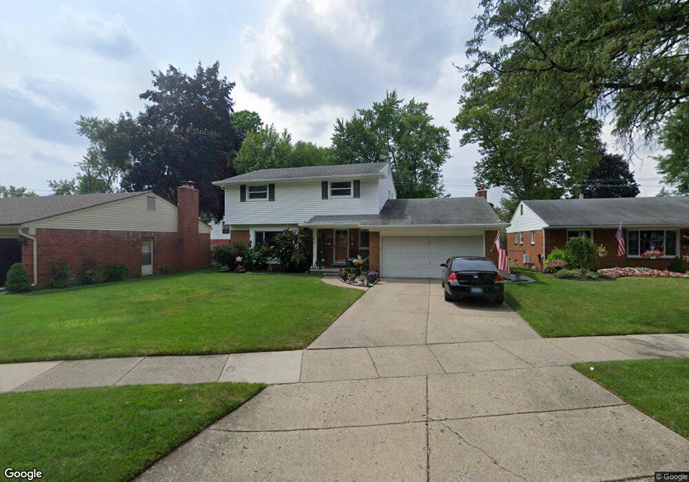
14155 Westmore St Livonia, MI 48154
Estimated Value: $346,803 - $409,000
--
Bed
3
Baths
1,965
Sq Ft
$194/Sq Ft
Est. Value
About This Home
This home is located at 14155 Westmore St, Livonia, MI 48154 and is currently estimated at $380,451, approximately $193 per square foot. 14155 Westmore St is a home located in Wayne County with nearby schools including Kennedy Elementary School, Johnson Upper Elementary School, and Frost Middle School.
Ownership History
Date
Name
Owned For
Owner Type
Purchase Details
Closed on
Dec 3, 2012
Sold by
The James R Sielaff Trust
Bought by
Hunt David M
Current Estimated Value
Home Financials for this Owner
Home Financials are based on the most recent Mortgage that was taken out on this home.
Original Mortgage
$117,739
Outstanding Balance
$81,073
Interest Rate
3.24%
Mortgage Type
FHA
Estimated Equity
$299,378
Purchase Details
Closed on
May 19, 2011
Sold by
Sielaff James R
Bought by
Sielaff James R and Sielaff Richard T
Create a Home Valuation Report for This Property
The Home Valuation Report is an in-depth analysis detailing your home's value as well as a comparison with similar homes in the area
Home Values in the Area
Average Home Value in this Area
Purchase History
| Date | Buyer | Sale Price | Title Company |
|---|---|---|---|
| Hunt David M | $120,000 | Cislo Title Co | |
| Sielaff James R | -- | None Available |
Source: Public Records
Mortgage History
| Date | Status | Borrower | Loan Amount |
|---|---|---|---|
| Open | Hunt David M | $117,739 |
Source: Public Records
Tax History Compared to Growth
Tax History
| Year | Tax Paid | Tax Assessment Tax Assessment Total Assessment is a certain percentage of the fair market value that is determined by local assessors to be the total taxable value of land and additions on the property. | Land | Improvement |
|---|---|---|---|---|
| 2025 | $2,254 | $171,800 | $0 | $0 |
| 2024 | $2,254 | $163,900 | $0 | $0 |
| 2023 | $2,150 | $150,500 | $0 | $0 |
| 2022 | $3,775 | $137,600 | $0 | $0 |
| 2021 | $3,667 | $128,700 | $0 | $0 |
| 2019 | $3,518 | $117,200 | $0 | $0 |
| 2018 | $1,818 | $108,700 | $0 | $0 |
| 2017 | $3,217 | $104,300 | $0 | $0 |
| 2016 | $3,382 | $104,300 | $0 | $0 |
| 2015 | $7,778 | $91,550 | $0 | $0 |
| 2012 | -- | $73,280 | $16,110 | $57,170 |
Source: Public Records
Map
Nearby Homes
- 33025 Martin St
- 33233 Lyndon St
- 33040 Allen St
- 33146 Lyndon St
- 33129 Oakley St
- 14214 Cranston St
- 14879 Fairfield St
- 13947 Ashurst St
- 14030 Ingram St
- 14155 Berwick St
- 32136 Lyndon St
- 15075 Hubbard St Unit 5
- 13975 Riverside Ct
- 32651 5 Mile Rd Unit 15
- 14677 Auburndale St
- 14563 Melrose St
- 14327 Arden St
- 14109 Arden St
- 15040 Berwick St
- 14127 Ramblewood St
- 14161 Westmore St
- 14149 Westmore St
- 14172 Farmington Rd
- 14171 Westmore St
- 14141 Westmore St
- 14204 Farmington Rd
- 14212 Farmington Rd
- 33129 Perth St Unit Bldg-Unit
- 33129 Perth St
- 14183 Westmore St
- 14218 Farmington Rd
- 14133 Westmore St
- 33130 Middleboro St
- 14180 Westmore St
- 14226 Farmington Rd
- 14154 Farmington Rd
- 33119 Perth St
- 14195 Westmore St
- 14125 Westmore St
- 33118 Middleboro St